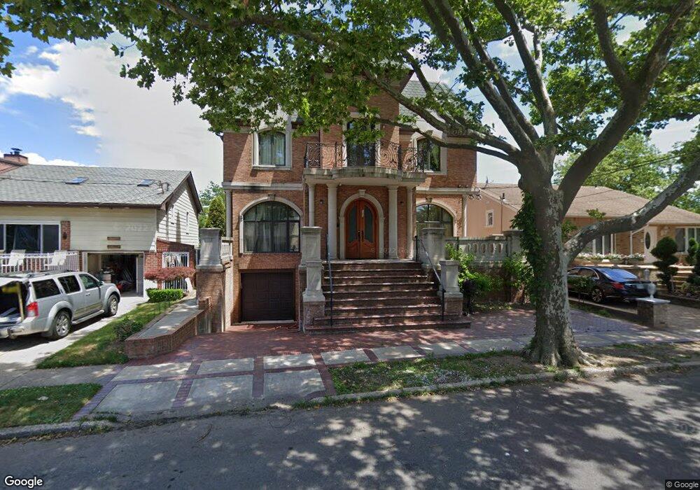
103 Barlow Dr N Brooklyn, NY 11234
Mill Basin NeighborhoodEstimated Value: $1,172,000 - $3,107,000
--
Bed
--
Bath
5,600
Sq Ft
$447/Sq Ft
Est. Value
About This Home
This home is located at 103 Barlow Dr N, Brooklyn, NY 11234 and is currently estimated at $2,504,950, approximately $447 per square foot. 103 Barlow Dr N is a home located in Kings County with nearby schools including P.S. 236 Mill Basin, James Madison High School, and Hebrew Language Academy.
Ownership History
Date
Name
Owned For
Owner Type
Purchase Details
Closed on
Aug 23, 2005
Sold by
Somma Lela
Bought by
Milman Boris and Milman Raisa
Current Estimated Value
Home Financials for this Owner
Home Financials are based on the most recent Mortgage that was taken out on this home.
Original Mortgage
$785,000
Outstanding Balance
$415,810
Interest Rate
5.79%
Mortgage Type
Purchase Money Mortgage
Estimated Equity
$2,089,140
Create a Home Valuation Report for This Property
The Home Valuation Report is an in-depth analysis detailing your home's value as well as a comparison with similar homes in the area
Home Values in the Area
Average Home Value in this Area
Purchase History
| Date | Buyer | Sale Price | Title Company |
|---|---|---|---|
| Milman Boris | $985,000 | -- |
Source: Public Records
Mortgage History
| Date | Status | Borrower | Loan Amount |
|---|---|---|---|
| Open | Milman Boris | $785,000 |
Source: Public Records
Tax History Compared to Growth
Tax History
| Year | Tax Paid | Tax Assessment Tax Assessment Total Assessment is a certain percentage of the fair market value that is determined by local assessors to be the total taxable value of land and additions on the property. | Land | Improvement |
|---|---|---|---|---|
| 2025 | $16,585 | $208,020 | $21,600 | $186,420 |
| 2024 | $16,585 | $184,800 | $21,600 | $163,200 |
| 2023 | $15,897 | $163,020 | $21,600 | $141,420 |
| 2022 | $14,830 | $178,620 | $21,600 | $157,020 |
| 2021 | $14,749 | $154,860 | $21,600 | $133,260 |
| 2020 | $7,228 | $160,380 | $21,600 | $138,780 |
| 2019 | $14,394 | $152,040 | $21,600 | $130,440 |
| 2018 | $13,297 | $65,228 | $8,188 | $57,040 |
| 2017 | $12,620 | $61,906 | $12,259 | $49,647 |
| 2016 | $11,675 | $58,402 | $13,451 | $44,951 |
| 2015 | $7,044 | $57,578 | $19,889 | $37,689 |
| 2014 | $7,044 | $57,342 | $19,807 | $37,535 |
Source: Public Records
Map
Nearby Homes
- 333 Mayfair Dr N
- 163 Whitman Dr
- 203 Whitman Dr
- 73 Barlow Dr N
- 47 Gaylord Dr N
- 38 Bassett Ave
- 86 Gaylord Dr S
- 389 Mayfair Dr S
- 7 Montana Place
- 80 Whitman Dr
- 255 Mayfair Dr N
- 2446 E 66th St
- 299 Whitman Dr
- 320 Whitman Dr
- 225 Mayfair Dr N
- 2434 E 66th St
- 303 Whitman Dr
- 29 Kansas Place
- 2445 E 65th St
- 32 Whitman Dr
- 97 Barlow Dr N
- 109 Barlow Dr N
- 330 Mayfair Dr N
- 324 Mayfair Dr N
- 91 Barlow Dr N
- 318 Mayfair Dr N
- 336 Mayfair Dr N
- 312 Mayfair Dr N
- 312 Mayfair Dr N
- 312 Mayfair Dr N
- 85 Barlow Dr N
- 80 Barlow Dr N
- 74 Barlow Dr N
- 113 Barlow Dr S
- 68 Barlow Dr N
- 306 Mayfair Dr N
- 79 Barlow Dr N
- 340 Mayfair Dr S
- 117 Barlow Dr S
- 62 Barlow Dr N