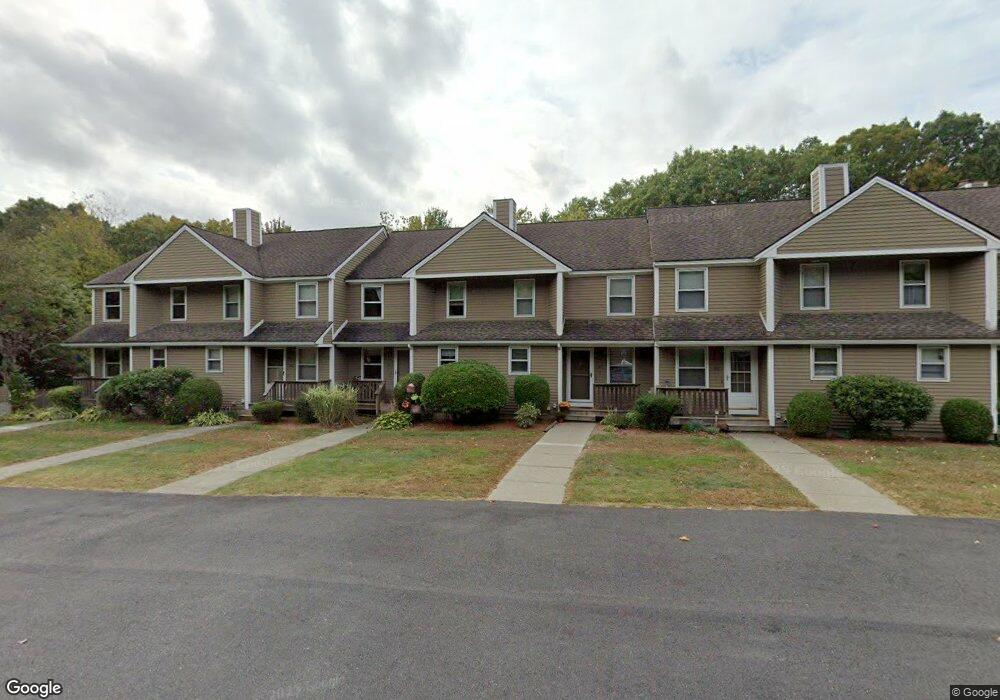
103 Pennacook Dr Leominster, MA 01453
Estimated Value: $329,000 - $341,000
2
Beds
2
Baths
1,147
Sq Ft
$290/Sq Ft
Est. Value
About This Home
This home is located at 103 Pennacook Dr, Leominster, MA 01453 and is currently estimated at $332,849, approximately $290 per square foot. 103 Pennacook Dr is a home located in Worcester County with nearby schools including Leominster High School, St. Anna Catholic School, and St. Leo School.
Ownership History
Date
Name
Owned For
Owner Type
Purchase Details
Closed on
Dec 6, 2023
Sold by
Gabriel Timothy C and Gabriel Cindy L
Bought by
Gabriel Lt and Gabriel
Current Estimated Value
Purchase Details
Closed on
Sep 7, 2005
Sold by
Wilcox John G
Bought by
Gabriel Cindy L and Gabriel Timothy C
Home Financials for this Owner
Home Financials are based on the most recent Mortgage that was taken out on this home.
Original Mortgage
$88,000
Interest Rate
5.79%
Mortgage Type
Purchase Money Mortgage
Purchase Details
Closed on
Oct 3, 2001
Sold by
Holsopple Stephanie A
Bought by
Wilcox John G
Purchase Details
Closed on
Dec 22, 1999
Sold by
Antonioni John G Est and Antonioni
Bought by
Holsopple Stephanie A
Purchase Details
Closed on
Feb 23, 1989
Sold by
Greenway Land Tr
Bought by
Longo F M
Create a Home Valuation Report for This Property
The Home Valuation Report is an in-depth analysis detailing your home's value as well as a comparison with similar homes in the area
Home Values in the Area
Average Home Value in this Area
Purchase History
| Date | Buyer | Sale Price | Title Company |
|---|---|---|---|
| Gabriel Lt | -- | None Available | |
| Gabriel Cindy L | $198,000 | -- | |
| Wilcox John G | $139,900 | -- | |
| Holsopple Stephanie A | $94,000 | -- | |
| Longo F M | $115,500 | -- | |
| Longo F M | $115,500 | -- |
Source: Public Records
Mortgage History
| Date | Status | Borrower | Loan Amount |
|---|---|---|---|
| Previous Owner | Longo F M | $55,400 | |
| Previous Owner | Longo F M | $80,300 | |
| Previous Owner | Gabriel Cindy L | $88,000 | |
| Previous Owner | Longo F M | $26,100 |
Source: Public Records
Tax History Compared to Growth
Tax History
| Year | Tax Paid | Tax Assessment Tax Assessment Total Assessment is a certain percentage of the fair market value that is determined by local assessors to be the total taxable value of land and additions on the property. | Land | Improvement |
|---|---|---|---|---|
| 2025 | $3,732 | $266,000 | $0 | $266,000 |
| 2024 | $3,596 | $247,800 | $0 | $247,800 |
| 2023 | $3,420 | $220,100 | $0 | $220,100 |
| 2022 | $2,898 | $175,000 | $0 | $175,000 |
| 2021 | $2,993 | $165,100 | $0 | $165,100 |
| 2020 | $2,880 | $160,200 | $0 | $160,200 |
| 2019 | $2,659 | $143,400 | $0 | $143,400 |
| 2018 | $2,596 | $134,300 | $0 | $134,300 |
| 2017 | $2,391 | $121,200 | $0 | $121,200 |
| 2016 | $2,124 | $108,500 | $0 | $108,500 |
| 2015 | $2,051 | $105,500 | $0 | $105,500 |
| 2014 | $2,136 | $113,100 | $0 | $113,100 |
Source: Public Records
Map
Nearby Homes
- 498 Lancaster St
- 851 Lancaster St
- 6 Longwood Ave
- 740 Central St Unit R24
- 740 Central St Unit L22
- 17 1st Ave
- 36 Meadow Pond Dr Unit I
- 30 Abbey Rd Unit 207
- 10 Abbey Rd Unit 108
- 30 Abbey Rd Unit 202
- 10 Abbey Rd Unit 205
- 556 Central St Unit 43
- 556 Central St Unit 39
- 197 Chapman Place Unit 197
- 31 Johnson St
- 213 Bayberry Hill Ln
- 64 Sycamore Dr
- 57 Chapman Place
- 177 Chapman Place
- 161 11th St
- 97 Pennacook Dr
- 85 Pennacook Dr
- 79 Pennacook Dr
- 82 Pennacook Dr
- 75 Pennacook Dr
- 78 Pennacook Dr
- 73 Pennacook Dr
- 76 Pennacook Dr
- 74 Pennacook Dr
- 69 Pennacook Dr
- 103 Pennacook Dr Unit 46,103
- 74 Pennacook Dr Unit 13 74
- 75 Pennacook Dr Unit 75
- 69 Pennacook Dr Unit 69
- 97 Pennacook Dr Unit 97
- 76 Pennacook Dr Unit 76
- 79 Pennacook Dr Unit 79
- 103 Pennacook Dr Unit 6
- 97 Pennacook Dr Unit 40
- 73 Pennacook Dr Unit 16