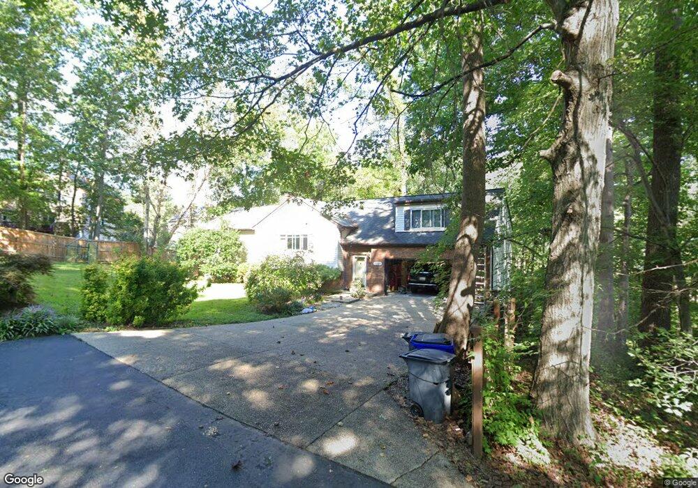
10324 Stansfield Rd Laurel, MD 20723
Estimated Value: $663,000 - $736,000
--
Bed
3
Baths
1,968
Sq Ft
$352/Sq Ft
Est. Value
About This Home
This home is located at 10324 Stansfield Rd, Laurel, MD 20723 and is currently estimated at $692,466, approximately $351 per square foot. 10324 Stansfield Rd is a home located in Howard County with nearby schools including Hammond Elementary School, Hammond Middle School, and Reservoir High School.
Ownership History
Date
Name
Owned For
Owner Type
Purchase Details
Closed on
Dec 29, 1998
Sold by
Zowd Phillip A
Bought by
Toibero Dennis and Toibero Elizabeth
Current Estimated Value
Purchase Details
Closed on
Jul 19, 1985
Sold by
Lakeview Joint Venture
Bought by
Zowd Phillip A
Home Financials for this Owner
Home Financials are based on the most recent Mortgage that was taken out on this home.
Original Mortgage
$25,000
Interest Rate
11.94%
Create a Home Valuation Report for This Property
The Home Valuation Report is an in-depth analysis detailing your home's value as well as a comparison with similar homes in the area
Home Values in the Area
Average Home Value in this Area
Purchase History
| Date | Buyer | Sale Price | Title Company |
|---|---|---|---|
| Toibero Dennis | $225,000 | -- | |
| Zowd Phillip A | $29,900 | -- |
Source: Public Records
Mortgage History
| Date | Status | Borrower | Loan Amount |
|---|---|---|---|
| Previous Owner | Zowd Phillip A | $25,000 | |
| Closed | Toibero Dennis | -- |
Source: Public Records
Tax History Compared to Growth
Tax History
| Year | Tax Paid | Tax Assessment Tax Assessment Total Assessment is a certain percentage of the fair market value that is determined by local assessors to be the total taxable value of land and additions on the property. | Land | Improvement |
|---|---|---|---|---|
| 2025 | $8,233 | $592,500 | $252,000 | $340,500 |
| 2024 | $8,233 | $554,167 | $0 | $0 |
| 2023 | $7,687 | $515,833 | $0 | $0 |
| 2022 | $7,276 | $477,500 | $222,000 | $255,500 |
| 2021 | $6,804 | $461,067 | $0 | $0 |
| 2020 | $6,804 | $444,633 | $0 | $0 |
| 2019 | $6,568 | $428,200 | $234,900 | $193,300 |
| 2018 | $6,129 | $420,667 | $0 | $0 |
| 2017 | $6,004 | $428,200 | $0 | $0 |
| 2016 | -- | $405,600 | $0 | $0 |
| 2015 | -- | $404,600 | $0 | $0 |
| 2014 | -- | $403,600 | $0 | $0 |
Source: Public Records
Map
Nearby Homes
- 8719 Susini Dr
- 9256 Laurens Way
- 10681 Old Bond Mill Rd
- 10417 Leslie Dr
- 9260 Old Scaggsville Rd
- 10520 Scaggsville Rd
- 10571 Scaggsville Rd
- 7209 Brooklyn Bridge Rd
- Dorchester IV Plan at Cole's Manor
- Tidewater Plan at Cole's Manor
- Stratton Plan at Cole's Manor
- Adrienne's Honneur II Plan at Cole's Manor
- Mount Vernon IV Villa 2 Plan at Cole's Manor
- Federal Hill II Plan at Cole's Manor
- 7709 Brooklyn Bridge Rd
- 9420 Fairview Ave
- 9422 Fairview Ave
- 211 Patuxent Rd
- 9786 Whiskey Run
- 7616 Woodbine Dr
- 10320 Stansfield Rd
- 8822 Cardinal Ct
- 8819 Bluebird Trace
- 8818 Cardinal Ct
- 10360 Stansfield Rd
- 8815 Bluebird Trace
- 8823 Bluebird Trace
- 8825 Cardinal Ct
- 10364 Stansfield Rd
- 8814 Cardinal Ct
- 8811 Bluebird Trace
- 9050 Dumhart Rd
- 8816 Bluebird Trace
- 8821 Cardinal Ct
- 10368 Stansfield Rd
- 9046 Dumhart Rd
- 8810 Cardinal Ct
- 10305 Stansfield Rd
- 8817 Cardinal Ct
- 8807 Bluebird Trace