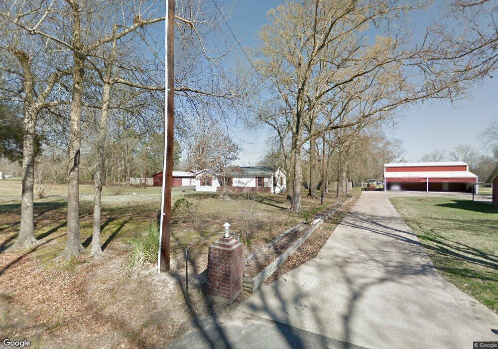
1033 Stephenson Brown Rd Lufkin, TX 75904
Estimated Value: $167,000 - $320,000
--
Bed
2
Baths
1,280
Sq Ft
$192/Sq Ft
Est. Value
About This Home
This home is located at 1033 Stephenson Brown Rd, Lufkin, TX 75904 and is currently estimated at $246,019, approximately $192 per square foot. 1033 Stephenson Brown Rd is a home located in Angelina County with nearby schools including W.F. Peavy Primary School, W.H. Bonner Elementary School, and Hudson Middle School.
Ownership History
Date
Name
Owned For
Owner Type
Purchase Details
Closed on
Jul 1, 2021
Sold by
First City Properties Llc
Bought by
Roy Sarah Alyssa and Roy Jason Duane
Current Estimated Value
Home Financials for this Owner
Home Financials are based on the most recent Mortgage that was taken out on this home.
Original Mortgage
$237,500
Outstanding Balance
$215,027
Interest Rate
2.9%
Mortgage Type
New Conventional
Estimated Equity
$30,992
Create a Home Valuation Report for This Property
The Home Valuation Report is an in-depth analysis detailing your home's value as well as a comparison with similar homes in the area
Home Values in the Area
Average Home Value in this Area
Purchase History
| Date | Buyer | Sale Price | Title Company |
|---|---|---|---|
| Roy Sarah Alyssa | -- | Security & Guaranty Abstract |
Source: Public Records
Mortgage History
| Date | Status | Borrower | Loan Amount |
|---|---|---|---|
| Open | Roy Sarah Alyssa | $237,500 |
Source: Public Records
Tax History Compared to Growth
Tax History
| Year | Tax Paid | Tax Assessment Tax Assessment Total Assessment is a certain percentage of the fair market value that is determined by local assessors to be the total taxable value of land and additions on the property. | Land | Improvement |
|---|---|---|---|---|
| 2025 | $2,953 | $198,910 | $99,630 | $99,280 |
| 2024 | $2,944 | $198,320 | $99,630 | $98,690 |
| 2023 | $2,473 | $167,570 | $99,630 | $67,940 |
| 2022 | $1,914 | $113,750 | $71,190 | $42,560 |
| 2021 | $1,996 | $108,810 | $71,190 | $37,620 |
| 2020 | $2,132 | $116,080 | $53,490 | $62,590 |
| 2019 | $2,139 | $112,690 | $51,940 | $60,750 |
| 2018 | $1,857 | $110,920 | $51,940 | $58,980 |
| 2017 | $1,857 | $96,730 | $50,560 | $46,170 |
| 2016 | $2,275 | $118,440 | $50,560 | $67,880 |
| 2015 | $133 | $88,300 | $20,420 | $67,880 |
| 2014 | $133 | $89,260 | $20,250 | $69,010 |
Source: Public Records
Map
Nearby Homes
- 1072 Stephenson Brown Rd
- 3405 Bethlehem Rd
- 3335 Bethlehem Rd
- 4136 Bethlehem Rd
- 105,115,116,195 Wilcox Dr
- 325 Evans Gann Rd
- 3202 Bethlehem Rd
- R143729 (Lot 6) Dena Kay Dr
- R143727 (Lot 4) Dena Kay Dr
- 130 Dena Kay Dr
- 465 Roper Rd
- 358 Stone Dr
- R143745 (Lot22) Dena Kay Dr
- R143749(Lot26) Dena Kay Dr
- R143749 Dena Kay Dr
- R143745 Dena Kay Dr
- multiple Dena Kay Dr
- R143742 (Lot19) Dena Kay Dr
- R143729 Dena Kay Dr
- R143739 Dena Kay Dr
- 1061 Stephenson Brown Rd
- 1048 Stephenson Brown Rd
- 959 Stephenson Brown Rd
- 1073 Stephenson Brown Rd
- 1074 Stephenson Brown Rd
- 1065 Stephenson Brown Rd
- 933 Stephenson Brown Rd
- 1076 Stephenson Brown Rd
- 1194 Stephenson Brown Rd
- 907 Stephenson Brown Rd
- tbd Stephenson Brown Rd
- 0 Stephenson Brown Rd
- 830 Stephenson Brown Rd
- 779 Stephenson Brown Rd
- 174 Robinson Rd
- 174 Robinson Rd
- 689 Stephenson Brown Rd
- 218 Robinson Rd
- 1267 Stephenson Brown Rd
- 1282 Stephenson Brown Rd