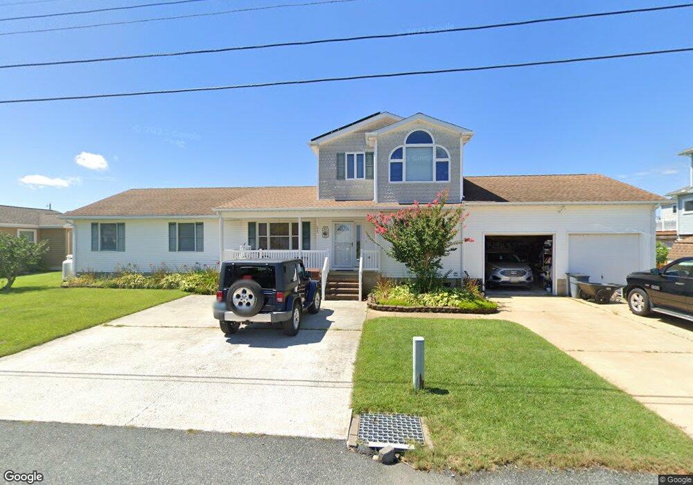
10349 Brighton Rd Ocean City, MD 21842
West Ocean City NeighborhoodEstimated Value: $700,171 - $968,000
--
Bed
4
Baths
2,808
Sq Ft
$290/Sq Ft
Est. Value
About This Home
This home is located at 10349 Brighton Rd, Ocean City, MD 21842 and is currently estimated at $813,043, approximately $289 per square foot. 10349 Brighton Rd is a home located in Worcester County with nearby schools including Ocean City Elementary School, Stephen Decatur Middle School, and Berlin Intermediate School.
Ownership History
Date
Name
Owned For
Owner Type
Purchase Details
Closed on
Apr 17, 1991
Sold by
Giove Ralph and Giove Joan
Bought by
Marshall Robert L and Marshall Theodora J
Current Estimated Value
Home Financials for this Owner
Home Financials are based on the most recent Mortgage that was taken out on this home.
Original Mortgage
$70,350
Interest Rate
9.48%
Create a Home Valuation Report for This Property
The Home Valuation Report is an in-depth analysis detailing your home's value as well as a comparison with similar homes in the area
Home Values in the Area
Average Home Value in this Area
Purchase History
| Date | Buyer | Sale Price | Title Company |
|---|---|---|---|
| Marshall Robert L | $100,500 | -- |
Source: Public Records
Mortgage History
| Date | Status | Borrower | Loan Amount |
|---|---|---|---|
| Closed | Marshall Robert L | $70,350 |
Source: Public Records
Tax History Compared to Growth
Tax History
| Year | Tax Paid | Tax Assessment Tax Assessment Total Assessment is a certain percentage of the fair market value that is determined by local assessors to be the total taxable value of land and additions on the property. | Land | Improvement |
|---|---|---|---|---|
| 2025 | $6,132 | $664,400 | $202,900 | $461,500 |
| 2024 | $5,657 | $593,700 | $0 | $0 |
| 2023 | $4,983 | $523,000 | $0 | $0 |
| 2022 | $4,309 | $452,300 | $187,900 | $264,400 |
| 2021 | $4,083 | $426,600 | $0 | $0 |
| 2020 | $3,837 | $400,900 | $0 | $0 |
| 2019 | $3,591 | $375,200 | $187,900 | $187,300 |
| 2018 | $3,418 | $368,067 | $0 | $0 |
| 2017 | $3,418 | $360,933 | $0 | $0 |
| 2016 | -- | $353,800 | $0 | $0 |
| 2015 | -- | $353,800 | $0 | $0 |
| 2014 | $3,007 | $353,800 | $0 | $0 |
Source: Public Records
Map
Nearby Homes
- 12542 Torquay Rd
- 10312 Bristol Rd
- 10352 Keyser Point Rd
- 12624 Balte Rd
- Lot #1 Exeter Rd
- LOT#2 Exeter Rd
- 10427 New Quay Rd
- Lot 3 Windsor Rd
- 0 W Torquay Rd
- 10434 New Quay Rd
- 12608 Selsey Rd
- Lot A Salisbury Rd
- 12524 Salisbury Rd
- 12520 Selsey Rd
- 10288 Broken Sound Blvd
- 0 Keyser Point Rd Unit MDWO118100
- 12403 Salisbury Rd
- 12528 Nature Park Dr
- 10117 Keyser Point Rd
- 12633 Whisper Trace Dr
- 10347 Brighton Rd
- 10355 Brighton Rd
- 10345 Brighton Rd
- 10344 Exeter Rd
- 10348 Brighton Rd
- 10359 Brighton Rd
- 10352 Exeter Rd
- 10346 Exeter Rd
- 12620 Quay Ln
- 10342 Exeter Rd
- 10340 Exeter Rd
- 12623 Quay Ln
- 10346 Brighton Rd
- 12630 Quay Ln
- 12625 Quay Ln
- 12621 Torquay Rd
- 12619 Torquay Rd
- 10360 Brighton Rd
- 12623 Torquay Rd
- 10403 Brighton Rd