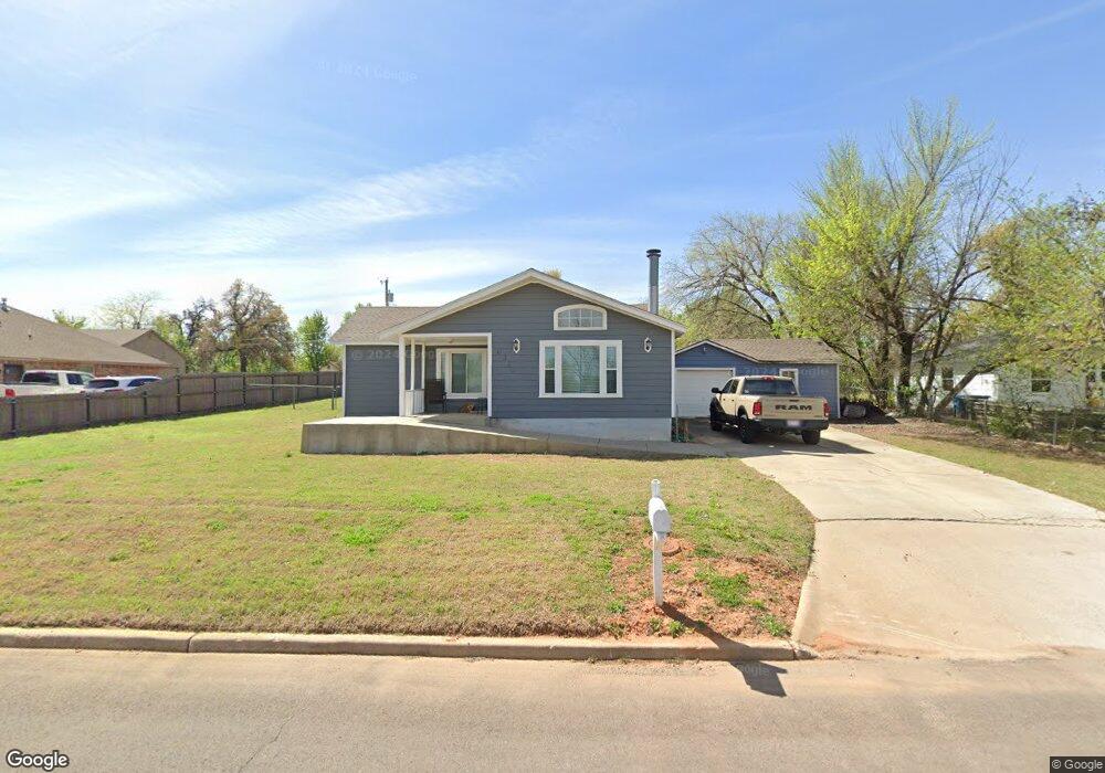
10350 Saint Patrick Dr Oklahoma City, OK 73130
Estimated Value: $162,000 - $214,000
3
Beds
2
Baths
1,598
Sq Ft
$119/Sq Ft
Est. Value
About This Home
This home is located at 10350 Saint Patrick Dr, Oklahoma City, OK 73130 and is currently estimated at $190,353, approximately $119 per square foot. 10350 Saint Patrick Dr is a home located in Oklahoma County with nearby schools including Carl Albert Middle School, Carl Albert High School, and Insight School of Oklahoma High School.
Ownership History
Date
Name
Owned For
Owner Type
Purchase Details
Closed on
Mar 28, 2019
Sold by
Wootmorelnnd Lana and Moore Irma
Bought by
Wootmorelnnd Lana and Hebrlnk Bryce
Current Estimated Value
Purchase Details
Closed on
Mar 6, 2018
Sold by
Gilley Leonard C
Bought by
U S Bank N A
Purchase Details
Closed on
May 17, 2017
Sold by
Hebrink Bryce
Bought by
Westmoreland Lana and Moore Irma
Purchase Details
Closed on
Jun 27, 2003
Sold by
Black Richard Aaron and Black Sherri Aline
Bought by
Westmoreland Lana
Purchase Details
Closed on
Jun 17, 2003
Sold by
Black Richard A and Black Latrissia J
Bought by
Black Richard Aaron and Black Sherri Aline
Purchase Details
Closed on
Aug 23, 1999
Sold by
Bank One Arizona
Bought by
Black Richard A and Black Latrissia J
Purchase Details
Closed on
Feb 2, 1999
Sold by
Whetsel John and Williams David W
Bought by
Liberty Bank & Trust Co Of Ok City N A
Create a Home Valuation Report for This Property
The Home Valuation Report is an in-depth analysis detailing your home's value as well as a comparison with similar homes in the area
Home Values in the Area
Average Home Value in this Area
Purchase History
| Date | Buyer | Sale Price | Title Company |
|---|---|---|---|
| Wootmorelnnd Lana | -- | Accommodation | |
| U S Bank N A | -- | None Available | |
| Westmoreland Lana | -- | None Available | |
| Westmoreland Lana | $59,000 | Capitol Abstract & Title Co | |
| Black Richard Aaron | -- | Capitol Abstract & Title | |
| Black Richard A | $9,000 | -- | |
| Liberty Bank & Trust Co Of Ok City N A | $32,676 | -- |
Source: Public Records
Tax History Compared to Growth
Tax History
| Year | Tax Paid | Tax Assessment Tax Assessment Total Assessment is a certain percentage of the fair market value that is determined by local assessors to be the total taxable value of land and additions on the property. | Land | Improvement |
|---|---|---|---|---|
| 2024 | $995 | $8,876 | $2,226 | $6,650 |
| 2023 | $995 | $8,454 | $2,168 | $6,286 |
| 2022 | $822 | $8,051 | $2,317 | $5,734 |
| 2021 | $814 | $7,817 | $3,168 | $4,649 |
| 2020 | $932 | $7,590 | $1,848 | $5,742 |
| 2019 | $885 | $7,535 | $2,618 | $4,917 |
| 2018 | $837 | $7,590 | $0 | $0 |
| 2017 | $834 | $7,449 | $2,569 | $4,880 |
| 2016 | $816 | $7,095 | $2,618 | $4,477 |
| 2015 | $863 | $7,206 | $1,705 | $5,501 |
| 2014 | $766 | $7,397 | $1,705 | $5,692 |
Source: Public Records
Map
Nearby Homes
- 10305 Saint Patrick Dr
- 10236 Bellmont Ave
- 10505 Willow Ridge Dr
- 000 Tbd Bellview Dr
- 313 Remington Ave
- 10107 Saint Patrick Dr
- 1104 Victor Ct
- 10813 SE 9th St
- 10800 SE 9th St
- 9909 Fox Fair Hollow
- 1501 S Avery Ave
- 11101 E Reno Ave
- 10820 Ohara Ln
- 129 Oak Tree Dr
- 1301 Grand Manor
- 203 Oak Tree Ln
- 104 Stone Creek Rd
- 10323 Haven Cir
- 1010 S Caldwell Dr
- 11030 Madison Ave
- 10344 Saint Patrick Dr
- 10358 Saint Patrick Dr
- 10343 Lejean Dr
- 10351 Lejean Dr
- 10351 Saint Patrick Dr
- 10334 Saint Patrick Dr
- 10362 Saint Patrick Dr
- 10343 Saint Patrick Dr
- 10359 Saint Patrick Dr
- 10335 Lejean Dr
- 721 E Bellview Dr
- 10335 Le Jean Dr
- 10335 Saint Patrick Dr
- 10367 Saint Patrick Dr
- 10324 Saint Patrick Dr
- 612 S Marion Ave
- 613 S Marion Ave
- 10344 Lejean Dr
- 10325 Lejean Dr
- 10346 Lejean Dr