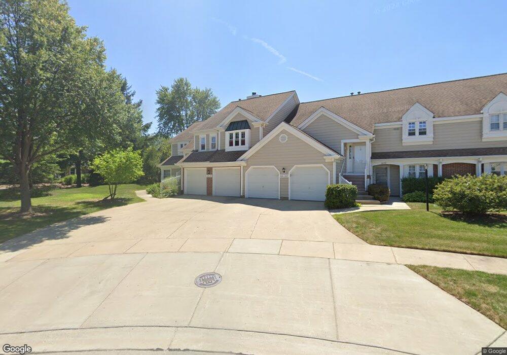
1036 Brentwood Cir Unit 115 Buffalo Grove, IL 60089
South Buffalo Grove NeighborhoodEstimated Value: $293,565 - $345,000
3
Beds
--
Bath
232,812
Sq Ft
$1/Sq Ft
Est. Value
About This Home
This home is located at 1036 Brentwood Cir Unit 115, Buffalo Grove, IL 60089 and is currently estimated at $319,641, approximately $1 per square foot. 1036 Brentwood Cir Unit 115 is a home located in Cook County with nearby schools including J.W. Riley Elementary School, Jack London Middle School, and Buffalo Grove High School.
Ownership History
Date
Name
Owned For
Owner Type
Purchase Details
Closed on
Sep 29, 2003
Sold by
Saks Elsie
Bought by
Orlowski Juliusz and Orlowski Magdlena
Current Estimated Value
Home Financials for this Owner
Home Financials are based on the most recent Mortgage that was taken out on this home.
Original Mortgage
$190,000
Outstanding Balance
$90,364
Interest Rate
6.49%
Mortgage Type
Unknown
Estimated Equity
$229,277
Create a Home Valuation Report for This Property
The Home Valuation Report is an in-depth analysis detailing your home's value as well as a comparison with similar homes in the area
Home Values in the Area
Average Home Value in this Area
Purchase History
| Date | Buyer | Sale Price | Title Company |
|---|---|---|---|
| Orlowski Juliusz | $237,500 | Rtc |
Source: Public Records
Mortgage History
| Date | Status | Borrower | Loan Amount |
|---|---|---|---|
| Open | Orlowski Juliusz | $190,000 |
Source: Public Records
Tax History Compared to Growth
Tax History
| Year | Tax Paid | Tax Assessment Tax Assessment Total Assessment is a certain percentage of the fair market value that is determined by local assessors to be the total taxable value of land and additions on the property. | Land | Improvement |
|---|---|---|---|---|
| 2024 | $6,680 | $24,190 | $3,618 | $20,572 |
| 2023 | $6,395 | $24,190 | $3,618 | $20,572 |
| 2022 | $6,395 | $24,190 | $3,618 | $20,572 |
| 2021 | $5,553 | $19,049 | $531 | $18,518 |
| 2020 | $5,483 | $19,049 | $531 | $18,518 |
| 2019 | $5,485 | $21,144 | $531 | $20,613 |
| 2018 | $4,350 | $16,066 | $430 | $15,636 |
| 2017 | $4,290 | $16,066 | $430 | $15,636 |
| 2016 | $4,262 | $16,066 | $430 | $15,636 |
| 2015 | $4,047 | $14,536 | $1,707 | $12,829 |
| 2014 | $3,998 | $14,536 | $1,707 | $12,829 |
| 2013 | $3,677 | $14,536 | $1,707 | $12,829 |
Source: Public Records
Map
Nearby Homes
- 3300 N Carriageway Dr Unit 317
- 3451 N Carriageway Dr Unit 503
- 3157 N Daniels Ct Unit 1502
- 3023 N Windsor Dr
- 3401 N Ellen Dr
- 3400 N Buffalo Grove Rd
- 1306 E Best Dr
- 665 Thornwood Dr
- 1127 Miller Ln Unit 107
- 820 Weidner Rd Unit 4013
- 820 Weidner Rd Unit 409
- 1225 Radcliffe Rd Unit 2
- 972 Thornton Ln Unit 102
- 12 Oak Creek Dr Unit 2212
- 1115 Miller Ln Unit 104
- 3222 N Heritage Ln
- 813 Stradford Cir Unit 21B2
- 3227 N Heritage Ln
- 18 E Heritage Ct
- 51 Old Oak Dr Unit 302
- 1038 Brentwood Cir Unit 111
- 1034 Brentwood Cir Unit 116
- 1032 Brentwood Cir Unit 112
- 1028 Brentwood Cir Unit 113
- 1026 Brentwood Cir Unit 117
- 1024 Brentwood Cir Unit 118
- 551 Park View Terrace Unit 151
- 1037 Brentwood Cir Unit 104
- 553 Park View Terrace Unit 155
- 1035 Brentwood Cir Unit 108
- 1022 Brentwood Cir Unit 114
- 555 Park View Terrace Unit 156
- 555 Park View Terrace Unit 555
- 1033 Brentwood Cir Unit 107
- 557 Park View Terrace Unit 152
- 3246 N Volz Dr W
- 3242 N Volz Dr W
- 1031 Brentwood Cir Unit 103
- 1031 Brentwood Cir Unit 1031
- 3250 N Volz Dr W