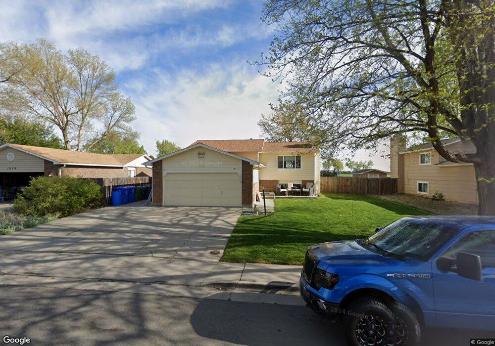
1038 Blue Spruce Dr Loveland, CO 80538
Estimated Value: $470,000 - $500,000
4
Beds
2
Baths
1,744
Sq Ft
$278/Sq Ft
Est. Value
About This Home
This home is located at 1038 Blue Spruce Dr, Loveland, CO 80538 and is currently estimated at $485,534, approximately $278 per square foot. 1038 Blue Spruce Dr is a home located in Larimer County with nearby schools including Peakview Academy at Conrad Ball, Mary Blair Elementary School, and Mountain View High School.
Ownership History
Date
Name
Owned For
Owner Type
Purchase Details
Closed on
Nov 27, 2001
Sold by
Mccrimmon Christopher P
Bought by
Mccrimmon Ronald B and Mccrimmon Elizabeth A
Current Estimated Value
Home Financials for this Owner
Home Financials are based on the most recent Mortgage that was taken out on this home.
Original Mortgage
$130,000
Interest Rate
5.88%
Purchase Details
Closed on
Apr 1, 1994
Sold by
Lehmann Marla S
Bought by
Mccrimmon Ronald B
Create a Home Valuation Report for This Property
The Home Valuation Report is an in-depth analysis detailing your home's value as well as a comparison with similar homes in the area
Home Values in the Area
Average Home Value in this Area
Purchase History
| Date | Buyer | Sale Price | Title Company |
|---|---|---|---|
| Mccrimmon Ronald B | -- | Security Title | |
| Mccrimmon Ronald B | $110,000 | -- |
Source: Public Records
Mortgage History
| Date | Status | Borrower | Loan Amount |
|---|---|---|---|
| Closed | Mccrimmon Ronald B | $130,000 |
Source: Public Records
Tax History Compared to Growth
Tax History
| Year | Tax Paid | Tax Assessment Tax Assessment Total Assessment is a certain percentage of the fair market value that is determined by local assessors to be the total taxable value of land and additions on the property. | Land | Improvement |
|---|---|---|---|---|
| 2025 | $2,276 | $32,200 | $3,216 | $28,984 |
| 2024 | $2,195 | $32,200 | $3,216 | $28,984 |
| 2022 | $1,899 | $23,866 | $3,336 | $20,530 |
| 2021 | $1,951 | $24,553 | $3,432 | $21,121 |
| 2020 | $1,972 | $24,796 | $3,432 | $21,364 |
| 2019 | $1,938 | $24,796 | $3,432 | $21,364 |
| 2018 | $1,607 | $19,526 | $3,456 | $16,070 |
| 2017 | $1,384 | $19,526 | $3,456 | $16,070 |
| 2016 | $1,231 | $16,780 | $3,821 | $12,959 |
| 2015 | $1,221 | $16,780 | $3,820 | $12,960 |
| 2014 | $1,014 | $13,480 | $3,820 | $9,660 |
Source: Public Records
Map
Nearby Homes
- 1009 Blue Spruce Place
- 3402 White Ash Ct
- 3546 Silver Leaf Dr
- 1208 Silver Fir Dr
- 6429 Union Creek Dr
- 6465 Union Creek Dr
- 502 Honey Locust Dr
- 2526 Silver Fir Ave
- 2562 Tupelo Dr
- 3244 Hawthorn Dr
- 1493 Park Dr
- 1820 Pyramid Peak Place
- 1327 Silver Leaf Dr
- 2718 Park Ct
- 1929 Pikes Peak Dr
- 2265 Albany Ct
- 1233 Ulmus Dr
- 1803 Park Dr
- 1927 Sunshine Peak Dr
- 2216 Albany Ct
- 1036 Blue Spruce Dr
- 1040 Blue Spruce Dr
- 1042 Blue Spruce Dr
- 1034 Blue Spruce Dr
- 1035 Blue Spruce Dr
- 1039 Blue Spruce Dr
- 1041 Blue Spruce Dr
- 10163 Meadow Place
- 1044 Blue Spruce Dr
- 1027 Blue Spruce Dr
- 3328 Silver Leaf Dr
- 1032 Blue Spruce Dr
- 1030 Blue Spruce Dr
- 3292 Silver Leaf Dr
- 1007 Blue Spruce Place
- 3350 Silver Leaf Dr
- 1028 Blue Spruce Dr
- 1005 Blue Spruce Place
- 3266 Silver Leaf Dr
- 1026 Blue Spruce Dr