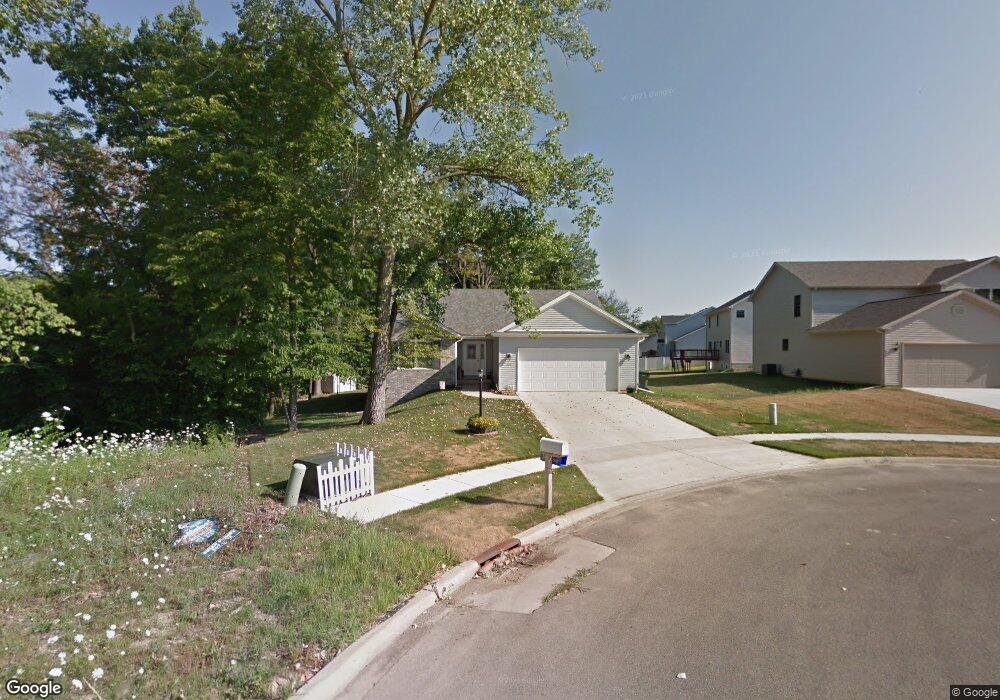
104 Country Ridge Ct East Peoria, IL 61611
Estimated Value: $256,000 - $309,000
3
Beds
2
Baths
1,364
Sq Ft
$210/Sq Ft
Est. Value
About This Home
This home is located at 104 Country Ridge Ct, East Peoria, IL 61611 and is currently estimated at $287,020, approximately $210 per square foot. 104 Country Ridge Ct is a home located in Tazewell County with nearby schools including Lasalle Elementary School, Parkview Jr High School, and East Peoria High School.
Ownership History
Date
Name
Owned For
Owner Type
Purchase Details
Closed on
Feb 24, 2023
Sold by
Littlefair Family Trust
Bought by
Littlefair Sylvia L
Current Estimated Value
Purchase Details
Closed on
Apr 24, 2013
Sold by
Littlefair John T and Littlefair Sylvia L
Bought by
The Littlefair Family Trust
Purchase Details
Closed on
Jun 4, 2010
Sold by
Cole Valley Llc
Bought by
Littlefair John T and Littlefair Sylvia L
Home Financials for this Owner
Home Financials are based on the most recent Mortgage that was taken out on this home.
Original Mortgage
$60,000
Interest Rate
4.41%
Mortgage Type
New Conventional
Create a Home Valuation Report for This Property
The Home Valuation Report is an in-depth analysis detailing your home's value as well as a comparison with similar homes in the area
Home Values in the Area
Average Home Value in this Area
Purchase History
| Date | Buyer | Sale Price | Title Company |
|---|---|---|---|
| Littlefair Sylvia L | -- | -- | |
| The Littlefair Family Trust | -- | None Available | |
| Littlefair John T | $186,500 | Pekin Title Llc |
Source: Public Records
Mortgage History
| Date | Status | Borrower | Loan Amount |
|---|---|---|---|
| Previous Owner | Littlefair John T | $60,000 |
Source: Public Records
Tax History Compared to Growth
Tax History
| Year | Tax Paid | Tax Assessment Tax Assessment Total Assessment is a certain percentage of the fair market value that is determined by local assessors to be the total taxable value of land and additions on the property. | Land | Improvement |
|---|---|---|---|---|
| 2024 | $4,664 | $77,500 | $14,720 | $62,780 |
| 2023 | $4,664 | $71,150 | $13,510 | $57,640 |
| 2022 | $4,837 | $65,820 | $12,500 | $53,320 |
| 2021 | $4,795 | $63,290 | $12,020 | $51,270 |
| 2020 | $4,636 | $63,290 | $12,020 | $51,270 |
| 2019 | $4,596 | $63,290 | $12,020 | $51,270 |
| 2018 | $4,479 | $63,290 | $12,020 | $51,270 |
| 2017 | $4,432 | $63,290 | $12,020 | $51,270 |
| 2016 | $4,364 | $63,470 | $11,920 | $51,550 |
| 2015 | $4,318 | $0 | $0 | $0 |
| 2013 | $4,349 | $61,490 | $11,550 | $49,940 |
Source: Public Records
Map
Nearby Homes
- 101 Woodbrook Ct
- 1604 Springfield Rd
- 106 Field Grove Rd
- 2217 Springfield Rd
- 1406 Springfield Rd
- 108 Kohl St
- 129 Glenridge Dr
- 515 Briarbrook Dr
- 409 Briarbrook Dr
- 404 Rainbow Dr
- 301 Briarbrook Dr
- Lot 1 Briarbrook Dr
- Lot 2 Briarbrook Dr
- 1004 Springfield Rd
- 015 Harris Rd
- Lot 4 Harris Rd
- 557 Groveland St
- 104 Lewis Ct
- 120 Gerber Ct
- 529 Carola St
- 102 Country Ridge Ct
- 317 Stonewood Dr
- 116 Woodbrook Ct
- 319 Stonewood Dr
- 103 Country Ridge Ct
- 311 Stonewood Dr
- 115 Woodbrook Ct
- 321 Stonewood Dr
- 309 Stonewood Dr
- 323 Stonewood Dr
- 112 Woodbrook Ct
- 316 Stonewood Dr
- 314 Stonewood Dr
- 113 Woodbrook Ct
- 307 Stonewood Dr
- 318 Stonewood Dr
- 312 Stonewood Dr
- 320 Stonewood Dr
- 325 Stonewood Dr
- 310 Stonewood Dr