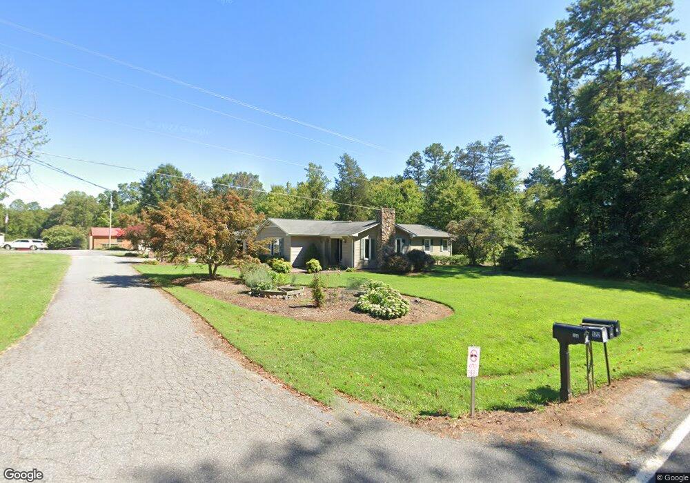
104 Dealwood Dr Statesville, NC 28625
Estimated Value: $331,000 - $427,000
2
Beds
3
Baths
2,192
Sq Ft
$166/Sq Ft
Est. Value
About This Home
This home is located at 104 Dealwood Dr, Statesville, NC 28625 and is currently estimated at $364,602, approximately $166 per square foot. 104 Dealwood Dr is a home located in Iredell County with nearby schools including Cool Spring Elementary School, East Iredell Middle School, and North Iredell High School.
Ownership History
Date
Name
Owned For
Owner Type
Purchase Details
Closed on
Jul 26, 2019
Sold by
Deal Loretta R
Bought by
Jones Charles Andrew and Jones Michelle
Current Estimated Value
Home Financials for this Owner
Home Financials are based on the most recent Mortgage that was taken out on this home.
Original Mortgage
$113,296
Outstanding Balance
$98,830
Interest Rate
3.82%
Mortgage Type
New Conventional
Estimated Equity
$265,772
Purchase Details
Closed on
Jan 30, 2015
Sold by
Bradshaw William A and Bradshaw Faye D
Bought by
Deal Lonnie W and Deal Loretta R
Home Financials for this Owner
Home Financials are based on the most recent Mortgage that was taken out on this home.
Original Mortgage
$100,000
Interest Rate
3.94%
Mortgage Type
Purchase Money Mortgage
Purchase Details
Closed on
Jun 1, 1981
Purchase Details
Closed on
Jun 1, 1975
Create a Home Valuation Report for This Property
The Home Valuation Report is an in-depth analysis detailing your home's value as well as a comparison with similar homes in the area
Home Values in the Area
Average Home Value in this Area
Purchase History
| Date | Buyer | Sale Price | Title Company |
|---|---|---|---|
| Jones Charles Andrew | $175,000 | None Available | |
| Deal Lonnie W | $160,000 | None Available | |
| -- | -- | -- | |
| -- | -- | -- |
Source: Public Records
Mortgage History
| Date | Status | Borrower | Loan Amount |
|---|---|---|---|
| Open | Jones Charles Andrew | $113,296 | |
| Previous Owner | Deal Lonnie W | $100,000 |
Source: Public Records
Tax History Compared to Growth
Tax History
| Year | Tax Paid | Tax Assessment Tax Assessment Total Assessment is a certain percentage of the fair market value that is determined by local assessors to be the total taxable value of land and additions on the property. | Land | Improvement |
|---|---|---|---|---|
| 2025 | $1,298 | $209,790 | $29,700 | $180,090 |
| 2024 | $1,298 | $209,790 | $29,700 | $180,090 |
| 2023 | $1,298 | $209,790 | $29,700 | $180,090 |
| 2022 | $1,053 | $158,200 | $24,130 | $134,070 |
| 2021 | $1,049 | $158,200 | $24,130 | $134,070 |
| 2020 | $1,049 | $158,200 | $24,130 | $134,070 |
| 2019 | $1,033 | $158,200 | $24,130 | $134,070 |
| 2018 | $849 | $133,360 | $24,130 | $109,230 |
| 2017 | $849 | $133,360 | $24,130 | $109,230 |
| 2016 | $849 | $133,360 | $24,130 | $109,230 |
| 2015 | $849 | $133,360 | $24,130 | $109,230 |
| 2014 | $891 | $151,120 | $29,700 | $121,420 |
Source: Public Records
Map
Nearby Homes
- 110 Taylors Garden Way
- 188 Gays Chapel Rd
- 258 New Salem Rd
- 358 New Salem Rd
- 507 New Salem Rd
- 484 New Salem Rd
- 535 New Salem Rd Unit 27
- 000 Pops Lake Rd
- 5131 Colchester Ct Unit 74
- 197 Sain Rd
- 208 James Dr
- 243 Jarab Hill Ln
- Plan 2505 at Swann Hills
- Plan 2328 at Swann Hills
- Plan 3210 at Swann Hills
- Plan 2906 at Swann Hills
- Plan 2700 at Swann Hills
- Plan 3119 at Swann Hills
- Plan 3130 at Swann Hills
- Plan 3040 at Swann Hills
- 217 Elmwood Rd
- 121 Dealwood Dr
- 226 Elmwood Rd
- 209 Elmwood Rd
- 122 Dealwood Dr
- 242 Elmwood Rd
- 236 Elmwood Rd
- 201 Elmwood Rd
- 253 Elmwood Rd
- n/a Elmwood Rd
- 248 Elmwood Rd
- 261 Elmwood Rd
- 194 Elmwood Rd
- 195 Elmwood Rd
- 254 Elmwood Rd
- 117 Dealwood Dr
- 188 Elmwood Rd
- 258 Elmwood Rd
- 193 Elmwood Rd
- 270 Elmwood Rd