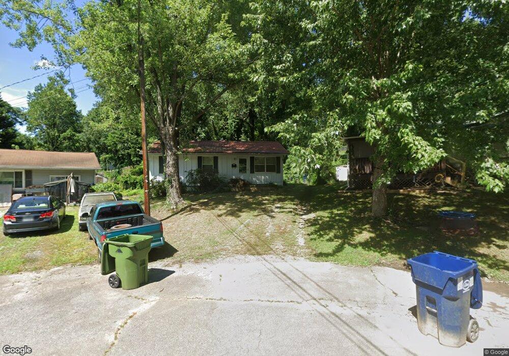
104 Martin Ave Asheville, NC 28806
West Asheville NeighborhoodEstimated Value: $352,000 - $399,000
3
Beds
2
Baths
952
Sq Ft
$401/Sq Ft
Est. Value
About This Home
This home is located at 104 Martin Ave, Asheville, NC 28806 and is currently estimated at $381,773, approximately $401 per square foot. 104 Martin Ave is a home located in Buncombe County with nearby schools including Hall Fletcher Elementary, Isaac Dickson Elementary, and Ira B Jones Elementary.
Ownership History
Date
Name
Owned For
Owner Type
Purchase Details
Closed on
Jul 15, 2011
Sold by
Bright Cynthia F
Bought by
Gordon Margaret E
Current Estimated Value
Home Financials for this Owner
Home Financials are based on the most recent Mortgage that was taken out on this home.
Original Mortgage
$114,520
Outstanding Balance
$78,749
Interest Rate
4.5%
Mortgage Type
FHA
Estimated Equity
$303,024
Purchase Details
Closed on
Oct 26, 1998
Sold by
Banks Doris D
Bought by
Bright Eric V and Bright Cynthia F
Create a Home Valuation Report for This Property
The Home Valuation Report is an in-depth analysis detailing your home's value as well as a comparison with similar homes in the area
Home Values in the Area
Average Home Value in this Area
Purchase History
| Date | Buyer | Sale Price | Title Company |
|---|---|---|---|
| Gordon Margaret E | $118,000 | None Available | |
| Bright Eric V | $70,000 | -- |
Source: Public Records
Mortgage History
| Date | Status | Borrower | Loan Amount |
|---|---|---|---|
| Open | Gordon Margaret E | $114,520 |
Source: Public Records
Tax History Compared to Growth
Tax History
| Year | Tax Paid | Tax Assessment Tax Assessment Total Assessment is a certain percentage of the fair market value that is determined by local assessors to be the total taxable value of land and additions on the property. | Land | Improvement |
|---|---|---|---|---|
| 2025 | $2,609 | $252,500 | $55,700 | $196,800 |
| 2024 | $2,609 | $252,500 | $55,700 | $196,800 |
| 2023 | $2,609 | $252,500 | $55,700 | $196,800 |
| 2022 | $2,518 | $252,500 | $55,700 | $196,800 |
| 2021 | $2,518 | $252,500 | $0 | $0 |
| 2020 | $2,109 | $195,700 | $0 | $0 |
| 2019 | $2,109 | $195,700 | $0 | $0 |
| 2018 | $2,109 | $195,700 | $0 | $0 |
| 2017 | $2,129 | $120,700 | $0 | $0 |
| 2016 | $1,483 | $120,700 | $0 | $0 |
| 2015 | $1,483 | $120,700 | $0 | $0 |
| 2014 | $1,465 | $120,700 | $0 | $0 |
Source: Public Records
Map
Nearby Homes
- 60 Dorchester Ave
- 37 Bryant St
- 74 Brucemont Cir
- 197 Brucemont Cir
- 113 Burton St
- 54 Louisiana Ave
- 141 Louisiana Ave
- 52 Boyd Ave
- 123 Brucemont Cir
- 55 Herron Ave
- 199 Pennsylvania Ave
- 18 Jarrett St
- 7 Mauricet Ln
- 43 Argyle Ln
- 68 1/2 Nevada Ave
- 27 Mauricet Ln
- 75 Nevada Ave
- 99999 State St
- 219 Fayetteville St
- 68 Vandalia Ave
- 100 Martin Ave
- 103 Martin Ave
- 25 Florida Ave
- 43 Kendall St
- 98 Martin Ave
- 96 Martin Ave
- 45 Kendall St
- 99 Martin Ave
- 94 Martin Ave
- 49 Downing St
- 41 Kendall St
- 27 Florida Ave
- 91 Martin Ave
- 75 Balm Grove Ave
- 71 Balm Grove Ave
- 92 Martin Ave
- 39 Kendall St
- 91 Downing St
- 2 Downing St Units A & B
- 99999 Balm Grove Ave