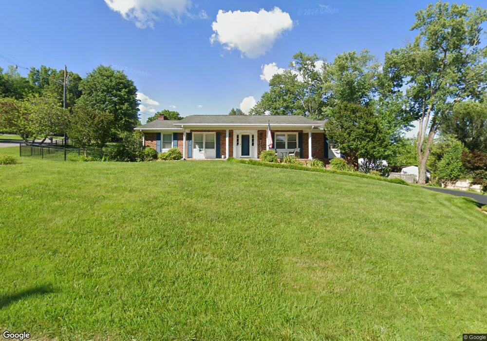
104 Pecos St Bristol, TN 37620
Estimated Value: $244,000 - $327,000
3
Beds
2
Baths
1,711
Sq Ft
$168/Sq Ft
Est. Value
About This Home
This home is located at 104 Pecos St, Bristol, TN 37620 and is currently estimated at $288,170, approximately $168 per square foot. 104 Pecos St is a home located in Sullivan County with nearby schools including Avoca Elementary School, Vance Middle School, and Tennessee High School.
Ownership History
Date
Name
Owned For
Owner Type
Purchase Details
Closed on
Jul 2, 2002
Sold by
Homeq Servicing Corporatio
Bought by
Meares Darrell P
Current Estimated Value
Home Financials for this Owner
Home Financials are based on the most recent Mortgage that was taken out on this home.
Original Mortgage
$72,000
Outstanding Balance
$30,436
Interest Rate
6.67%
Estimated Equity
$257,734
Purchase Details
Closed on
Dec 6, 2001
Purchase Details
Closed on
Mar 28, 1995
Sold by
Phillips Gladys M
Bought by
Wesley Jackson
Create a Home Valuation Report for This Property
The Home Valuation Report is an in-depth analysis detailing your home's value as well as a comparison with similar homes in the area
Home Values in the Area
Average Home Value in this Area
Purchase History
| Date | Buyer | Sale Price | Title Company |
|---|---|---|---|
| Meares Darrell P | $90,000 | -- | |
| -- | $85,200 | -- | |
| Wesley Jackson | $69,900 | -- |
Source: Public Records
Mortgage History
| Date | Status | Borrower | Loan Amount |
|---|---|---|---|
| Open | Wesley Jackson | $72,000 | |
| Closed | Wesley Jackson | $18,000 |
Source: Public Records
Tax History Compared to Growth
Tax History
| Year | Tax Paid | Tax Assessment Tax Assessment Total Assessment is a certain percentage of the fair market value that is determined by local assessors to be the total taxable value of land and additions on the property. | Land | Improvement |
|---|---|---|---|---|
| 2024 | -- | $40,325 | $4,950 | $35,375 |
| 2023 | $1,771 | $40,325 | $4,950 | $35,375 |
| 2022 | $1,771 | $40,325 | $4,950 | $35,375 |
| 2021 | $1,771 | $40,325 | $4,950 | $35,375 |
| 2020 | $1,789 | $40,325 | $4,950 | $35,375 |
| 2019 | $1,789 | $37,825 | $4,950 | $32,875 |
| 2018 | $1,782 | $37,825 | $4,950 | $32,875 |
| 2017 | $1,782 | $37,825 | $4,950 | $32,875 |
| 2016 | $1,703 | $35,300 | $4,950 | $30,350 |
| 2014 | -- | $35,304 | $0 | $0 |
Source: Public Records
Map
Nearby Homes
- 521 Hickory Rd
- 301 El Paso Dr
- 209 Santa fe Dr
- 305 Sunnybrook Dr
- 212 Hemlock Rd
- 210 Hemlock Rd
- 113 Hemlock Rd
- 2118 King College Rd
- 403 Martindale Rd
- 302 Martindale Rd
- 1026 Deer Harbour Rd
- 100 Martindale Rd
- 101 Timberlane Rd
- 112 Holston View Dr
- 1208 Bluff City Hwy
- 108 Quail Run
- 316 Timberlane Rd
- 204 Johnston Ave
- 101 Tween Hills Rd
- 307 Tween Hills Rd
- 204 Whitaker Dr
- 805 Santa fe Dr
- 801 Santa fe Dr
- 105 Pecos St
- 133 Whitaker Dr
- 809 Santa fe Dr
- 208 Whitaker Dr
- 129 Whitaker Dr
- 717 Santa fe Dr
- 116 Whitaker Dr
- 616 San Antonio Dr
- 808 Santa fe Dr
- 201 Whitaker Dr
- 711 Santa fe Dr
- 114 Whitaker Dr
- 612 San Antonio Dr
- 804 Santa fe Dr
- 621 San Antonio Dr
- 621 San Antonio Dr Unit 1
- 800 Santa fe Dr