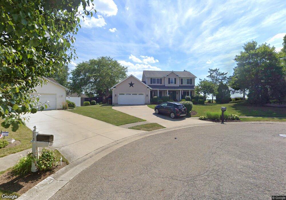
104 Shawnee Cir Louisville, OH 44641
Estimated Value: $287,614 - $337,000
3
Beds
3
Baths
2,022
Sq Ft
$156/Sq Ft
Est. Value
About This Home
This home is located at 104 Shawnee Cir, Louisville, OH 44641 and is currently estimated at $316,404, approximately $156 per square foot. 104 Shawnee Cir is a home located in Stark County with nearby schools including Louisville High School and St. Thomas Aquinas High School & Middle School.
Ownership History
Date
Name
Owned For
Owner Type
Purchase Details
Closed on
May 21, 2003
Sold by
Campbell Glen and Campbell Jamie
Bought by
Gatta Edward J and Gatta Christine A
Current Estimated Value
Home Financials for this Owner
Home Financials are based on the most recent Mortgage that was taken out on this home.
Original Mortgage
$116,000
Interest Rate
5.95%
Mortgage Type
Purchase Money Mortgage
Create a Home Valuation Report for This Property
The Home Valuation Report is an in-depth analysis detailing your home's value as well as a comparison with similar homes in the area
Home Values in the Area
Average Home Value in this Area
Purchase History
| Date | Buyer | Sale Price | Title Company |
|---|---|---|---|
| Gatta Edward J | $166,000 | -- |
Source: Public Records
Mortgage History
| Date | Status | Borrower | Loan Amount |
|---|---|---|---|
| Closed | Gatta Edward J | $116,000 |
Source: Public Records
Tax History Compared to Growth
Tax History
| Year | Tax Paid | Tax Assessment Tax Assessment Total Assessment is a certain percentage of the fair market value that is determined by local assessors to be the total taxable value of land and additions on the property. | Land | Improvement |
|---|---|---|---|---|
| 2025 | -- | $95,240 | $17,750 | $77,490 |
| 2024 | -- | $95,240 | $17,750 | $77,490 |
| 2023 | $2,913 | $67,800 | $17,610 | $50,190 |
| 2022 | $1,460 | $67,800 | $17,610 | $50,190 |
| 2021 | $2,928 | $67,800 | $17,610 | $50,190 |
| 2020 | $2,426 | $61,010 | $15,890 | $45,120 |
| 2019 | $2,436 | $60,130 | $15,890 | $44,240 |
| 2018 | $2,391 | $60,130 | $15,890 | $44,240 |
| 2017 | $2,238 | $54,290 | $12,950 | $41,340 |
| 2016 | $2,284 | $54,290 | $12,950 | $41,340 |
| 2015 | $2,290 | $54,290 | $12,950 | $41,340 |
| 2014 | $127 | $46,870 | $11,200 | $35,670 |
| 2013 | $1,067 | $46,870 | $11,200 | $35,670 |
Source: Public Records
Map
Nearby Homes
- 1702 View Pointe Ave
- 1639 Horizon Dr
- 908 Sand Lot Cir
- 510 S Bauman Ct
- 8225 Georgetown St
- 204 E Broad St
- 6969 Georgetown St NE
- 107 E Broad St
- 728 E Broad St
- 520 S Silver St
- 641 S Nickelplate St
- 2425 Miday Ave NE
- 308 Superior St
- 1715 High St
- 2110 Edmar St
- 201 Indiana Ave
- 3390 Meese Rd NE
- 325 Lincoln Ave
- 1812 E Broad St
- 4060 Hambleton Ave NE
- 40 Shawnee Cir
- 38 Shawnee Cir
- 114 Shawnee Cir
- 34 Shawnee Cir
- 105 Buffalo Ridge St
- 33 Shawnee Cir
- 204 Shawnee Cir
- 115 Buffalo Ridge St
- 105 Shawnee Cir
- 1825 S Chapel St
- 115 Shawnee Cir
- 205 Buffalo Ridge St
- 205 Shawnee Cir
- 214 Shawnee Cir
- 215 Buffalo Ridge St
- 215 Shawnee Cir
- 1811 S Chapel St
- 104 Buffalo Ridge St
- 304 Shawnee Cir
- 114 Buffalo Ridge St