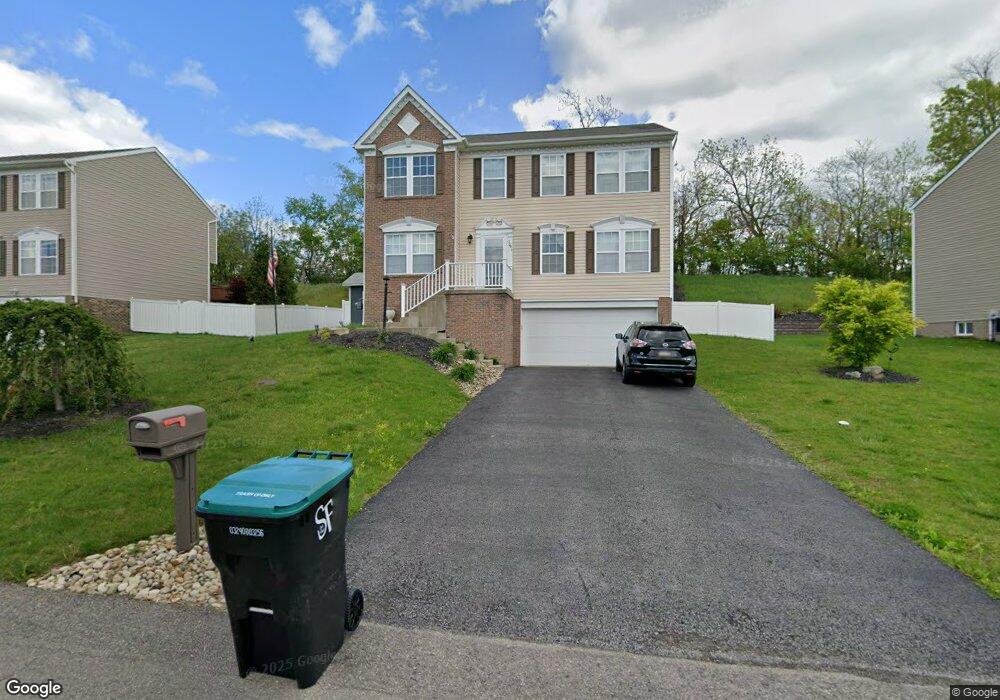
1041 Granite Dr Mc Donald, PA 15057
Estimated Value: $409,000 - $463,000
4
Beds
3
Baths
1,988
Sq Ft
$217/Sq Ft
Est. Value
About This Home
This home is located at 1041 Granite Dr, Mc Donald, PA 15057 and is currently estimated at $431,477, approximately $217 per square foot. 1041 Granite Dr is a home located in Allegheny County with nearby schools including South Fayette Elementary School, South Fayette Intermediate School, and South Fayette Middle School.
Ownership History
Date
Name
Owned For
Owner Type
Purchase Details
Closed on
Aug 27, 2014
Sold by
Maronda Homes Inc
Bought by
Coccaro Jeffrey R
Current Estimated Value
Home Financials for this Owner
Home Financials are based on the most recent Mortgage that was taken out on this home.
Original Mortgage
$241,706
Outstanding Balance
$184,905
Interest Rate
4.12%
Mortgage Type
FHA
Estimated Equity
$246,572
Create a Home Valuation Report for This Property
The Home Valuation Report is an in-depth analysis detailing your home's value as well as a comparison with similar homes in the area
Home Values in the Area
Average Home Value in this Area
Purchase History
| Date | Buyer | Sale Price | Title Company |
|---|---|---|---|
| Coccaro Jeffrey R | $246,165 | -- |
Source: Public Records
Mortgage History
| Date | Status | Borrower | Loan Amount |
|---|---|---|---|
| Open | Coccaro Jeffrey R | $241,706 |
Source: Public Records
Tax History Compared to Growth
Tax History
| Year | Tax Paid | Tax Assessment Tax Assessment Total Assessment is a certain percentage of the fair market value that is determined by local assessors to be the total taxable value of land and additions on the property. | Land | Improvement |
|---|---|---|---|---|
| 2025 | $8,009 | $221,500 | $37,200 | $184,300 |
| 2024 | $8,009 | $221,500 | $37,200 | $184,300 |
| 2023 | $8,009 | $221,500 | $37,200 | $184,300 |
| 2022 | $8,009 | $221,500 | $37,200 | $184,300 |
| 2021 | $2,095 | $221,500 | $37,200 | $184,300 |
| 2020 | $8,009 | $221,500 | $37,200 | $184,300 |
| 2019 | $8,009 | $221,500 | $37,200 | $184,300 |
| 2018 | $1,048 | $221,500 | $37,200 | $184,300 |
| 2017 | $7,954 | $221,500 | $37,200 | $184,300 |
| 2016 | $1,048 | $221,500 | $37,200 | $184,300 |
| 2015 | $1,048 | $129,350 | $37,200 | $92,150 |
| 2014 | $4,323 | $900 | $900 | $0 |
Source: Public Records
Map
Nearby Homes
- 1015 Granite Dr
- 1232 Gneiss Dr
- Lot 3166 Robinson Run Rd
- 146 Mcvey St
- 114 Mcvey St
- 2033 Field Stone Dr
- Lot 3 McVey Street Extension
- Lot 4 McVey Street Extension
- 809 Station St
- 0 McVey St Extension Unit 1692515
- 2006 Field Stone Dr
- 4401 Battle Ridge Rd
- Tucson Plan at Stonegate
- Birmingham Plan at Stonegate
- Waterloo Plan at Stonegate
- Boston Plan at Stonegate
- Carlisle Plan at Stonegate
- Somerset Plan at Stonegate
- Hoover Plan at Stonegate
- Truman Plan at Stonegate
- 1039 Granite Dr
- Lot325 Granite Dr
- Lot 327 Granite Dr
- 1043 Granite Dr
- 1037 Granite Dr
- 1037 Granite Dr
- 1042 Granite Dr
- 1040 Granite Dr
- 1044 Granite Dr
- 1038 Granite Dr
- 1046 Granite Dr
- 1035 Granite Dr
- 1036 Granite Dr
- 1048 Granite Dr
- 1050 Granite Dr
- 1051 Granite Dr
- 1032 Granite Dr
- 1317 Sandstone Dr
- 1315 Sandstone Dr
- 1053 Granite Dr