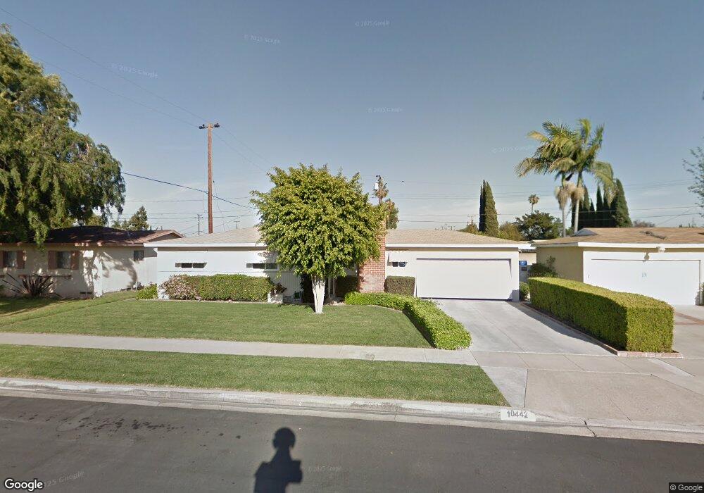
10442 Hedlund Dr Anaheim, CA 92804
West Anaheim NeighborhoodEstimated Value: $767,000 - $883,125
3
Beds
2
Baths
1,125
Sq Ft
$734/Sq Ft
Est. Value
About This Home
This home is located at 10442 Hedlund Dr, Anaheim, CA 92804 and is currently estimated at $826,031, approximately $734 per square foot. 10442 Hedlund Dr is a home located in Orange County with nearby schools including Jonas E. Salk Elementary School, Dale Jr High School, and Magnolia High.
Ownership History
Date
Name
Owned For
Owner Type
Purchase Details
Closed on
Apr 24, 2024
Sold by
Fami Herbert R and Fami Margarethe
Bought by
Puvvada Ami and Puvvada Rakesh
Current Estimated Value
Purchase Details
Closed on
Oct 7, 1997
Sold by
Eichler Herbert R and Eichler M H
Bought by
Eichler Herbert R and Eichler Margarethe M H
Purchase Details
Closed on
Sep 15, 1997
Sold by
Eichler Herbert R and Eichler M H
Bought by
Eichler Herbert R and Eichler Margarethe M H
Create a Home Valuation Report for This Property
The Home Valuation Report is an in-depth analysis detailing your home's value as well as a comparison with similar homes in the area
Home Values in the Area
Average Home Value in this Area
Purchase History
| Date | Buyer | Sale Price | Title Company |
|---|---|---|---|
| Puvvada Ami | $700,000 | Lawyers Title Company | |
| Eichler Herbert R | -- | -- | |
| Eichler Herbert R | -- | -- |
Source: Public Records
Tax History Compared to Growth
Tax History
| Year | Tax Paid | Tax Assessment Tax Assessment Total Assessment is a certain percentage of the fair market value that is determined by local assessors to be the total taxable value of land and additions on the property. | Land | Improvement |
|---|---|---|---|---|
| 2025 | $8,193 | $826,200 | $767,770 | $58,430 |
| 2024 | $8,193 | $58,491 | $29,749 | $28,742 |
| 2023 | $1,050 | $57,345 | $29,166 | $28,179 |
| 2022 | $1,061 | $56,221 | $28,594 | $27,627 |
| 2021 | $1,050 | $55,119 | $28,033 | $27,086 |
| 2020 | $1,023 | $54,554 | $27,745 | $26,809 |
| 2019 | $1,008 | $53,485 | $27,201 | $26,284 |
| 2018 | $1,016 | $52,437 | $26,668 | $25,769 |
| 2017 | $991 | $51,409 | $26,145 | $25,264 |
| 2016 | $983 | $50,401 | $25,632 | $24,769 |
| 2015 | $967 | $49,644 | $25,247 | $24,397 |
| 2014 | $936 | $48,672 | $24,752 | $23,920 |
Source: Public Records
Map
Nearby Homes
- 10301 Rhiems Rd
- 10301 Antigua St
- 9272 Cerritos Ave
- 1250 S Brookhurst St Unit 1059
- 1250 S Brookhurst St Unit 2028
- 1250 S Brookhurst St Unit 2080
- 1250 S Brookhurst St
- 1250 S Brookhurst St Unit 2033
- 1350 S Ashington Ln
- 1765 S Biscayne Ct
- 998 S Crossbow Ln Unit 12D
- 994 S Sutter Creek Rd Unit 60
- 958 S Crossbow Ln Unit 8
- 9155 Pacific Ave Unit 265
- 1737 S Garden Dr
- 9592 Katella Ave
- 938 S Sutter Creek Rd Unit 54
- 917 S Sutter Creek Rd Unit 46
- 1944 W Lullaby Ln
- 2533 W Chanticleer Rd
- 10432 Hedlund Dr
- 10462 Hedlund Dr
- 10441 Perdido St
- 10451 Perdido St
- 10421 Perdido St
- 10412 Hedlund Dr
- 10461 Perdido St
- 10472 Hedlund Dr
- 10441 Hedlund Dr
- 10461 Hedlund Dr
- 10431 Hedlund Dr
- 10411 Perdido St
- 10471 Perdido St
- 10402 Hedlund Dr
- 10471 Hedlund Dr
- 10411 Hedlund Dr
- 9711 Hawkeye Ln
- 10401 Perdido St
- 9772 Lullaby Ln
- 10452 Oakley Dr