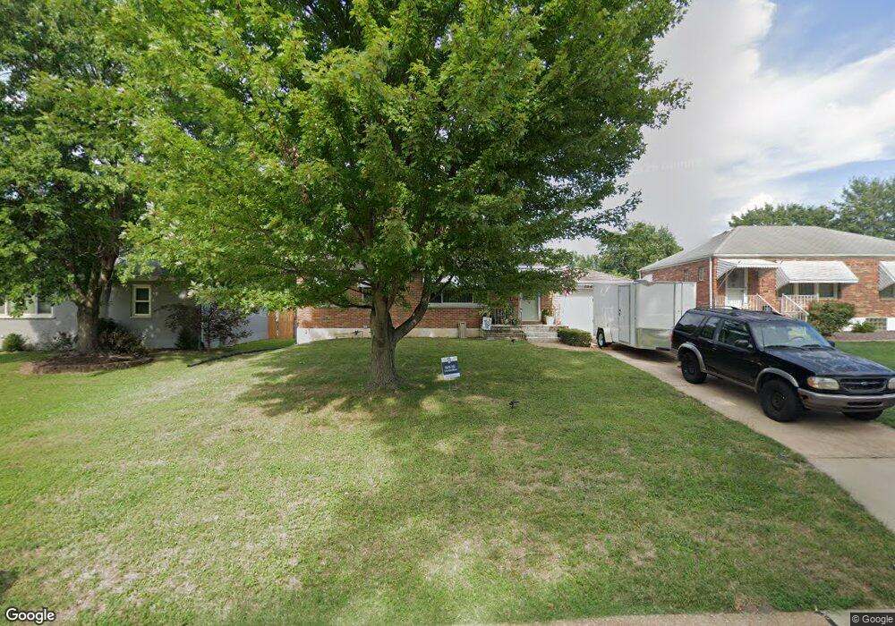
1045 Roxbury Dr Saint Louis, MO 63125
Mehlville NeighborhoodEstimated Value: $200,783 - $233,000
2
Beds
1
Bath
962
Sq Ft
$223/Sq Ft
Est. Value
About This Home
This home is located at 1045 Roxbury Dr, Saint Louis, MO 63125 and is currently estimated at $214,696, approximately $223 per square foot. 1045 Roxbury Dr is a home located in St. Louis County with nearby schools including Forder Elementary School, Margaret Buerkle Middle School, and Mehlville High School.
Ownership History
Date
Name
Owned For
Owner Type
Purchase Details
Closed on
Feb 13, 2003
Sold by
Minnick Joseph R
Bought by
Rodriguez Charlie
Current Estimated Value
Home Financials for this Owner
Home Financials are based on the most recent Mortgage that was taken out on this home.
Original Mortgage
$93,500
Interest Rate
5.83%
Mortgage Type
Purchase Money Mortgage
Purchase Details
Closed on
Mar 16, 1998
Sold by
Kemper James T
Bought by
Minnick Joseph R
Home Financials for this Owner
Home Financials are based on the most recent Mortgage that was taken out on this home.
Original Mortgage
$83,400
Interest Rate
7.12%
Create a Home Valuation Report for This Property
The Home Valuation Report is an in-depth analysis detailing your home's value as well as a comparison with similar homes in the area
Home Values in the Area
Average Home Value in this Area
Purchase History
| Date | Buyer | Sale Price | Title Company |
|---|---|---|---|
| Rodriguez Charlie | $117,000 | -- | |
| Minnick Joseph R | -- | -- |
Source: Public Records
Mortgage History
| Date | Status | Borrower | Loan Amount |
|---|---|---|---|
| Closed | Rodriguez Charlie | $93,500 | |
| Previous Owner | Minnick Joseph R | $83,400 |
Source: Public Records
Tax History Compared to Growth
Tax History
| Year | Tax Paid | Tax Assessment Tax Assessment Total Assessment is a certain percentage of the fair market value that is determined by local assessors to be the total taxable value of land and additions on the property. | Land | Improvement |
|---|---|---|---|---|
| 2025 | $2,099 | $34,640 | $16,610 | $18,030 |
| 2024 | $2,099 | $30,800 | $10,810 | $19,990 |
| 2023 | $2,072 | $30,800 | $10,810 | $19,990 |
| 2022 | $1,846 | $25,440 | $10,810 | $14,630 |
| 2021 | $1,639 | $25,440 | $10,810 | $14,630 |
| 2020 | $1,729 | $25,540 | $10,810 | $14,730 |
| 2019 | $1,724 | $25,540 | $10,810 | $14,730 |
| 2018 | $1,606 | $21,470 | $6,880 | $14,590 |
| 2017 | $1,604 | $21,470 | $6,880 | $14,590 |
| 2016 | $1,554 | $19,950 | $5,930 | $14,020 |
| 2015 | $1,458 | $19,950 | $5,930 | $14,020 |
| 2014 | $1,490 | $20,200 | $5,470 | $14,730 |
Source: Public Records
Map
Nearby Homes
- 1153 Calley Dr Unit 1153
- 1275 Gardens Circle Dr Unit A
- 2460 Lampong Dr Unit 100C
- 2669 Jonathan Dr
- 669 Vista Conn Dr
- 2216 Apple Bud Ln
- 660 Rochester Dr
- 32 Buckley Meadows Dr
- 2215 Apple Bud Ln
- 669 Bellsworth Dr
- 645 Vista Conn Dr
- 2105 Telford Dr
- 502 Nannette Dr
- 600 Ellwine Dr
- 2228 Hagenstone Terrace
- 3618 Tracey Rich Rd Unit 1B
- 1716 Mayenne Ct Unit E
- 2414 Via Miralesta Dr
- 2444 Via Miralesta Dr
- 3809 Tahquitz Dr
- 1041 Roxbury Dr
- 1101 Roxbury Dr
- 1037 Roxbury Dr
- 1105 Roxbury Dr
- 0TBB Peppermil
- 1034 Reavis Barracks Rd
- 1030 Reavis Barracks Rd
- 1100 Reavis Barracks Rd
- 1075 Rainbow Dr
- 1033 Roxbury Dr
- 1109 Roxbury Dr
- 1038 Roxbury Dr
- 1026 Reavis Barracks Rd
- 1104 Reavis Barracks Rd
- 1022 Reavis Barracks Rd
- 1029 Roxbury Dr
- 1034 Roxbury Dr
- 1113 Roxbury Dr
- 1067 Rainbow Dr
- 1018 Reavis Barracks Rd