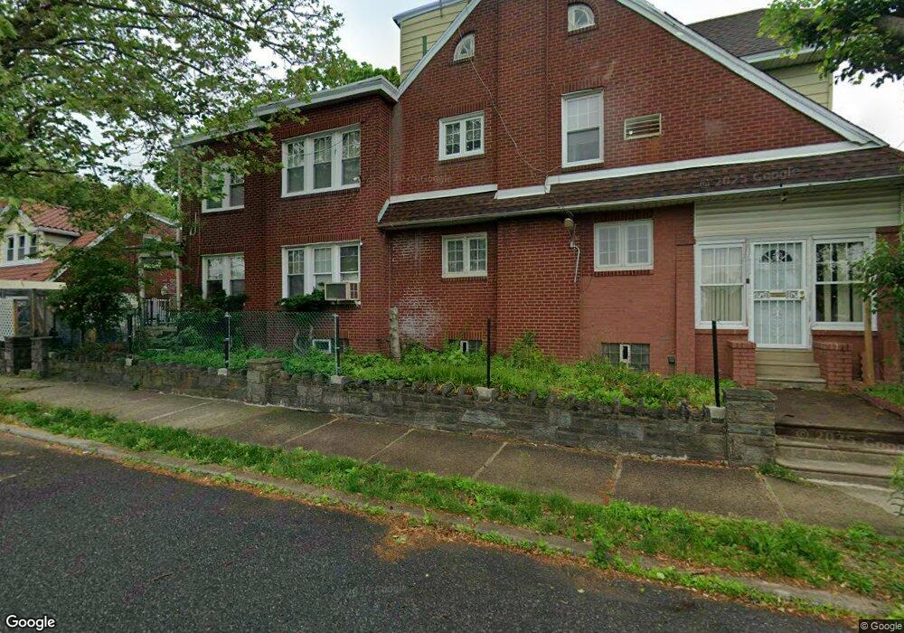
1048 Pratt St Philadelphia, PA 19124
Frankford NeighborhoodEstimated Value: $315,432 - $383,000
--
Bed
--
Bath
2,232
Sq Ft
$157/Sq Ft
Est. Value
About This Home
This home is located at 1048 Pratt St, Philadelphia, PA 19124 and is currently estimated at $350,108, approximately $156 per square foot. 1048 Pratt St is a home located in Philadelphia County with nearby schools including Frankford High School, The Philadelphia Charter School for the Arts & Sciences, and Northwood Academy Charter School.
Ownership History
Date
Name
Owned For
Owner Type
Purchase Details
Closed on
Nov 10, 2005
Sold by
Luberski Leon A and Luberski Dorothy A
Bought by
Derisier Jacqueline
Current Estimated Value
Home Financials for this Owner
Home Financials are based on the most recent Mortgage that was taken out on this home.
Original Mortgage
$140,000
Outstanding Balance
$76,392
Interest Rate
6.07%
Mortgage Type
Fannie Mae Freddie Mac
Estimated Equity
$273,716
Create a Home Valuation Report for This Property
The Home Valuation Report is an in-depth analysis detailing your home's value as well as a comparison with similar homes in the area
Home Values in the Area
Average Home Value in this Area
Purchase History
| Date | Buyer | Sale Price | Title Company |
|---|---|---|---|
| Derisier Jacqueline | $240,000 | None Available |
Source: Public Records
Mortgage History
| Date | Status | Borrower | Loan Amount |
|---|---|---|---|
| Open | Derisier Jacqueline | $140,000 |
Source: Public Records
Tax History Compared to Growth
Tax History
| Year | Tax Paid | Tax Assessment Tax Assessment Total Assessment is a certain percentage of the fair market value that is determined by local assessors to be the total taxable value of land and additions on the property. | Land | Improvement |
|---|---|---|---|---|
| 2026 | $3,141 | $270,200 | $54,040 | $216,160 |
| 2025 | $3,141 | $270,200 | $54,040 | $216,160 |
| 2024 | $3,141 | $270,200 | $54,040 | $216,160 |
| 2023 | $3,141 | $224,400 | $44,880 | $179,520 |
| 2022 | $2,326 | $224,400 | $44,880 | $179,520 |
| 2021 | $2,326 | $0 | $0 | $0 |
| 2020 | $2,326 | $0 | $0 | $0 |
| 2019 | $2,233 | $0 | $0 | $0 |
| 2018 | $2,315 | $0 | $0 | $0 |
| 2017 | $2,315 | $0 | $0 | $0 |
| 2016 | $2,315 | $0 | $0 | $0 |
| 2015 | $2,216 | $0 | $0 | $0 |
| 2014 | -- | $165,400 | $51,241 | $114,159 |
| 2012 | -- | $22,368 | $3,288 | $19,080 |
Source: Public Records
Map
Nearby Homes
- 1048 Bridge St
- 1137 Bridge St
- 1204 Pratt St
- 1218 Pratt St
- 1220 Pratt St
- 5118 Oakland St
- 1208 Haworth St
- 5659 Miriam Rd
- 5661 Miriam Rd
- 1214 Haworth St
- 5640 Miriam Rd
- 5347 Sylvester St
- 1052 Allengrove St
- 1244 E Sanger St
- 5505 Loretto Ave
- 5304 Akron St
- 5241 Akron St
- 4046 E Roosevelt Blvd
- 1859 Harrison St
- 5244 Saul St