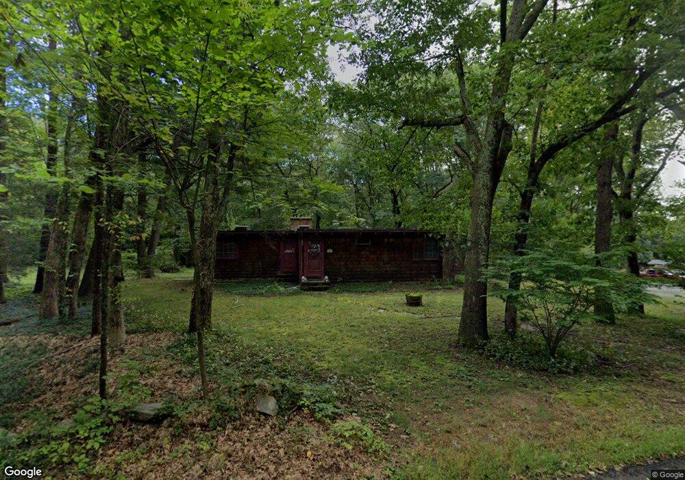
1049 Lebanon Hill Rd Southbridge, MA 01550
Estimated Value: $404,000 - $461,000
3
Beds
2
Baths
1,705
Sq Ft
$250/Sq Ft
Est. Value
About This Home
This home is located at 1049 Lebanon Hill Rd, Southbridge, MA 01550 and is currently estimated at $425,929, approximately $249 per square foot. 1049 Lebanon Hill Rd is a home located in Worcester County.
Ownership History
Date
Name
Owned For
Owner Type
Purchase Details
Closed on
May 19, 1992
Sold by
Meunier Evelyn L and Meunier Robert
Bought by
Mahan Bernard and Mahan Theresa
Current Estimated Value
Home Financials for this Owner
Home Financials are based on the most recent Mortgage that was taken out on this home.
Original Mortgage
$28,000
Interest Rate
8.89%
Mortgage Type
Purchase Money Mortgage
Create a Home Valuation Report for This Property
The Home Valuation Report is an in-depth analysis detailing your home's value as well as a comparison with similar homes in the area
Home Values in the Area
Average Home Value in this Area
Purchase History
| Date | Buyer | Sale Price | Title Company |
|---|---|---|---|
| Mahan Bernard | $98,000 | -- |
Source: Public Records
Mortgage History
| Date | Status | Borrower | Loan Amount |
|---|---|---|---|
| Closed | Mahan Bernard | $28,000 | |
| Previous Owner | Mahan Bernard | $95,000 |
Source: Public Records
Tax History Compared to Growth
Tax History
| Year | Tax Paid | Tax Assessment Tax Assessment Total Assessment is a certain percentage of the fair market value that is determined by local assessors to be the total taxable value of land and additions on the property. | Land | Improvement |
|---|---|---|---|---|
| 2025 | $5,181 | $353,400 | $74,800 | $278,600 |
| 2024 | $5,529 | $362,300 | $68,100 | $294,200 |
| 2023 | $5,340 | $337,100 | $68,100 | $269,000 |
| 2022 | $5,076 | $283,600 | $58,300 | $225,300 |
| 2021 | $4,891 | $251,600 | $58,300 | $193,300 |
| 2020 | $4,704 | $241,500 | $58,300 | $183,200 |
| 2018 | $4,524 | $218,000 | $58,300 | $159,700 |
| 2017 | $4,289 | $208,500 | $58,300 | $150,200 |
| 2016 | $4,208 | $208,200 | $64,300 | $143,900 |
| 2015 | $4,048 | $198,800 | $64,300 | $134,500 |
| 2014 | $3,781 | $192,500 | $64,300 | $128,200 |
Source: Public Records
Map
Nearby Homes
- 55 Pond View Dr
- 504 Alpine Dr
- 1023 N Woodstock Rd
- 00 Ide Perrin Rd
- 104 Hilltop Dr Unit 2
- 1669 Route 169
- 717 Tipton Rock Rd
- 0 Alpine Dr
- 71 Rawson Rd
- 0 English Neighborhood Rd
- 99 Lebanon Hill Rd
- 29 Arland Dr
- 0 Brentwood Dr
- 0 Lebanon Hill Rd
- 22 Jacobs Rd
- 320 Elm St
- 38 Meadowbrook Rd
- 325 Ashland Ave Unit 10
- 325 Ashland Ave Unit 2
- 325 Ashland Ave Unit 12
- 1063 Lebanon Hill Rd
- 1079 Lebanon Hill Rd
- 1081 Lebanon Hill Rd
- 1093 Lebanon Hill Rd
- 980 Lebanon Hill Rd
- 1105 Lebanon Hill Rd
- 183 Lebanon Hill Rd
- 00 Lebanon Hill Rd
- 1570 Lebanon Hill Rd
- 173 Lebanon Hill Rd
- 949 Lebanon Hill Rd
- 59 Oak Hill Ln
- 76 Oak Hill Ln
- 0 Oak Dr
- 50 Oak Hill Ln
- XX Pond Factory Rd
- Lot59 Oak
- 258 Pond Factory Rd
- 151 Lebanon Hill Rd
- 911 Lebanon Hill Rd