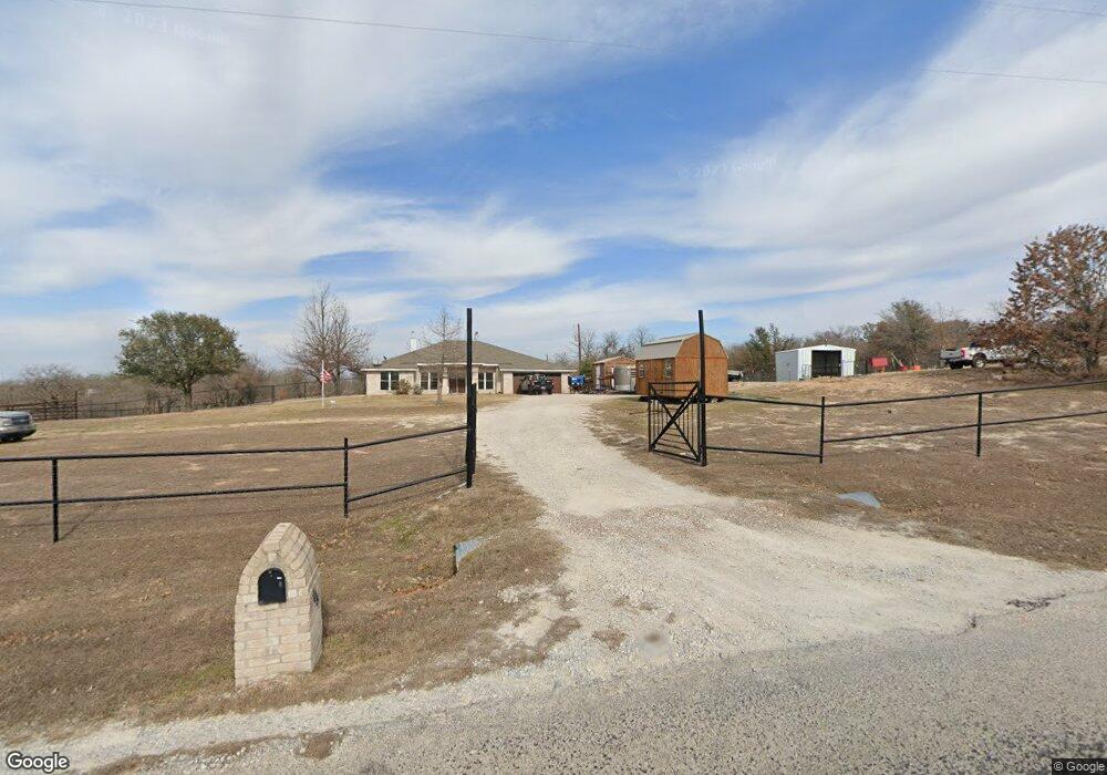
105 Bronco Ln Springtown, TX 76082
Estimated Value: $548,000 - $606,000
4
Beds
3
Baths
2,448
Sq Ft
$234/Sq Ft
Est. Value
About This Home
This home is located at 105 Bronco Ln, Springtown, TX 76082 and is currently estimated at $573,100, approximately $234 per square foot. 105 Bronco Ln is a home with nearby schools including Poolville Elementary School, Poolville J High School, and Poolville High School.
Ownership History
Date
Name
Owned For
Owner Type
Purchase Details
Closed on
Jun 10, 2025
Sold by
Monaco Karen P
Bought by
Salas Bidal and Salas Amanda Mae
Current Estimated Value
Home Financials for this Owner
Home Financials are based on the most recent Mortgage that was taken out on this home.
Original Mortgage
$519,412
Outstanding Balance
$518,065
Interest Rate
6.76%
Mortgage Type
VA
Estimated Equity
$55,035
Purchase Details
Closed on
Dec 14, 2017
Sold by
Cosby Timothy W and Cosby Sandra G
Bought by
Monaco Karen P
Home Financials for this Owner
Home Financials are based on the most recent Mortgage that was taken out on this home.
Original Mortgage
$272,000
Interest Rate
3.9%
Mortgage Type
New Conventional
Purchase Details
Closed on
Jan 1, 1901
Bought by
Cosby Timothy and Cosby Sandra
Create a Home Valuation Report for This Property
The Home Valuation Report is an in-depth analysis detailing your home's value as well as a comparison with similar homes in the area
Home Values in the Area
Average Home Value in this Area
Purchase History
| Date | Buyer | Sale Price | Title Company |
|---|---|---|---|
| Salas Bidal | -- | None Listed On Document | |
| Monaco Karen P | -- | Affinity Title | |
| Cosby Timothy | -- | -- |
Source: Public Records
Mortgage History
| Date | Status | Borrower | Loan Amount |
|---|---|---|---|
| Open | Salas Bidal | $519,412 | |
| Previous Owner | Monaco Karen P | $272,000 |
Source: Public Records
Tax History Compared to Growth
Tax History
| Year | Tax Paid | Tax Assessment Tax Assessment Total Assessment is a certain percentage of the fair market value that is determined by local assessors to be the total taxable value of land and additions on the property. | Land | Improvement |
|---|---|---|---|---|
| 2025 | $1,589 | $508,648 | $153,750 | $354,898 |
| 2024 | $1,589 | $498,994 | $0 | $0 |
| 2023 | $5,184 | $445,900 | $0 | $0 |
| 2022 | $6,279 | $405,364 | $0 | $0 |
| 2021 | $5,675 | $372,940 | $108,750 | $264,190 |
| 2020 | $5,474 | $335,010 | $84,370 | $250,640 |
| 2019 | $5,773 | $328,340 | $84,370 | $243,970 |
| 2018 | $5,588 | $307,270 | $70,620 | $236,650 |
| 2017 | $4,559 | $250,700 | $55,620 | $195,080 |
| 2016 | $4,124 | $242,220 | $53,440 | $188,780 |
| 2015 | -- | $214,070 | $51,250 | $162,820 |
| 2014 | -- | $207,020 | $51,250 | $155,770 |
Source: Public Records
Map
Nearby Homes
- 166 S Bronco Ct
- TBD Agnes N
- 203 Saddle Ridge Ct
- TBD Private Road 3823
- TBD Rock Salt Dr
- 383 County Road 3672
- 1052 Agnes N
- TBD Table Salt Ct
- 3025 W Fork Way
- 396 Wild Hill Oak Dr
- 150 Cherokee Trail
- 107 Rock Salt Ct
- 112 Rock Salt Ct
- 1012 Agnes N
- 125 Rock Salt Ct
- 105 Marsh Salt Ct
- 5005 Cottontail Ct
- 3001 Westfork Way
- 3028 Westfork Way
- 6001 Cottontail Ct
- 149 Bronco Ln
- 136 N Bronco Ct
- 109 N Bronco Ct
- TBD S Bronco Ct
- 128 S Bronco Ct
- 223 S Bronco Ct
- 111 N Quinella Ct
- 116 N Quinella Ct
- 149 N Bronco Ct
- 155 N Quinella Ct
- 152 N Quinella Ct
- 148 Bronco Ln
- 163 N Quinella Ct
- 303 Saddle Ridge Ct
- 127 S Quinella Ct
- 363 Tejas Trail
- 222 S Bronco Ct
- 222 S Bronco Ct
- 309 Tejas Trail
- 283 Saddle Ridge Ct