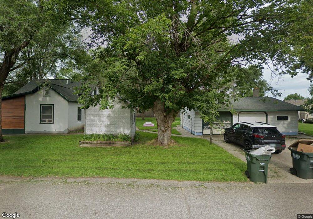
105 Fir Ave NW Richmond, MN 56368
Estimated Value: $210,750 - $276,000
4
Beds
2
Baths
1,458
Sq Ft
$162/Sq Ft
Est. Value
About This Home
This home is located at 105 Fir Ave NW, Richmond, MN 56368 and is currently estimated at $236,438, approximately $162 per square foot. 105 Fir Ave NW is a home with nearby schools including Rocori Senior High School and Saints Peter & Paul Catholic School.
Ownership History
Date
Name
Owned For
Owner Type
Purchase Details
Closed on
Oct 22, 2025
Sold by
Spohn Kenneth
Bought by
Ken Spohn Enterprises Inc
Current Estimated Value
Purchase Details
Closed on
Apr 30, 2024
Sold by
Spleiss Michael and Spleiss Sarah
Bought by
Sjbl Properties Llc
Home Financials for this Owner
Home Financials are based on the most recent Mortgage that was taken out on this home.
Original Mortgage
$140,000
Interest Rate
6.74%
Mortgage Type
New Conventional
Purchase Details
Closed on
Jun 29, 2021
Sold by
Spielss Michael K Est
Bought by
Spleisa Sarah and Spleiss Michael
Purchase Details
Closed on
Oct 1, 1998
Sold by
Eisenchenk Steve
Bought by
Spleiss Michael
Purchase Details
Closed on
Jul 25, 1991
Sold by
Nordmann Charles
Bought by
Eisenschenk Steven
Create a Home Valuation Report for This Property
The Home Valuation Report is an in-depth analysis detailing your home's value as well as a comparison with similar homes in the area
Home Values in the Area
Average Home Value in this Area
Purchase History
| Date | Buyer | Sale Price | Title Company |
|---|---|---|---|
| Ken Spohn Enterprises Inc | $500 | None Listed On Document | |
| Sjbl Properties Llc | $140,000 | -- | |
| Spleisa Sarah | -- | None Available | |
| Spleiss Michael | $70,000 | -- | |
| Eisenschenk Steven | $52,000 | -- |
Source: Public Records
Mortgage History
| Date | Status | Borrower | Loan Amount |
|---|---|---|---|
| Previous Owner | Sjbl Properties Llc | $140,000 |
Source: Public Records
Tax History Compared to Growth
Tax History
| Year | Tax Paid | Tax Assessment Tax Assessment Total Assessment is a certain percentage of the fair market value that is determined by local assessors to be the total taxable value of land and additions on the property. | Land | Improvement |
|---|---|---|---|---|
| 2025 | $2,020 | $159,500 | $38,000 | $121,500 |
| 2024 | $2,182 | $153,300 | $38,000 | $115,300 |
| 2023 | $2,140 | $140,100 | $35,000 | $105,100 |
| 2022 | $2,126 | $115,800 | $32,000 | $83,800 |
| 2021 | $415 | $115,800 | $32,000 | $83,800 |
| 2020 | $415 | $115,900 | $32,000 | $83,900 |
| 2019 | $405 | $118,000 | $32,000 | $86,000 |
| 2018 | $407 | $106,400 | $30,000 | $76,400 |
| 2017 | $407 | $101,200 | $30,000 | $71,200 |
| 2016 | $407 | $0 | $0 | $0 |
| 2015 | $407 | $0 | $0 | $0 |
| 2014 | -- | $0 | $0 | $0 |
Source: Public Records
Map
Nearby Homes
- 148 Main St W
- 261 Main St W
- 205 Grant Ave SW
- 577 Main St W
- 153 Central Ave S
- 232 Main St E
- 101 Barry Loop NW
- 448 1st St NE
- 464 Main St E
- 22296 Hall Ave SW
- XXX Eastfield Dr
- 22579 Fordham Rd
- 21107 State Highway 23
- 20734 Black Cherry Dr
- 21312 State Highway 22 #4
- 21312 State Highway 22 Unit 20
- 21312 State Highway 22 Unit 25
- 22314 Mallard Ct
- 20554 Elkview Ct
- 20568 Elkview Ct