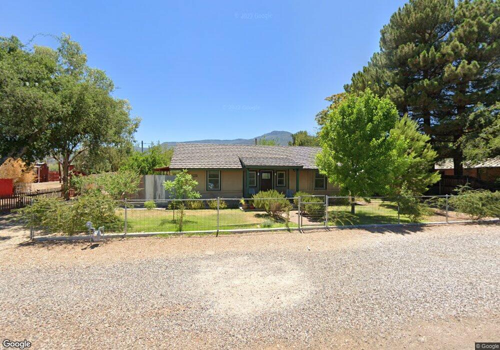
105 S Airport Rd Cottonwood, AZ 86326
Cottonwood NeighborhoodEstimated Value: $251,000 - $453,000
--
Bed
--
Bath
2,259
Sq Ft
$158/Sq Ft
Est. Value
About This Home
This home is located at 105 S Airport Rd, Cottonwood, AZ 86326 and is currently estimated at $357,112, approximately $158 per square foot. 105 S Airport Rd is a home located in Yavapai County with nearby schools including Cottonwood Elementary School, Dr Daniel Bright Elementary School, and Cottonwood Community School.
Ownership History
Date
Name
Owned For
Owner Type
Purchase Details
Closed on
Sep 24, 2018
Sold by
Waak Karl C
Bought by
Waak Karl C and Waak Barbara Dee
Current Estimated Value
Purchase Details
Closed on
Nov 30, 2009
Sold by
Waak Allyson L
Bought by
Waak Karl C
Purchase Details
Closed on
Dec 1, 2003
Sold by
Cole Philip K and Cole Susan M
Bought by
Waak Karl C and Waak Allyson L
Home Financials for this Owner
Home Financials are based on the most recent Mortgage that was taken out on this home.
Original Mortgage
$127,500
Interest Rate
4.87%
Mortgage Type
New Conventional
Purchase Details
Closed on
Oct 6, 2003
Sold by
Wiltz Eric Edwin and Wiltz Dianne Irene
Bought by
Cole Philip A and Cole Susan M
Home Financials for this Owner
Home Financials are based on the most recent Mortgage that was taken out on this home.
Original Mortgage
$127,500
Interest Rate
4.87%
Mortgage Type
New Conventional
Purchase Details
Closed on
Nov 13, 1998
Sold by
Blanchard Patricia
Bought by
Wiltz Eric Edwin and Wiltz Dianne Irene
Home Financials for this Owner
Home Financials are based on the most recent Mortgage that was taken out on this home.
Original Mortgage
$88,050
Interest Rate
6.42%
Mortgage Type
VA
Create a Home Valuation Report for This Property
The Home Valuation Report is an in-depth analysis detailing your home's value as well as a comparison with similar homes in the area
Home Values in the Area
Average Home Value in this Area
Purchase History
| Date | Buyer | Sale Price | Title Company |
|---|---|---|---|
| Waak Karl C | -- | None Available | |
| Waak Karl C | -- | None Available | |
| Waak Karl C | $170,000 | First American Title Ins Co | |
| Cole Philip A | $170,000 | First American Title Ins Co | |
| Wiltz Eric Edwin | $85,500 | First American Title |
Source: Public Records
Mortgage History
| Date | Status | Borrower | Loan Amount |
|---|---|---|---|
| Previous Owner | Waak Karl C | $127,500 | |
| Previous Owner | Wiltz Eric Edwin | $88,050 |
Source: Public Records
Tax History Compared to Growth
Tax History
| Year | Tax Paid | Tax Assessment Tax Assessment Total Assessment is a certain percentage of the fair market value that is determined by local assessors to be the total taxable value of land and additions on the property. | Land | Improvement |
|---|---|---|---|---|
| 2026 | $1,030 | $22,184 | -- | -- |
| 2024 | $1,006 | $22,109 | -- | -- |
| 2023 | $1,009 | $18,017 | $5,085 | $12,932 |
| 2022 | $1,006 | $16,586 | $4,094 | $12,492 |
| 2021 | $1,094 | $15,532 | $4,134 | $11,398 |
| 2020 | $1,086 | $0 | $0 | $0 |
| 2019 | $1,080 | $0 | $0 | $0 |
| 2018 | $1,038 | $0 | $0 | $0 |
| 2017 | $994 | $0 | $0 | $0 |
| 2016 | $977 | $0 | $0 | $0 |
| 2015 | $763 | $0 | $0 | $0 |
| 2014 | $676 | $0 | $0 | $0 |
Source: Public Records
Map
Nearby Homes
- 240 S Maverick Way
- 1830 W Trail Blazer Dr
- 1660 W Bronco Ln
- 1869 W Trail Blazer Dr
- 15 N Alamos Dr Unit A & B
- 1910 W Trail Blazer Dr
- Xxxx Xxxx --
- 1850 W Wagon Wheel Rd
- 293 S Wild Horse Way
- 1865 W Wagon Wheel Rd
- 338 S Wild Horse Way
- 240 Rogers Place
- 222 Rogers Place
- 265 S Latigo Way
- 235 S Cowboy Way
- 1941 Crossroads Blvd
- 2101 Canyon Dr
- 1985 Roadrunner Ct
- 421 Casner Dr
- 1975 Golddust Cir