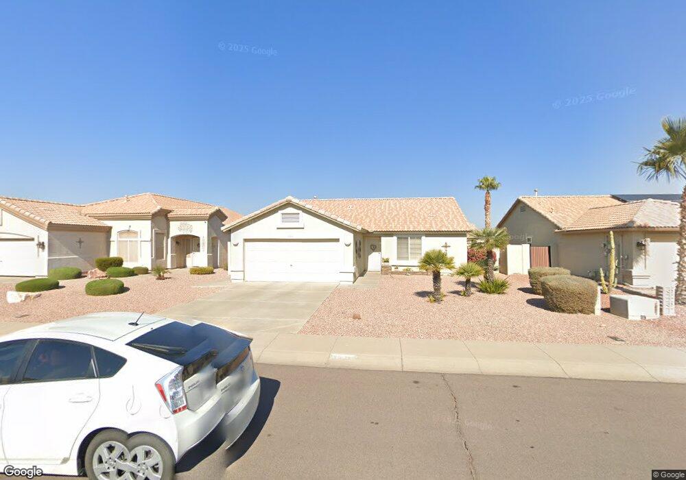
10510 W Potter Dr Peoria, AZ 85382
Estimated Value: $339,205 - $369,000
2
Beds
2
Baths
1,336
Sq Ft
$266/Sq Ft
Est. Value
About This Home
This home is located at 10510 W Potter Dr, Peoria, AZ 85382 and is currently estimated at $355,801, approximately $266 per square foot. 10510 W Potter Dr is a home located in Maricopa County with nearby schools including Parkridge Elementary School, Sunrise Mountain High School, and Candeo Peoria.
Ownership History
Date
Name
Owned For
Owner Type
Purchase Details
Closed on
Feb 20, 2019
Sold by
Perone Linda A and Casazza Trust
Bought by
Gordon Alastair and Gordon Catherine
Current Estimated Value
Purchase Details
Closed on
May 14, 2002
Sold by
Casazza Anthony Andrew and Casazza Marie Elizabeth
Bought by
Casazza Anthony Andrew and Casazza Marie Elizabeth
Purchase Details
Closed on
Feb 6, 2001
Sold by
Lennar Homes Of Arizona Inc
Bought by
Casazza Anthony Andrew and Casazza Marie
Purchase Details
Closed on
Jan 17, 2001
Sold by
Lennar Communities Development Inc
Bought by
Lennar Homes Of Arizona Inc
Purchase Details
Closed on
Oct 31, 2000
Sold by
Lennar Land Partners Ii
Bought by
Lennar Homes Of Arizona Inc
Create a Home Valuation Report for This Property
The Home Valuation Report is an in-depth analysis detailing your home's value as well as a comparison with similar homes in the area
Home Values in the Area
Average Home Value in this Area
Purchase History
| Date | Buyer | Sale Price | Title Company |
|---|---|---|---|
| Gordon Alastair | $215,000 | Equity Title Agency Inc | |
| Casazza Anthony Andrew | -- | -- | |
| Casazza Anthony Andrew | $132,047 | North American Title Agency | |
| Lennar Homes Of Arizona Inc | -- | North American Title Agency | |
| Lennar Homes Of Arizona Inc | -- | North American Title Agency | |
| Lennar Homes Of Arizona Inc | $24,000 | North American Title Agency |
Source: Public Records
Tax History Compared to Growth
Tax History
| Year | Tax Paid | Tax Assessment Tax Assessment Total Assessment is a certain percentage of the fair market value that is determined by local assessors to be the total taxable value of land and additions on the property. | Land | Improvement |
|---|---|---|---|---|
| 2025 | $1,233 | $16,932 | -- | -- |
| 2024 | $1,339 | $14,715 | -- | -- |
| 2023 | $1,339 | $25,480 | $5,090 | $20,390 |
| 2022 | $1,561 | $20,060 | $4,010 | $16,050 |
| 2021 | $1,628 | $19,060 | $3,810 | $15,250 |
| 2020 | $1,631 | $16,860 | $3,370 | $13,490 |
| 2019 | $1,574 | $15,850 | $3,170 | $12,680 |
| 2018 | $1,296 | $14,930 | $2,980 | $11,950 |
| 2017 | $1,298 | $13,080 | $2,610 | $10,470 |
| 2016 | $1,265 | $12,870 | $2,570 | $10,300 |
| 2015 | $1,198 | $12,130 | $2,420 | $9,710 |
Source: Public Records
Map
Nearby Homes
- 10528 W Potter Dr
- 20670 N 105th Dr
- 20769 N 106th Ln
- 20615 N 105th Ave
- 10630 W Mohawk Ln
- 10672 W Ross Ave
- 20957 N 107th Dr
- 10722 W Irma Ln
- 10728 W Irma Ln
- 10368 W Ross Ave
- 20360 N 106th Ln
- 10344 W Burnett Rd
- 10347 W Mohawk Ln
- 10549 W Albert Ln
- 10659 W Yukon Dr
- 10763 W Runion Dr
- 10379 W Tonopah Dr
- 20274 N 104th Ave
- 10816 W Deanna Dr
- 10816 W Quail Ave
- 10510 W Potter Dr
- 10516 W Potter Dr
- 10522 W Potter Dr
- 10470 W Potter Dr
- 10504 W Potter Dr
- 10509 W Ross Ave
- 10503 W Ross Ave
- 10515 W Ross Ave
- 10469 W Ross Ave
- 10515 W Potter Dr
- 10521 W Ross Ave
- 10509 W Potter Dr
- 10521 W Potter Dr
- 10503 W Potter Dr
- 10527 W Potter Dr
- 10534 W Potter Dr
- 10534 W Potter Dr
- 10469 W Potter Dr
- 10533 W Potter Dr
- 10533 W Ross Ave