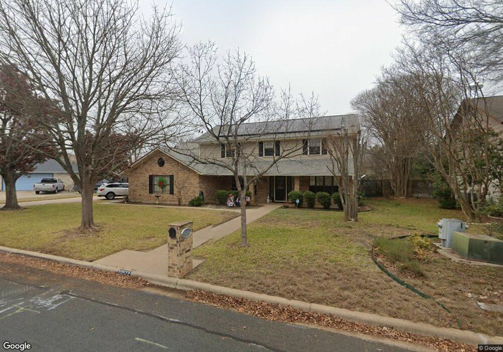
10512 Loring Dr Austin, TX 78750
Bull Creek NeighborhoodEstimated Value: $920,000 - $1,073,000
--
Bed
3
Baths
2,973
Sq Ft
$331/Sq Ft
Est. Value
About This Home
This home is located at 10512 Loring Dr, Austin, TX 78750 and is currently estimated at $983,979, approximately $330 per square foot. 10512 Loring Dr is a home located in Travis County with nearby schools including Spicewood Elementary School, Canyon Vista Middle, and Westwood High School.
Ownership History
Date
Name
Owned For
Owner Type
Purchase Details
Closed on
Sep 6, 2024
Sold by
Bowne Robert Horace and Bowne Dora Tamez
Bought by
Bowne Revocable Trust
Current Estimated Value
Purchase Details
Closed on
Feb 12, 2004
Sold by
Chase Michael and Chase Allison
Bought by
Bowne Robert and Bowne Robert H
Home Financials for this Owner
Home Financials are based on the most recent Mortgage that was taken out on this home.
Original Mortgage
$192,587
Interest Rate
5.86%
Mortgage Type
Purchase Money Mortgage
Purchase Details
Closed on
May 18, 2001
Sold by
Albrecht William H and Albrecht Julianne T
Bought by
Chase Michael and Chase Allison
Home Financials for this Owner
Home Financials are based on the most recent Mortgage that was taken out on this home.
Original Mortgage
$208,900
Interest Rate
7.01%
Mortgage Type
Purchase Money Mortgage
Create a Home Valuation Report for This Property
The Home Valuation Report is an in-depth analysis detailing your home's value as well as a comparison with similar homes in the area
Home Values in the Area
Average Home Value in this Area
Purchase History
| Date | Buyer | Sale Price | Title Company |
|---|---|---|---|
| Bowne Revocable Trust | -- | None Listed On Document | |
| Bowne Robert | -- | Chicago Title Insurance Comp | |
| Chase Michael | -- | Austin Title Company |
Source: Public Records
Mortgage History
| Date | Status | Borrower | Loan Amount |
|---|---|---|---|
| Previous Owner | Bowne Robert | $192,587 | |
| Previous Owner | Chase Michael | $208,900 |
Source: Public Records
Tax History Compared to Growth
Tax History
| Year | Tax Paid | Tax Assessment Tax Assessment Total Assessment is a certain percentage of the fair market value that is determined by local assessors to be the total taxable value of land and additions on the property. | Land | Improvement |
|---|---|---|---|---|
| 2025 | $7,454 | $749,373 | $400,000 | $349,373 |
| 2023 | $6,968 | $624,018 | $0 | $0 |
| 2022 | $11,578 | $567,289 | $0 | $0 |
| 2021 | $11,596 | $515,717 | $200,000 | $464,100 |
| 2020 | $10,936 | $484,410 | $200,000 | $284,410 |
| 2018 | $10,734 | $461,340 | $200,000 | $275,258 |
| 2017 | $9,942 | $419,400 | $165,000 | $310,729 |
| 2016 | $9,039 | $381,273 | $165,000 | $275,469 |
| 2015 | $7,290 | $346,612 | $70,000 | $304,118 |
| 2014 | $7,290 | $315,102 | $0 | $0 |
Source: Public Records
Map
Nearby Homes
- 11402 Pickfair Dr
- 11302 Centennial Trail
- 10606 Mourning Dove Dr
- 11533 Sandy Loam Trail
- 10903 Cade Cir
- 11512 Tin Cup Dr Unit 309
- 11512 Tin Cup Dr Unit 205
- 11000 Anderson Mill Rd Unit 96
- 11000 Anderson Mill Rd Unit 63
- 11310 Spicewood Club Dr Unit 12
- 11310 Spicewood Club Dr Unit 21
- 10404 Mourning Dove Dr
- 11902 Millwright Pkwy
- 11007 Opal Trail
- 10255 Missel Thrush Dr
- 10401 Mourning Dove Dr
- 11100 Alison Parke Trail
- 11905 Millwright Pkwy
- 10229 Missel Thrush Dr
- 10903 Centennial Trail
- 10510 Loring Dr
- 10600 Loring Dr
- 11608 Spicewood #38 Pkwy Unit 38
- 10513 Loring Dr
- 10511 Loring Dr
- 11503 Taterwood Dr
- 10508 Loring Dr
- 11501 Taterwood Dr
- 10601 Loring Dr
- 10509 Loring Dr
- 10522 Weller Dr
- 11409 Taterwood Dr
- 11505 Taterwood Dr
- 11500 Dosshills Dr
- 10506 Loring Dr
- 10521 Weller Dr
- 11412 Dosshills Dr
- 11407 Taterwood Dr
- 10501 Glass Mountain Trail
- 10520 Weller Dr