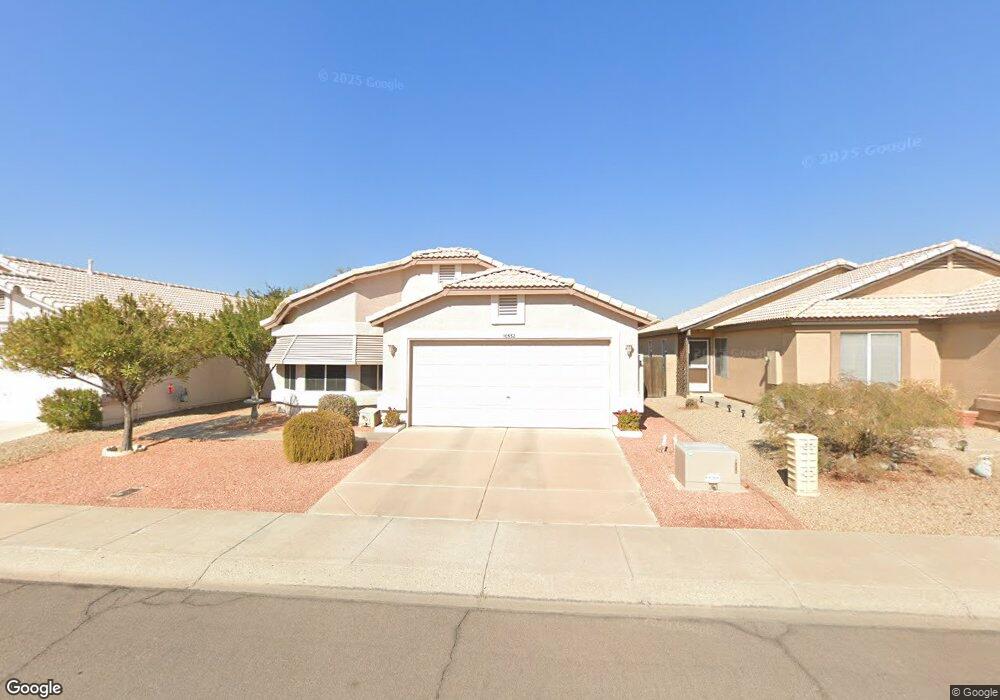
10532 W Runion Dr Peoria, AZ 85382
Estimated Value: $298,118 - $371,000
--
Bed
3
Baths
1,475
Sq Ft
$235/Sq Ft
Est. Value
About This Home
This home is located at 10532 W Runion Dr, Peoria, AZ 85382 and is currently estimated at $347,280, approximately $235 per square foot. 10532 W Runion Dr is a home located in Maricopa County with nearby schools including Parkridge Elementary School, Sunrise Mountain High School, and Guidepost Montessori at Peoria.
Ownership History
Date
Name
Owned For
Owner Type
Purchase Details
Closed on
Sep 4, 1998
Sold by
Sarnecki Walter Frank and Sarnecki Audrey Alice
Bought by
Krackenberger Donald and Krackenberger Sharon
Current Estimated Value
Home Financials for this Owner
Home Financials are based on the most recent Mortgage that was taken out on this home.
Original Mortgage
$108,027
Outstanding Balance
$23,136
Interest Rate
6.93%
Mortgage Type
FHA
Estimated Equity
$324,144
Purchase Details
Closed on
Feb 27, 1996
Sold by
Frank Walter and Sarnecki Audrey Alice
Bought by
Sarnecki Walter and Sarnecki Audrey A
Create a Home Valuation Report for This Property
The Home Valuation Report is an in-depth analysis detailing your home's value as well as a comparison with similar homes in the area
Home Values in the Area
Average Home Value in this Area
Purchase History
| Date | Buyer | Sale Price | Title Company |
|---|---|---|---|
| Krackenberger Donald | $109,000 | Fidelity Title | |
| Sarnecki Walter | -- | -- |
Source: Public Records
Mortgage History
| Date | Status | Borrower | Loan Amount |
|---|---|---|---|
| Open | Krackenberger Donald | $108,027 |
Source: Public Records
Tax History Compared to Growth
Tax History
| Year | Tax Paid | Tax Assessment Tax Assessment Total Assessment is a certain percentage of the fair market value that is determined by local assessors to be the total taxable value of land and additions on the property. | Land | Improvement |
|---|---|---|---|---|
| 2025 | $848 | $15,992 | -- | -- |
| 2024 | $921 | $15,230 | -- | -- |
| 2023 | $921 | $12,430 | $2,480 | $9,950 |
| 2022 | $947 | $12,430 | $2,480 | $9,950 |
| 2021 | $1,064 | $18,430 | $3,680 | $14,750 |
| 2020 | $1,128 | $16,180 | $3,230 | $12,950 |
| 2019 | $1,092 | $15,270 | $3,050 | $12,220 |
| 2018 | $929 | $14,410 | $2,880 | $11,530 |
| 2017 | $1,220 | $12,430 | $2,480 | $9,950 |
| 2016 | $1,195 | $12,300 | $2,460 | $9,840 |
| 2015 | $1,127 | $11,560 | $2,310 | $9,250 |
Source: Public Records
Map
Nearby Homes
- 20615 N 105th Ave
- 10630 W Mohawk Ln
- 20670 N 105th Dr
- 20360 N 106th Ln
- 10347 W Mohawk Ln
- 10528 W Potter Dr
- 10659 W Yukon Dr
- 20769 N 106th Ln
- 20274 N 104th Ave
- 10379 W Tonopah Dr
- 10722 W Irma Ln
- 10344 W Burnett Rd
- 10728 W Irma Ln
- 10763 W Runion Dr
- 10672 W Ross Ave
- 10368 W Ross Ave
- 20957 N 107th Dr
- 20017 N 101st Ave
- 19845 N Welk Dr
- 20056 N 107th Ln
- 10528 W Runion Dr
- 10536 W Runion Dr
- 10540 W Runion Dr
- 10524 W Runion Dr
- 10527 W Mohawk Ln
- 10523 W Mohawk Ln
- 10531 W Mohawk Ln
- 10520 W Runion Dr
- 10519 W Mohawk Ln
- 10601 W Mohawk Ln
- 10600 W Runion Dr
- 10525 W Runion Dr
- 10529 W Runion Dr
- 10521 W Runion Dr
- 10515 W Mohawk Ln
- 10533 W Runion Dr
- 10517 W Runion Dr
- 10516 W Runion Dr
- 10609 W Mohawk Ln
- 10604 W Runion Dr