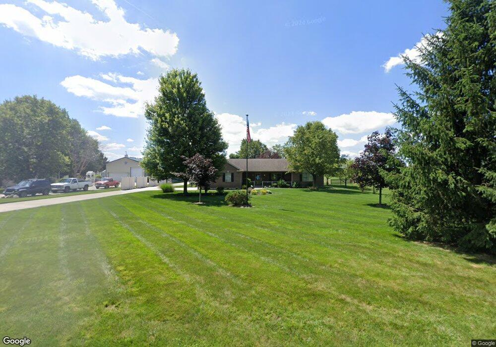
1054 W Evanston Rd Tipp City, OH 45371
Estimated Value: $455,000 - $545,750
3
Beds
4
Baths
1,900
Sq Ft
$263/Sq Ft
Est. Value
About This Home
This home is located at 1054 W Evanston Rd, Tipp City, OH 45371 and is currently estimated at $498,938, approximately $262 per square foot. 1054 W Evanston Rd is a home located in Miami County with nearby schools including Broadway Elementary School, Nevin Coppock Elementary School, and L. T. Ball Intermediate School.
Ownership History
Date
Name
Owned For
Owner Type
Purchase Details
Closed on
Oct 6, 2015
Sold by
Ditmer Richard M and Ditmer Clotine M
Bought by
Cook Todd G and Cook Donna J
Current Estimated Value
Home Financials for this Owner
Home Financials are based on the most recent Mortgage that was taken out on this home.
Original Mortgage
$205,500
Interest Rate
3.91%
Mortgage Type
New Conventional
Purchase Details
Closed on
Aug 28, 2007
Sold by
Dotson Ray and Dotson Carol D
Bought by
Ditmer Richard M and Ditmer Clotine M
Home Financials for this Owner
Home Financials are based on the most recent Mortgage that was taken out on this home.
Original Mortgage
$210,000
Interest Rate
6.77%
Mortgage Type
New Conventional
Create a Home Valuation Report for This Property
The Home Valuation Report is an in-depth analysis detailing your home's value as well as a comparison with similar homes in the area
Home Values in the Area
Average Home Value in this Area
Purchase History
| Date | Buyer | Sale Price | Title Company |
|---|---|---|---|
| Cook Todd G | $305,000 | First Ohio Title Insurance | |
| Ditmer Richard M | $280,000 | -- |
Source: Public Records
Mortgage History
| Date | Status | Borrower | Loan Amount |
|---|---|---|---|
| Closed | Cook Todd G | $205,500 | |
| Closed | Ditmer Richard M | $210,000 |
Source: Public Records
Tax History Compared to Growth
Tax History
| Year | Tax Paid | Tax Assessment Tax Assessment Total Assessment is a certain percentage of the fair market value that is determined by local assessors to be the total taxable value of land and additions on the property. | Land | Improvement |
|---|---|---|---|---|
| 2024 | $7,624 | $144,240 | $32,620 | $111,620 |
| 2023 | $7,624 | $144,240 | $32,620 | $111,620 |
| 2022 | $6,992 | $144,240 | $32,620 | $111,620 |
| 2021 | $5,531 | $101,150 | $24,150 | $77,000 |
| 2020 | $5,295 | $101,150 | $24,150 | $77,000 |
| 2019 | $5,239 | $99,190 | $24,150 | $75,040 |
| 2018 | $4,569 | $80,850 | $17,010 | $63,840 |
| 2017 | $4,585 | $80,850 | $17,010 | $63,840 |
| 2016 | $4,397 | $80,850 | $17,010 | $63,840 |
| 2015 | $3,280 | $72,210 | $15,190 | $57,020 |
| 2014 | $3,280 | $72,210 | $15,190 | $57,020 |
| 2013 | $3,297 | $72,210 | $15,190 | $57,020 |
Source: Public Records
Map
Nearby Homes
- 6060 Detrick Rd
- The Prescott Plan at Fieldstone Place
- The Lynwood Plan at Emerson Crossing
- The Concord Plan at Emerson Crossing
- The Magnolia Plan at Fieldstone Place
- The Cambridge Plan at Emerson Crossing
- The Sandalwood Plan at Fieldstone Place
- The Lincoln Plan at Emerson Crossing
- The Plainfield Plan at Fieldstone Place
- The Cambridge Plan at Fieldstone Place
- The Magnolia Plan at Emerson Crossing
- The Prescott Plan at Emerson Crossing
- The Fieldstone Plan at Emerson Crossing
- The Zink Plan at Fieldstone Place
- The Concord Plan at Fieldstone Place
- The Warren Plan at Fieldstone Place
- The Fieldstone Plan at Fieldstone Place
- The Warren Plan at Emerson Crossing
- The Lynwood Plan at Fieldstone Place
- The Arlington Plan at Emerson Crossing
- 1040 W Evanston Rd
- 1104 W Evanston Rd
- 1055 W Evanston Rd
- 1010 W Evanston Rd
- 1015 W Evanston Rd
- 975 W Evanston Rd
- 1190 W Evanston Rd
- 1150 W Evanston Rd
- 701 Quartz Ln
- 1280 W Evanston Rd
- 1275 W Evanston Rd
- 6475 Country Estates Dr
- 1330 W Evanston Rd
- 6415 Country Estates Dr
- 704 Quartz Ln
- 6375 Country Estates Dr
- 6470 Country Estates Dr
- 6345 Country Estates Dr
- 1355 W Evanston Rd
- 6410 Country Estates Dr