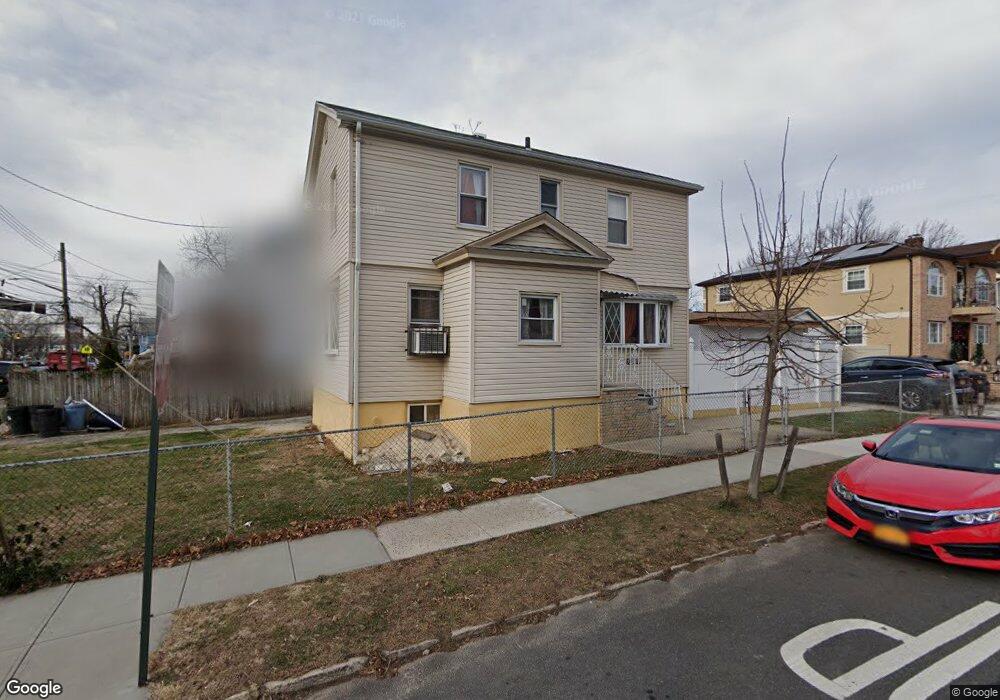
10540 191st St Saint Albans, NY 11412
Hollis NeighborhoodEstimated Value: $619,748 - $813,000
--
Bed
--
Bath
1,408
Sq Ft
$506/Sq Ft
Est. Value
About This Home
This home is located at 10540 191st St, Saint Albans, NY 11412 and is currently estimated at $711,937, approximately $505 per square foot. 10540 191st St is a home located in Queens County with nearby schools including P.S. 118 Lorraine Hansberry, I.S. 192 The Linden, and Wellspring Elementary & Middle.
Ownership History
Date
Name
Owned For
Owner Type
Purchase Details
Closed on
Jul 28, 1998
Sold by
White John and White Jean
Bought by
Mcleish Angela and Weston Stephen
Current Estimated Value
Home Financials for this Owner
Home Financials are based on the most recent Mortgage that was taken out on this home.
Original Mortgage
$146,900
Outstanding Balance
$30,593
Interest Rate
6.9%
Mortgage Type
FHA
Estimated Equity
$681,344
Create a Home Valuation Report for This Property
The Home Valuation Report is an in-depth analysis detailing your home's value as well as a comparison with similar homes in the area
Home Values in the Area
Average Home Value in this Area
Purchase History
| Date | Buyer | Sale Price | Title Company |
|---|---|---|---|
| Mcleish Angela | $150,000 | Security Title & Guaranty Co |
Source: Public Records
Mortgage History
| Date | Status | Borrower | Loan Amount |
|---|---|---|---|
| Open | Mcleish Angela | $146,900 |
Source: Public Records
Tax History Compared to Growth
Tax History
| Year | Tax Paid | Tax Assessment Tax Assessment Total Assessment is a certain percentage of the fair market value that is determined by local assessors to be the total taxable value of land and additions on the property. | Land | Improvement |
|---|---|---|---|---|
| 2025 | $5,839 | $29,860 | $9,618 | $20,242 |
| 2024 | $3,589 | $29,071 | $9,548 | $19,523 |
| 2023 | $5,509 | $27,427 | $8,442 | $18,985 |
| 2022 | $2,916 | $32,760 | $12,060 | $20,700 |
| 2021 | $5,446 | $32,520 | $12,060 | $20,460 |
| 2020 | $5,267 | $31,800 | $12,060 | $19,740 |
| 2019 | $5,068 | $27,240 | $12,060 | $15,180 |
| 2018 | $4,659 | $22,856 | $11,660 | $11,196 |
| 2017 | $4,396 | $21,565 | $9,987 | $11,578 |
| 2016 | $4,311 | $21,565 | $9,987 | $11,578 |
| 2015 | $2,234 | $20,736 | $11,918 | $8,818 |
| 2014 | $2,234 | $20,189 | $11,283 | $8,906 |
Source: Public Records
Map
Nearby Homes
- 19027 109th Rd
- 10533 Farmers Blvd
- 10532 192nd St
- 193-21 109th Rd
- 19319 109th Rd
- 104-40 194th St
- 187-23 Brinkerhoff Ave
- 111-06 Farmers Blvd
- 194-10 Hollis Ave
- 190-30 103rd Ave
- 19404 110th Rd
- 19022 111th Rd
- 10220 189th St
- 102-35 187th St
- 187-44 Jordan Ave
- 190-59 112th Ave
- 190-63 112th Ave
- 10211 187th St
- 194- 24 111th Rd
- 186-16 Hilburn Ave
- 19027 109th Rd
- 19021 109th Ave
- 10532 191st St
- 10532 191st St
- 19017 109th Ave
- 105-28 191st St
- 10528 191st St
- 19101 109th Ave
- 19015 109th Ave
- 10535 191st St
- 10531 191st St
- 10524 191st St
- 191-12 109th Ave
- 10527 191st St
- 10527 Farmers Blvd
- 19022 109th Ave
- 10529 Farmers Blvd
- 19020 109th Ave
- 10525 Farmers Blvd
- 10905 191st St