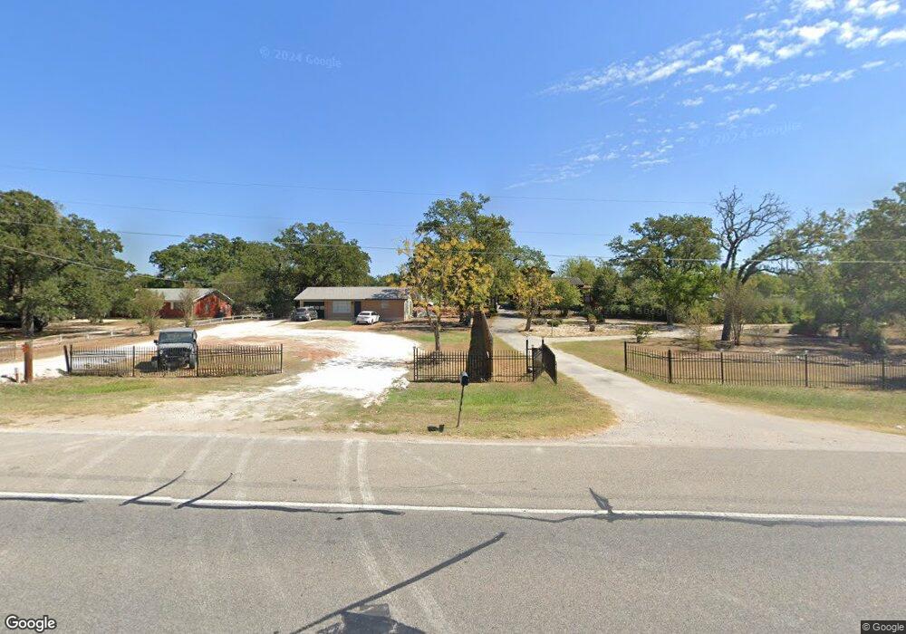
1059 Highway 95 N Bastrop, TX 78602
Estimated Value: $186,000 - $522,533
2
Beds
--
Bath
2,048
Sq Ft
$205/Sq Ft
Est. Value
About This Home
This home is located at 1059 Highway 95 N, Bastrop, TX 78602 and is currently estimated at $420,633, approximately $205 per square foot. 1059 Highway 95 N is a home located in Bastrop County with nearby schools including Lost Pines Elementary School, Bastrop Intermediate School, and Bastrop Middle School.
Ownership History
Date
Name
Owned For
Owner Type
Purchase Details
Closed on
Apr 19, 2024
Sold by
Boone Vinnie Ellen Long
Bought by
Ngam Celestine and Georges Grace
Current Estimated Value
Home Financials for this Owner
Home Financials are based on the most recent Mortgage that was taken out on this home.
Original Mortgage
$24,547
Interest Rate
6.88%
Purchase Details
Closed on
Aug 18, 2016
Sold by
Boone Vinnie Ellen Long
Bought by
Boone Vinnie Ellen
Purchase Details
Closed on
Sep 22, 2008
Sold by
Boone Vinnie E L
Bought by
The Current Symmetry Living Trust
Purchase Details
Closed on
Mar 13, 2007
Sold by
Kennedy Robert D and Kennedy Joan C
Bought by
Boone Vinnie
Home Financials for this Owner
Home Financials are based on the most recent Mortgage that was taken out on this home.
Original Mortgage
$92,200
Interest Rate
6.32%
Mortgage Type
New Conventional
Create a Home Valuation Report for This Property
The Home Valuation Report is an in-depth analysis detailing your home's value as well as a comparison with similar homes in the area
Home Values in the Area
Average Home Value in this Area
Purchase History
| Date | Buyer | Sale Price | Title Company |
|---|---|---|---|
| Ngam Celestine | -- | Benchmark Title | |
| Boone Vinnie Ellen | -- | None Available | |
| The Current Symmetry Living Trust | -- | None Available | |
| Boone Vinnie | -- | Alamo Title Company |
Source: Public Records
Mortgage History
| Date | Status | Borrower | Loan Amount |
|---|---|---|---|
| Closed | Ngam Celestine | $24,547 | |
| Open | Ngam Celestine | $490,943 | |
| Previous Owner | Boone Vinnie | $92,200 |
Source: Public Records
Tax History Compared to Growth
Tax History
| Year | Tax Paid | Tax Assessment Tax Assessment Total Assessment is a certain percentage of the fair market value that is determined by local assessors to be the total taxable value of land and additions on the property. | Land | Improvement |
|---|---|---|---|---|
| 2025 | $6,009 | $486,057 | $144,034 | $342,023 |
| 2023 | $6,009 | $201,182 | $0 | $0 |
| 2022 | $1,815 | $182,893 | $0 | $0 |
| 2021 | $3,291 | $166,266 | $45,204 | $121,062 |
| 2020 | $3,133 | $153,533 | $41,687 | $111,846 |
| 2019 | $3,131 | $147,758 | $41,687 | $106,071 |
| 2018 | $3,634 | $170,674 | $32,000 | $139,071 |
| 2017 | $3,472 | $155,158 | $40,000 | $120,000 |
| 2016 | $3,156 | $141,053 | $30,000 | $122,307 |
| 2015 | $1,920 | $128,230 | $43,560 | $103,805 |
| 2014 | $1,920 | $116,573 | $15,000 | $101,573 |
Source: Public Records
Map
Nearby Homes
- 146 Shadow Oak Dr
- 136 Shadow Oak Dr
- TBD Shadow Oak Dr
- 0 Road Runner Ln
- 144 San Jacinto St
- 122 Blanket Flower Dr
- 240 Shadow Oak Dr
- 155 Flint Ridge St
- 164 Chapel Hill Dr
- tbd Whippoorwill Dr
- 156 Lba Dr
- 207 Flint Ridge St
- LOT 31 Blanket Flower Dr
- 167 Blanket Flower Dr
- 183 Blanket Flower Dr
- 151 Short St
- 282 Flint Ridge St
- 26 Saddle Brook Dr
- TBD Saddle Brook Dr
- 254 Lba Dr
- 1059 State Highway 95
- 1063 N State Highway 95
- 1063 Highway 95 N
- 1057 N State Highway 95
- 1057 Highway 95 N
- 1067 N State Highway 95
- 1067 N State Highway 95
- 1053 Highway 95 N
- 95 N Sh
- 0 Blanket Flower Dr
- 1053 N State Highway 95
- 156 Shadow Oak Dr
- 164 Shadow Oak Dr
- 1041 Highway 95 N
- 1079 N State Highway 95
- 1041 N State Highway 95
- 2 Robin St
- 168 Shadow Oak Dr
- 000 Road Runner
- 00 Roadrunner