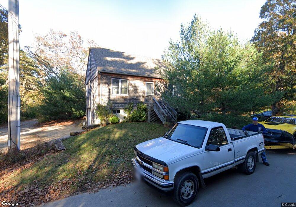
106 California Ave Oak Bluffs, MA 02557
Oak Bluffs NeighborhoodEstimated Value: $1,079,000 - $1,116,742
1
Bed
2
Baths
1,344
Sq Ft
$817/Sq Ft
Est. Value
About This Home
This home is located at 106 California Ave, Oak Bluffs, MA 02557 and is currently estimated at $1,098,436, approximately $817 per square foot. 106 California Ave is a home with nearby schools including Oak Bluffs Elementary School and Martha's Vineyard Regional High School.
Ownership History
Date
Name
Owned For
Owner Type
Purchase Details
Closed on
May 29, 2009
Sold by
Oak Bluffs Town Of
Bought by
Clements 4Th Albert R
Current Estimated Value
Home Financials for this Owner
Home Financials are based on the most recent Mortgage that was taken out on this home.
Original Mortgage
$150,000
Outstanding Balance
$95,282
Interest Rate
4.87%
Mortgage Type
Purchase Money Mortgage
Estimated Equity
$1,003,154
Create a Home Valuation Report for This Property
The Home Valuation Report is an in-depth analysis detailing your home's value as well as a comparison with similar homes in the area
Home Values in the Area
Average Home Value in this Area
Purchase History
| Date | Buyer | Sale Price | Title Company |
|---|---|---|---|
| Clements 4Th Albert R | $25,000 | -- | |
| Clements 4Th Albert R | $25,000 | -- | |
| Clements 4Th Albert R | $25,000 | -- |
Source: Public Records
Mortgage History
| Date | Status | Borrower | Loan Amount |
|---|---|---|---|
| Open | Clements 4Th Albert R | $150,000 | |
| Closed | Clements 4Th Albert R | $150,000 |
Source: Public Records
Tax History Compared to Growth
Tax History
| Year | Tax Paid | Tax Assessment Tax Assessment Total Assessment is a certain percentage of the fair market value that is determined by local assessors to be the total taxable value of land and additions on the property. | Land | Improvement |
|---|---|---|---|---|
| 2025 | $4,627 | $916,200 | $467,800 | $448,400 |
| 2024 | $4,575 | $874,800 | $425,100 | $449,700 |
| 2023 | $4,615 | $874,000 | $413,100 | $460,900 |
| 2022 | $4,454 | $656,000 | $311,100 | $344,900 |
| 2021 | $4,138 | $561,400 | $265,000 | $296,400 |
| 2020 | $3,928 | $528,000 | $252,300 | $275,700 |
| 2019 | $3,773 | $490,600 | $220,100 | $270,500 |
| 2018 | $3,677 | $469,600 | $198,800 | $270,800 |
| 2017 | $3,476 | $426,500 | $188,400 | $238,100 |
| 2016 | $3,260 | $402,000 | $194,200 | $207,800 |
| 2015 | $2,964 | $372,400 | $194,200 | $178,200 |
| 2014 | $2,791 | $357,400 | $174,400 | $183,000 |
Source: Public Records
Map
Nearby Homes
- 170 Barnes Rd
- 1 Onondaga Ave
- 0-A California Ave Unit Part lot 79
- 0-B California Ave Unit Part lot 79
- 0 California Ave Unit 76 42933
- 72 Washington Ave
- 69 Summit Ave
- 96 Manchester Ave
- 28 Barling Ave
- 57 Hines Point Rd
- 70 Carol Ln
- 60R Carol Ln
- 267 Barnes Rd
- 60 -R Carol Ln
- 6 Sachem Way
- 96 Pondview Dr
- 35 Stevens Ave
- 9 Bayview Ave
- 5 Weaver Ln
- 1 Jessie Leigh Mitchell Way
- 100 California Ave
- 104 California Ave
- 121 Washington Ave
- 119 Washington Ave
- 105 Washington Ave
- 131 Washington Ave
- 113 California Ave
- 130 Barnes Rd
- 131 Washington St
- 134 Barnes Rd
- 114 Hudson Ave
- 116 California Ave
- 128 Hudson Ave
- 136 Hudson Ave
- 152 Barnes Rd
- 152 Barnes Rd
- 33 Grace St
- 33 S Grace St
- 115 Washington Ave
- 38 California Ave