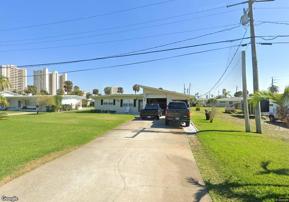
106 Simpson Ave Daytona Beach, FL 32118
Estimated Value: $280,000 - $419,000
2
Beds
2
Baths
1,238
Sq Ft
$270/Sq Ft
Est. Value
About This Home
This home is located at 106 Simpson Ave, Daytona Beach, FL 32118 and is currently estimated at $334,644, approximately $270 per square foot. 106 Simpson Ave is a home located in Volusia County with nearby schools including R.J. Longstreet Elementary School, Atlantic High School, and Silver Sands Middle School.
Ownership History
Date
Name
Owned For
Owner Type
Purchase Details
Closed on
Aug 20, 2007
Sold by
Wright Charles E
Bought by
Rowan Roger D
Current Estimated Value
Home Financials for this Owner
Home Financials are based on the most recent Mortgage that was taken out on this home.
Original Mortgage
$135,000
Outstanding Balance
$85,432
Interest Rate
6.65%
Mortgage Type
Purchase Money Mortgage
Estimated Equity
$249,212
Purchase Details
Closed on
Feb 23, 2007
Sold by
Morris Brenda F
Bought by
Wright Charles E
Purchase Details
Closed on
Jan 6, 2004
Sold by
Bonomi David A and Bonomi Karen C
Bought by
Morris Brenda F
Purchase Details
Closed on
Jun 30, 2003
Sold by
Watts Marcia L and Pedigo Paul A
Bought by
Bonomi David A and Bonomi Karen C
Purchase Details
Closed on
Jul 15, 1982
Bought by
Rowan Roger D
Purchase Details
Closed on
Jun 15, 1982
Bought by
Rowan Roger D
Create a Home Valuation Report for This Property
The Home Valuation Report is an in-depth analysis detailing your home's value as well as a comparison with similar homes in the area
Home Values in the Area
Average Home Value in this Area
Purchase History
| Date | Buyer | Sale Price | Title Company |
|---|---|---|---|
| Rowan Roger D | $175,000 | Waterside Title Co | |
| Wright Charles E | $202,500 | Waterside Title Co | |
| Morris Brenda F | $179,900 | -- | |
| Bonomi David A | $107,000 | -- | |
| Rowan Roger D | $100 | -- | |
| Rowan Roger D | $60,000 | -- |
Source: Public Records
Mortgage History
| Date | Status | Borrower | Loan Amount |
|---|---|---|---|
| Open | Rowan Roger D | $135,000 |
Source: Public Records
Tax History Compared to Growth
Tax History
| Year | Tax Paid | Tax Assessment Tax Assessment Total Assessment is a certain percentage of the fair market value that is determined by local assessors to be the total taxable value of land and additions on the property. | Land | Improvement |
|---|---|---|---|---|
| 2025 | $1,571 | $116,992 | -- | -- |
| 2024 | $1,571 | $113,695 | -- | -- |
| 2023 | $1,571 | $110,384 | $0 | $0 |
| 2022 | $1,515 | $107,169 | $0 | $0 |
| 2021 | $1,534 | $104,048 | $0 | $0 |
| 2020 | $1,502 | $102,611 | $0 | $0 |
| 2019 | $1,478 | $100,304 | $0 | $0 |
| 2018 | $1,444 | $98,434 | $0 | $0 |
| 2017 | $1,413 | $96,409 | $0 | $0 |
| 2016 | $1,392 | $94,426 | $0 | $0 |
| 2015 | $1,421 | $93,770 | $0 | $0 |
| 2014 | $1,397 | $93,026 | $0 | $0 |
Source: Public Records
Map
Nearby Homes
- 2 Talo Cir
- 100 Talo Cir
- 0 S Peninsula Dr Unit MFRV4942972
- 0 S Peninsula Dr Unit 1219405
- 0 S Peninsula Dr
- 0 S Peninsula Dr Unit 1213918
- 3244 S Peninsula Dr
- 5 Talo Cir
- 3315 S Atlantic Ave Unit 1605
- 3315 S Atlantic Ave Unit 1406
- 3315 S Atlantic Ave Unit 1005
- 3315 S Atlantic Ave Unit 806
- 3315 S Atlantic Ave Unit 1707
- 3315 S Atlantic Ave Unit 408
- 3315 S Atlantic Ave Unit 1108
- 3315 S Atlantic Ave Unit 1106
- 3255 S Atlantic Ave Unit 207
- 3255 S Atlantic Ave Unit 106
- 3245 S Atlantic Ave Unit 208
- 3311 S Atlantic Ave Unit 1504
- 108 Simpson Ave
- 107 Dottie Ave
- 100 Simpson Ave
- 111 Dottie Ave
- 3303 S Peninsula Dr
- 110 Simpson Ave
- 3305 S Peninsula Dr
- 115 Dottie Ave
- 3264 La Paloma Ave
- 117 Dottie Ave
- 112 Simpson Ave
- 3263 La Paloma Ave
- 108 Dottie Ave
- 3263 S Peninsula Dr
- 3311 S Peninsula Dr
- 3260 La Paloma Ave
- 112 Dottie Ave
- 119 Dottie Ave
- 3262 Esperanza Ave
- 3259 La Paloma Ave