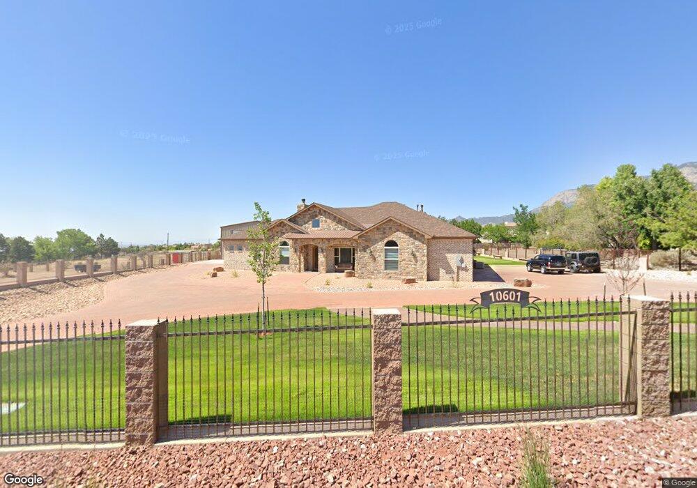
10601 San Antonio Dr NE Albuquerque, NM 87122
North Albuquerque Acres NeighborhoodEstimated Value: $822,000 - $1,251,000
--
Bed
--
Bath
3,036
Sq Ft
$327/Sq Ft
Est. Value
About This Home
This home is located at 10601 San Antonio Dr NE, Albuquerque, NM 87122 and is currently estimated at $994,057, approximately $327 per square foot. 10601 San Antonio Dr NE is a home with nearby schools including Double Eagle Elementary School, Desert Ridge Middle School, and La Cueva High School.
Ownership History
Date
Name
Owned For
Owner Type
Purchase Details
Closed on
Feb 24, 2012
Sold by
Maverick Development Inc
Bought by
Rozenblum Michael and Rozenblum Karen
Current Estimated Value
Purchase Details
Closed on
Feb 10, 2012
Sold by
Rozenblum Michael and Rozenblum Karen
Bought by
Reynolds Kenneth D and Reynolds Svetlana A
Purchase Details
Closed on
Jul 28, 2009
Sold by
Robles Anthony R and Ortega Robles Deana
Bought by
Rozenblum Michael and Rozenblum Karen
Purchase Details
Closed on
Mar 26, 2003
Sold by
Sheffield John W
Bought by
Torres Gary and Torres Margo
Create a Home Valuation Report for This Property
The Home Valuation Report is an in-depth analysis detailing your home's value as well as a comparison with similar homes in the area
Home Values in the Area
Average Home Value in this Area
Purchase History
| Date | Buyer | Sale Price | Title Company |
|---|---|---|---|
| Rozenblum Michael | -- | None Available | |
| Reynolds Kenneth D | -- | Fidelity Natl Title Ins Co | |
| Rozenblum Michael | -- | Accommodation | |
| Torres Gary | -- | -- |
Source: Public Records
Mortgage History
| Date | Status | Borrower | Loan Amount |
|---|---|---|---|
| Closed | Rozenblum Michael | $0 |
Source: Public Records
Tax History Compared to Growth
Tax History
| Year | Tax Paid | Tax Assessment Tax Assessment Total Assessment is a certain percentage of the fair market value that is determined by local assessors to be the total taxable value of land and additions on the property. | Land | Improvement |
|---|---|---|---|---|
| 2025 | $8,986 | $298,121 | $68,660 | $229,461 |
| 2024 | $8,986 | $289,438 | $66,660 | $222,778 |
| 2023 | $8,853 | $281,292 | $68,660 | $212,632 |
| 2022 | $8,466 | $270,273 | $66,660 | $203,613 |
| 2021 | $1,701 | $46,662 | $46,662 | $0 |
| 2020 | $1,701 | $46,662 | $46,662 | $0 |
| 2019 | $1,701 | $46,662 | $46,662 | $0 |
| 2018 | $1,702 | $46,662 | $46,662 | $0 |
| 2017 | $1,702 | $46,662 | $46,662 | $0 |
| 2016 | $1,457 | $39,996 | $39,996 | $0 |
| 2015 | $39,996 | $39,996 | $39,996 | $0 |
| 2014 | $1,430 | $39,996 | $39,996 | $0 |
| 2013 | -- | $39,996 | $39,996 | $0 |
Source: Public Records
Map
Nearby Homes
- 11128 Jordan Ave NE
- 0 Del Rey Ave NE Unit 1084354
- 9912 Alexandria Rd NE
- 10221 Las Casitas St NE
- 6424 Monte Serrano NE
- 10008 Denali Rd NE
- 10009 Fostoria Rd NE
- 11216 Woodmar Ln NE
- 10208 Admiral Halsey Dr NE
- 9704 Talea Ct NE
- 9517 Seabrook Dr NE
- 9840 Ranchitos Rd NE
- 9632 Merion Cir NE
- 11041 Academy Ridge Rd NE
- 9621 San Francisco Rd NE
- 9616 Peralta Rd NE
- 9604 Peralta Rd NE
- 10417 Malaguena Ln NE
- 9600 Merion Cir NE
- 10817 Lowe St NE
- 7029 Moon Glow Ct NE
- 7026 Moon Glow Ct NE
- 7025 Moon Glow Ct NE
- 10609 San Antonio Dr NE
- 7026 Morning Star Ct NE
- 7030 Morning Star Ct NE
- 7022 Moon Glow Ct NE
- 7021 Moon Glow Ct NE
- 10505 Morning Star Dr NE
- 7022 Morning Star Ct NE
- 10501 San Antonio Dr NE
- 7029 Morning Star Ct NE
- 10600 Santa Monica Dr NE
- 10509 Morning Star Dr NE
- 10701 San Antonio Dr NE
- 10620 Santa Monica Dr NE
- 10620 Santa Monica Ave NE
- 10506 Morning Star Dr NE
- 10428 Morning Star Dr NE
- 10502 Morning Star Dr NE