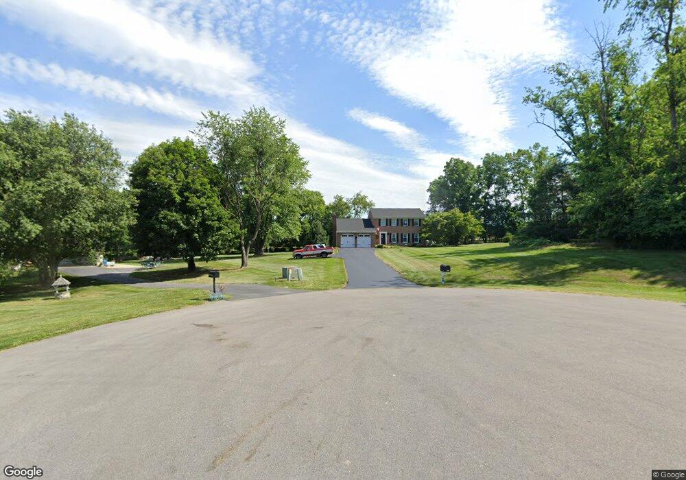
10617 Carter Way Hagerstown, MD 21742
Mount Aetna NeighborhoodEstimated Value: $419,000 - $585,000
--
Bed
3
Baths
2,137
Sq Ft
$234/Sq Ft
Est. Value
About This Home
This home is located at 10617 Carter Way, Hagerstown, MD 21742 and is currently estimated at $501,038, approximately $234 per square foot. 10617 Carter Way is a home located in Washington County with nearby schools including Old Forge Elementary School, Smithsburg Middle School, and Smithsburg High School.
Ownership History
Date
Name
Owned For
Owner Type
Purchase Details
Closed on
Sep 24, 1986
Sold by
Popp Laurence M and Popp Janet D
Bought by
Stevens Mark P and Stevens Kathleen
Current Estimated Value
Home Financials for this Owner
Home Financials are based on the most recent Mortgage that was taken out on this home.
Original Mortgage
$98,000
Interest Rate
10.07%
Purchase Details
Closed on
May 9, 1986
Sold by
Brown Joel R
Bought by
Popp Laurence M and Popp Janet D
Purchase Details
Closed on
Jul 3, 1984
Sold by
Bailey Walter E
Bought by
Brown Joel R
Home Financials for this Owner
Home Financials are based on the most recent Mortgage that was taken out on this home.
Original Mortgage
$5,000
Interest Rate
14.5%
Create a Home Valuation Report for This Property
The Home Valuation Report is an in-depth analysis detailing your home's value as well as a comparison with similar homes in the area
Home Values in the Area
Average Home Value in this Area
Purchase History
| Date | Buyer | Sale Price | Title Company |
|---|---|---|---|
| Stevens Mark P | $15,500 | -- | |
| Popp Laurence M | $14,500 | -- | |
| Brown Joel R | $13,000 | -- |
Source: Public Records
Mortgage History
| Date | Status | Borrower | Loan Amount |
|---|---|---|---|
| Closed | Stevens Mark P | $98,000 | |
| Previous Owner | Brown Joel R | $5,000 |
Source: Public Records
Tax History Compared to Growth
Tax History
| Year | Tax Paid | Tax Assessment Tax Assessment Total Assessment is a certain percentage of the fair market value that is determined by local assessors to be the total taxable value of land and additions on the property. | Land | Improvement |
|---|---|---|---|---|
| 2025 | $3,616 | $380,467 | $0 | $0 |
| 2024 | $3,616 | $343,500 | $96,600 | $246,900 |
| 2023 | $3,409 | $323,433 | $0 | $0 |
| 2022 | $3,201 | $303,367 | $0 | $0 |
| 2021 | $2,954 | $283,300 | $96,600 | $186,700 |
| 2020 | $2,954 | $274,233 | $0 | $0 |
| 2019 | $2,871 | $265,167 | $0 | $0 |
| 2018 | $2,775 | $256,100 | $96,600 | $159,500 |
| 2017 | $2,775 | $256,100 | $0 | $0 |
| 2016 | -- | $256,100 | $0 | $0 |
| 2015 | $3,209 | $279,000 | $0 | $0 |
| 2014 | $3,209 | $279,000 | $0 | $0 |
Source: Public Records
Map
Nearby Homes
- 10132 Crystal Falls Dr
- 10110 Easterday Ct
- 21712 Chewsville Rd
- 20931 Mount Aetna Rd
- 11510 Orange Blossom Ct
- 22107 Beaverbrook Dr
- 20505 Shaheen Ln
- 9508 Stottlemyer Rd
- 11013 Shalom Ln
- 21918 Jefferson Blvd
- 11117 Shalom Ln
- 20410 Trout Dr
- 11411 Woodview Dr
- 9812 Pembroke Dr
- 11029 Plumwood Cir
- 20314 Parkwood Ct
- 22420 Old Georgetown Rd
- 20204 Plumwood Dr
- 0 Cool Hollow Rd
- 20775 Beaver Creek Rd
- 10616 Carter Way
- 10609 Carter Way
- 10608 Carter Way
- 21706 O Toole Dr
- 21712 O Toole Dr
- 21642 O Toole Dr
- 21716 O Toole Dr
- 21707 O Toole Dr
- 21630 O Toole Dr
- 21715 O Toole Dr
- 21643 O Toole Dr
- 21724 O Toole Dr
- 10807 Mapleville Rd
- 21627 O Toole Dr
- 21723 O Toole Dr
- 21512 Mount Aetna Rd
- 21614 Horseshoe Ln
- 21732 O Toole Dr
- 10817 Mapleville Rd
- 21619 O Toole Dr