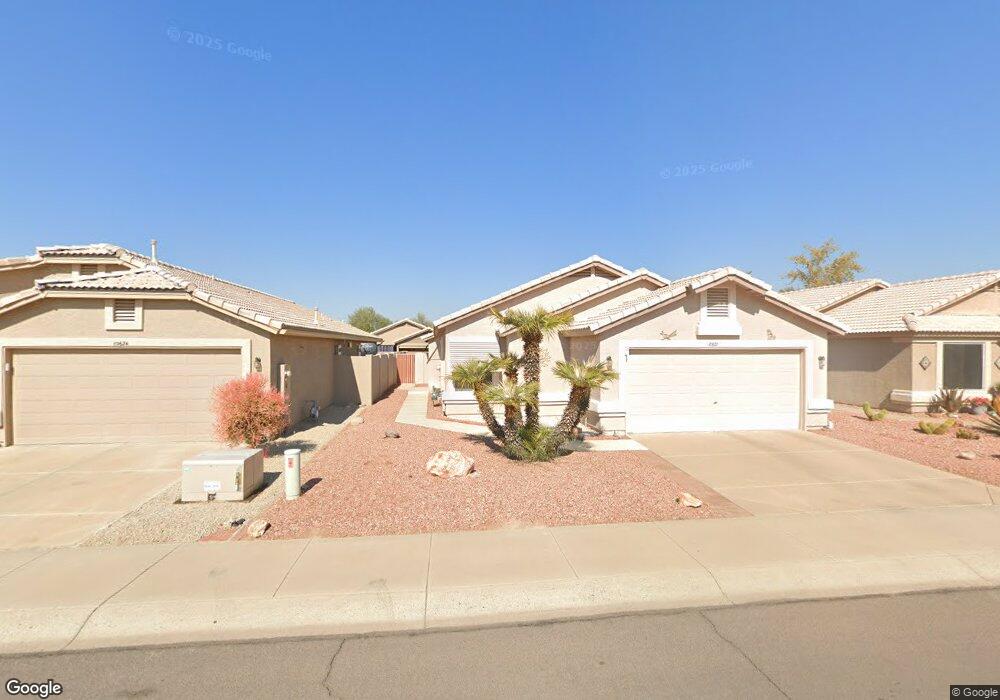
10620 W Runion Dr Peoria, AZ 85382
Estimated Value: $315,819 - $400,000
--
Bed
3
Baths
1,685
Sq Ft
$220/Sq Ft
Est. Value
About This Home
This home is located at 10620 W Runion Dr, Peoria, AZ 85382 and is currently estimated at $370,955, approximately $220 per square foot. 10620 W Runion Dr is a home located in Maricopa County with nearby schools including Parkridge Elementary School, Sunrise Mountain High School, and Guidepost Montessori at Peoria.
Ownership History
Date
Name
Owned For
Owner Type
Purchase Details
Closed on
Mar 30, 2022
Sold by
Breier Jeffrey J
Bought by
Breier Jeffrey J and Davis Christopher Fredric
Current Estimated Value
Purchase Details
Closed on
Dec 1, 2012
Sold by
Breier Edward
Bought by
Breier Edward and Breir Jeffrey J
Purchase Details
Closed on
Apr 27, 2012
Sold by
Breier Edward J and Bustin Beverly
Bought by
Breier Edward J
Purchase Details
Closed on
Feb 24, 2012
Sold by
Breier Edward J and Breier Jeffrey J
Bought by
Breier Edward J and Bustin Beverly
Purchase Details
Closed on
Nov 5, 2009
Sold by
Breier Edward J
Bought by
Breier Edward J and Breier Jeffrey J
Purchase Details
Closed on
Jun 20, 2005
Sold by
Breier Edward J and Breier Catherine
Bought by
Breier Edward J and Breier Catherine
Purchase Details
Closed on
Dec 4, 2003
Sold by
Breier Edward J and Breier Catherine
Bought by
Breier Edward J and Breier Catherine
Create a Home Valuation Report for This Property
The Home Valuation Report is an in-depth analysis detailing your home's value as well as a comparison with similar homes in the area
Home Values in the Area
Average Home Value in this Area
Purchase History
| Date | Buyer | Sale Price | Title Company |
|---|---|---|---|
| Breier Jeffrey J | -- | None Listed On Document | |
| Breier Edward | -- | None Available | |
| Breier Edward J | -- | None Available | |
| Breier Edward J | -- | None Available | |
| Breier Edward J | -- | None Available | |
| Breier Edward J | -- | -- | |
| Breier Edward J | -- | -- |
Source: Public Records
Tax History Compared to Growth
Tax History
| Year | Tax Paid | Tax Assessment Tax Assessment Total Assessment is a certain percentage of the fair market value that is determined by local assessors to be the total taxable value of land and additions on the property. | Land | Improvement |
|---|---|---|---|---|
| 2025 | $1,410 | $17,993 | -- | -- |
| 2024 | $1,389 | $17,136 | -- | -- |
| 2023 | $1,389 | $26,830 | $5,360 | $21,470 |
| 2022 | $1,360 | $21,060 | $4,210 | $16,850 |
| 2021 | $1,455 | $20,010 | $4,000 | $16,010 |
| 2020 | $1,469 | $17,650 | $3,530 | $14,120 |
| 2019 | $1,422 | $16,710 | $3,340 | $13,370 |
| 2018 | $1,372 | $15,900 | $3,180 | $12,720 |
| 2017 | $1,373 | $13,850 | $2,770 | $11,080 |
| 2016 | $1,358 | $11,470 | $2,290 | $9,180 |
| 2015 | $932 | $11,470 | $2,290 | $9,180 |
Source: Public Records
Map
Nearby Homes
- 20360 N 106th Ln
- 10659 W Yukon Dr
- 10630 W Mohawk Ln
- 20670 N 105th Dr
- 20615 N 105th Ave
- 10763 W Runion Dr
- 20274 N 104th Ave
- 20769 N 106th Ln
- 10722 W Irma Ln
- 10728 W Irma Ln
- 10347 W Mohawk Ln
- 10379 W Tonopah Dr
- 10528 W Potter Dr
- 20957 N 107th Dr
- 10672 W Ross Ave
- 20017 N 101st Ave
- 10344 W Burnett Rd
- 20056 N 107th Ln
- 19822 N Turquoise Hills Dr
- 10952 W Tonopah Dr
- 10624 W Runion Dr
- 10616 W Runion Dr
- 10628 W Runion Dr
- 10612 W Runion Dr
- 10625 W Mohawk Ln
- 10629 W Mohawk Ln
- 10621 W Mohawk Ln
- 10633 W Mohawk Ln
- 10632 W Runion Dr
- 10621 W Runion Dr
- 10617 W Mohawk Ln
- 10625 W Runion Dr
- 10637 W Mohawk Ln
- 10617 W Runion Dr
- 10629 W Runion Dr
- 10604 W Runion Dr
- 10636 W Runion Dr
- 10613 W Runion Dr
- 10613 W Mohawk Ln
- 10641 W Mohawk Ln