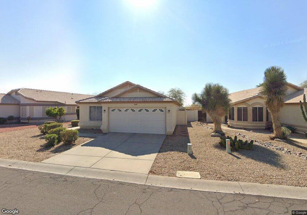
10639 W Yukon Dr Peoria, AZ 85382
Estimated Value: $294,720 - $340,000
3
Beds
2
Baths
1,295
Sq Ft
$253/Sq Ft
Est. Value
About This Home
This home is located at 10639 W Yukon Dr, Peoria, AZ 85382 and is currently estimated at $327,430, approximately $252 per square foot. 10639 W Yukon Dr is a home located in Maricopa County with nearby schools including Parkridge Elementary School, Sunrise Mountain High School, and Guidepost Montessori at Peoria.
Ownership History
Date
Name
Owned For
Owner Type
Purchase Details
Closed on
Mar 19, 2024
Sold by
Rivers Kimberley Ellen
Bought by
Kimberley E Rivers Living Trust and Rivers
Current Estimated Value
Purchase Details
Closed on
Jun 23, 2004
Sold by
Liv Gray Dorothy
Bought by
Bateman Rivers Kimberley Ellen and Bateman Rivers Constance
Purchase Details
Closed on
Oct 29, 1997
Sold by
Edmondson Ruth
Bought by
Liv Edmondson Ruth E and Liv Ruth E Edmondson Revocable
Create a Home Valuation Report for This Property
The Home Valuation Report is an in-depth analysis detailing your home's value as well as a comparison with similar homes in the area
Home Values in the Area
Average Home Value in this Area
Purchase History
| Date | Buyer | Sale Price | Title Company |
|---|---|---|---|
| Kimberley E Rivers Living Trust | -- | None Listed On Document | |
| Bateman Rivers Kimberley Ellen | $133,500 | First American Title Ins Co | |
| Liv Edmondson Ruth E | -- | -- |
Source: Public Records
Tax History Compared to Growth
Tax History
| Year | Tax Paid | Tax Assessment Tax Assessment Total Assessment is a certain percentage of the fair market value that is determined by local assessors to be the total taxable value of land and additions on the property. | Land | Improvement |
|---|---|---|---|---|
| 2025 | $1,159 | $14,794 | -- | -- |
| 2024 | $1,142 | $14,090 | -- | -- |
| 2023 | $1,142 | $23,430 | $4,680 | $18,750 |
| 2022 | $1,118 | $18,310 | $3,660 | $14,650 |
| 2021 | $1,197 | $17,250 | $3,450 | $13,800 |
| 2020 | $1,208 | $15,060 | $3,010 | $12,050 |
| 2019 | $1,169 | $14,110 | $2,820 | $11,290 |
| 2018 | $1,128 | $13,230 | $2,640 | $10,590 |
| 2017 | $1,129 | $11,420 | $2,280 | $9,140 |
| 2016 | $1,117 | $11,200 | $2,240 | $8,960 |
| 2015 | $1,042 | $10,530 | $2,100 | $8,430 |
Source: Public Records
Map
Nearby Homes
- 10659 W Yukon Dr
- 20360 N 106th Ln
- 10630 W Mohawk Ln
- 10763 W Runion Dr
- 20670 N 105th Dr
- 20615 N 105th Ave
- 10722 W Irma Ln
- 20274 N 104th Ave
- 10728 W Irma Ln
- 20769 N 106th Ln
- 20056 N 107th Ln
- 10379 W Tonopah Dr
- 10347 W Mohawk Ln
- 10528 W Potter Dr
- 10952 W Tonopah Dr
- 19822 N Turquoise Hills Dr
- 20957 N 107th Dr
- 20017 N 101st Ave
- 10672 W Ross Ave
- 19845 N Welk Dr
- 10635 W Yukon Dr
- 10643 W Yukon Dr
- 10631 W Yukon Dr
- 10631 W Yukon Dr
- 10647 W Yukon Dr
- 20304 N 106th Dr
- 10627 W Yukon Dr
- 10651 W Yukon Dr
- 20303 N 106th Dr
- 20310 N 106th Dr
- 20309 N 106th Dr
- 10655 W Yukon Dr
- 20316 N 106th Dr
- 20315 N 106th Dr
- 20313 N 106th Ln
- 20322 N 106th Dr
- 20321 N 106th Dr
- 20319 N 106th Ln
- 20304 N 106th Ave
- 20310 N 106th Ave