Estimated Value: $124,000 - $268,000
4
Beds
5
Baths
3,700
Sq Ft
$56/Sq Ft
Est. Value
About This Home
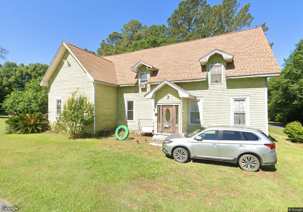
This home is located at 1065 N College St, Pavo, GA 31778 and is currently estimated at $208,066, approximately $56 per square foot. 1065 N College St is a home located in Thomas County with nearby schools including Hand in Hand Primary School, Garrison-Pilcher Elementary School, and Cross Creek Elementary School.
Ownership History
Date
Name
Owned For
Owner Type
Purchase Details
Closed on
Apr 11, 2007
Sold by
Beal Karyl C
Bought by
Spurlin Roswitha
Current Estimated Value
Purchase Details
Closed on
Nov 19, 2004
Sold by
Hart Sallylu H
Bought by
Beal Ronald L
Purchase Details
Closed on
Apr 30, 2004
Sold by
Hart Sallylu H
Bought by
Beal Ronald L and Beal Karyl C
Purchase Details
Closed on
Feb 28, 1980
Sold by
Johnson Ruby Lee
Bought by
Beal Ronald L and Beal Karyl C
Create a Home Valuation Report for This Property
The Home Valuation Report is an in-depth analysis detailing your home's value as well as a comparison with similar homes in the area
Home Values in the Area
Average Home Value in this Area
Purchase History
| Date | Buyer | Sale Price | Title Company |
|---|---|---|---|
| Spurlin Roswitha | $104,912 | -- | |
| Beal Ronald L | -- | -- | |
| Beal Ronald L | $2,900 | -- | |
| Beal Ronald L | $333,200 | -- |
Source: Public Records
Tax History Compared to Growth
Tax History
| Year | Tax Paid | Tax Assessment Tax Assessment Total Assessment is a certain percentage of the fair market value that is determined by local assessors to be the total taxable value of land and additions on the property. | Land | Improvement |
|---|---|---|---|---|
| 2024 | $2,080 | $64,484 | $6,113 | $58,371 |
| 2023 | $1,816 | $61,520 | $6,113 | $55,407 |
| 2022 | $952 | $45,980 | $4,890 | $41,090 |
| 2021 | $876 | $39,731 | $4,890 | $34,841 |
| 2020 | $1,066 | $39,479 | $4,890 | $34,589 |
| 2019 | $1,022 | $37,614 | $4,890 | $32,724 |
| 2018 | $1,052 | $38,418 | $4,890 | $33,528 |
| 2017 | $1,162 | $37,817 | $4,352 | $33,465 |
| 2016 | $1,056 | $37,906 | $4,352 | $33,554 |
| 2015 | $1,171 | $41,630 | $4,059 | $37,570 |
| 2014 | $1,155 | $40,826 | $4,059 | $36,767 |
| 2013 | -- | $40,826 | $4,059 | $36,767 |
Source: Public Records
Map
Nearby Homes
- 2051 W Pear St
- 2055 S Roberts St
- 1230 Parrish Rd
- 16343 Georgia 33
- 16343 Ga Hwy 33 -8 34 Acres
- 16343
- 16343 Ga Hwy 33 - 8 34 Acres Hwy
- 1136 Nesbitt Rd
- 813 Vonier Road (6 Acres)
- 13876 Ga Highway 122
- 1038-BA Church St
- 7402 Coffee Rd
- 7921 Five Forks Rd
- 9283 Tallokas Rd Unit 54/13
- 9283 Tallokas Rd
- 3812 Ponder Rd
- 110 Nicole Britt Dr
- 101 Bailey Cir
- 203 Bailey Cir
- 4855 Harts Mill Rd
- 1070 N College St
- 2045 N College St
- 2088 W Pear St
- 2088 Harris St
- 2060 W Pear St
- 3018 W Harris St
- 3068 W Joiner St
- 2082 W Harris St
- 3086 W Joiner St
- 3098 W Joiner St
- 4780 Harts Mill Rd
- 2038 W Pear St
- 2089 N College St
- 3033PA W Peachtree St
- 2046 W Harris St
- 1041 N Roberts St
- 2010 W Harris St
- 3007 W Harris St
- 4008 Joiner St