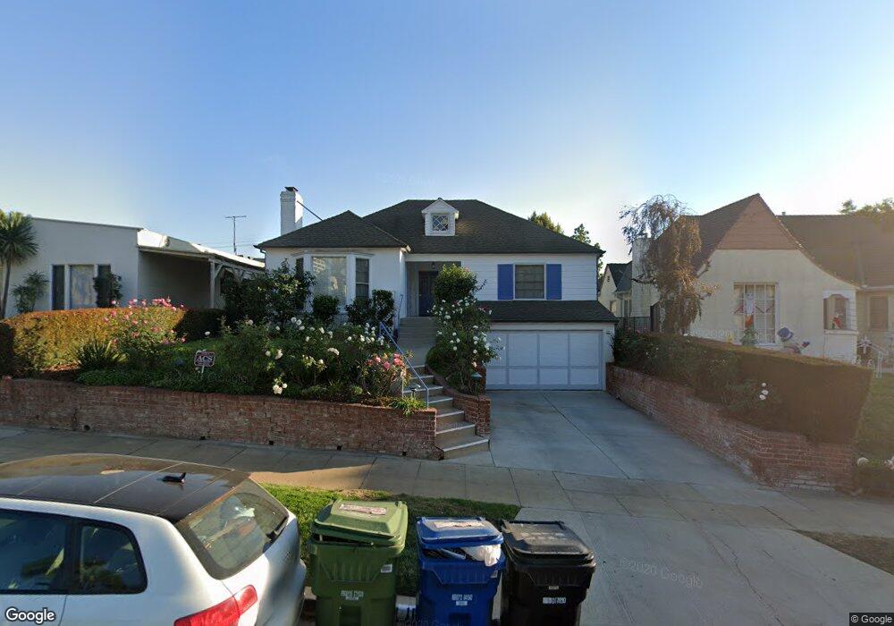
10670 Rochester Ave Los Angeles, CA 90024
Westwood NeighborhoodEstimated Value: $2,491,529 - $2,700,000
3
Beds
2
Baths
1,931
Sq Ft
$1,325/Sq Ft
Est. Value
About This Home
This home is located at 10670 Rochester Ave, Los Angeles, CA 90024 and is currently estimated at $2,557,632, approximately $1,324 per square foot. 10670 Rochester Ave is a home located in Los Angeles County with nearby schools including Fairburn Avenue Elementary, Westwood Charter School, and Ralph Waldo Emerson Community Charter Middle School.
Ownership History
Date
Name
Owned For
Owner Type
Purchase Details
Closed on
Sep 10, 1996
Sold by
Bamberger Mark G
Bought by
Combs Christopher Wentworth and Hughes Charlotte Freear
Current Estimated Value
Home Financials for this Owner
Home Financials are based on the most recent Mortgage that was taken out on this home.
Original Mortgage
$444,000
Outstanding Balance
$38,227
Interest Rate
8.23%
Estimated Equity
$2,519,405
Purchase Details
Closed on
Feb 8, 1996
Sold by
Bamberger Md Mark G and Bamberger Polly
Bought by
Bamberger Md Mark G and Bamberger Polly
Home Financials for this Owner
Home Financials are based on the most recent Mortgage that was taken out on this home.
Original Mortgage
$433,000
Interest Rate
7%
Create a Home Valuation Report for This Property
The Home Valuation Report is an in-depth analysis detailing your home's value as well as a comparison with similar homes in the area
Home Values in the Area
Average Home Value in this Area
Purchase History
| Date | Buyer | Sale Price | Title Company |
|---|---|---|---|
| Combs Christopher Wentworth | -- | Equity Title Company | |
| Bamberger Md Mark G | -- | Fidelity National Title Ins |
Source: Public Records
Mortgage History
| Date | Status | Borrower | Loan Amount |
|---|---|---|---|
| Open | Combs Christopher Wentworth | $444,000 | |
| Previous Owner | Bamberger Md Mark G | $433,000 |
Source: Public Records
Tax History Compared to Growth
Tax History
| Year | Tax Paid | Tax Assessment Tax Assessment Total Assessment is a certain percentage of the fair market value that is determined by local assessors to be the total taxable value of land and additions on the property. | Land | Improvement |
|---|---|---|---|---|
| 2025 | $11,437 | $946,699 | $537,461 | $409,238 |
| 2024 | $11,437 | $928,137 | $526,923 | $401,214 |
| 2023 | $11,220 | $909,940 | $516,592 | $393,348 |
| 2022 | $10,704 | $892,099 | $506,463 | $385,636 |
| 2021 | $10,565 | $874,608 | $496,533 | $378,075 |
| 2019 | $10,250 | $848,668 | $481,806 | $366,862 |
| 2018 | $10,156 | $832,028 | $472,359 | $359,669 |
| 2016 | $9,704 | $799,721 | $454,018 | $345,703 |
| 2015 | $9,562 | $787,710 | $447,199 | $340,511 |
| 2014 | $9,596 | $772,280 | $438,439 | $333,841 |
Source: Public Records
Map
Nearby Homes
- 10721 Ohio Ave
- 10687 Wilkins Ave Unit 1
- 10725 Ohio Ave Unit PH2
- 10725 Ohio Ave Unit 301
- 10671 Wilkins Ave Unit 5
- 10735 Rochester Ave
- 1551 Manning Ave Unit 101
- 10745 Ohio Ave
- 10633 Kinnard Ave Unit 1
- 10627 Ashton Ave Unit 103
- 10660 Wilshire Blvd Unit 609
- 10611 Ashton Ave Unit 1
- 10600 Wilkins Ave Unit 3D
- 10724 Wilshire Blvd Unit 1001
- 10724 Wilshire Blvd Unit 1209
- 10724 Wilshire Blvd Unit 1501
- 10724 Wilshire Blvd Unit 1402
- 10724 Wilshire Blvd Unit 607
- 10724 Wilshire Blvd Unit 703
- 10724 Wilshire Blvd Unit 1005
- 10664 Rochester Ave
- 10674 Rochester Ave
- 10660 Rochester Ave
- 10678 Rochester Ave
- 10667 Ohio Ave
- 10671 Ohio Ave
- 10661 Ohio Ave
- 10654 Rochester Ave
- 10677 Ohio Ave
- 10657 Ohio Ave
- 10669 Rochester Ave
- 10675 Rochester Ave
- 10650 Rochester Ave
- 10663 Rochester Ave
- 1320 Manning Ave
- 10651 Ohio Ave
- 10702 Rochester Ave
- 10659 Rochester Ave
- 10647 Ohio Ave
- 10701 Ohio Ave