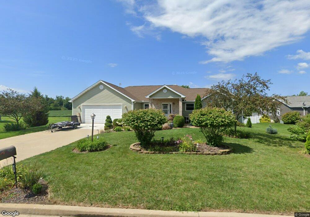
107 Nicholas Dr Groveland, IL 61535
Estimated Value: $306,000 - $398,000
4
Beds
3
Baths
1,894
Sq Ft
$190/Sq Ft
Est. Value
About This Home
This home is located at 107 Nicholas Dr, Groveland, IL 61535 and is currently estimated at $359,511, approximately $189 per square foot. 107 Nicholas Dr is a home with nearby schools including Morton High School, Bethel Lutheran School, and Blessed Sacrament School.
Ownership History
Date
Name
Owned For
Owner Type
Purchase Details
Closed on
Jul 30, 2008
Sold by
Bassett John C and Bassett Teresa E
Bought by
King John F and King Suzie
Current Estimated Value
Home Financials for this Owner
Home Financials are based on the most recent Mortgage that was taken out on this home.
Original Mortgage
$39,600
Outstanding Balance
$26,207
Interest Rate
6.5%
Mortgage Type
Purchase Money Mortgage
Estimated Equity
$333,304
Purchase Details
Closed on
Oct 20, 2006
Sold by
Knollenberg Leslie J
Bought by
Bassett John C and Bassett Teresa E
Create a Home Valuation Report for This Property
The Home Valuation Report is an in-depth analysis detailing your home's value as well as a comparison with similar homes in the area
Home Values in the Area
Average Home Value in this Area
Purchase History
| Date | Buyer | Sale Price | Title Company |
|---|---|---|---|
| King John F | $44,000 | First Community Title Svcs | |
| Bassett John C | $43,000 | First Community Title Svcs |
Source: Public Records
Mortgage History
| Date | Status | Borrower | Loan Amount |
|---|---|---|---|
| Open | King John F | $39,600 |
Source: Public Records
Tax History Compared to Growth
Tax History
| Year | Tax Paid | Tax Assessment Tax Assessment Total Assessment is a certain percentage of the fair market value that is determined by local assessors to be the total taxable value of land and additions on the property. | Land | Improvement |
|---|---|---|---|---|
| 2024 | $4,942 | $87,920 | $17,810 | $70,110 |
| 2023 | $4,942 | $80,720 | $16,350 | $64,370 |
| 2022 | $4,741 | $74,660 | $15,120 | $59,540 |
| 2021 | $4,895 | $71,790 | $14,540 | $57,250 |
| 2020 | $4,762 | $71,790 | $14,540 | $57,250 |
| 2019 | $4,753 | $71,790 | $14,540 | $57,250 |
| 2018 | $4,664 | $71,790 | $14,540 | $57,250 |
| 2017 | $4,544 | $69,550 | $14,090 | $55,460 |
| 2016 | $4,495 | $69,550 | $14,090 | $55,460 |
| 2015 | $4,347 | $0 | $0 | $0 |
| 2013 | $4,306 | $69,550 | $14,090 | $55,460 |
Source: Public Records
Map
Nearby Homes
- 123 Apache Way
- 109 Apache Way
- 210 Apache Way
- 105 Apache Way
- 417 Apache Way
- 101 Apache Way
- 19314 Springfield Rd
- 305 Apache Way
- 4851 Sheridan Rd
- 105 Sheffield Rd
- 19478 Springfield Rd
- 305 Conaghan Dr
- 5559 Broadway Rd
- 5859 Broadway Rd
- 16810 Springfield Rd
- 3747 Grandview Ct
- 015 Harris Rd
- Lot 4 Harris Rd
- Lot 37 Grandview Ct
- Lot 2 Grandview Ct
- 111 Nicholas Dr
- 103 Nicholas Dr
- 115 Nicholas Dr
- 108 Nicholas Dr
- 112 Nicholas Dr
- 120 Nicholas Dr
- 104 Nicholas Dr
- 100 Nicholas Dr
- 18811 Springfield Rd
- 116 Nicholas Dr
- 19001 Springfield Rd
- 18955 Springfield Rd
- 299 West St
- 18953 Springfield Rd
- 18793 Springfield Rd
- 101 Roberts St
- 18781 Springfield Rd
- 18985 Springfield Rd
- 18947 Springfield Rd
- 18965 Springfield Rd