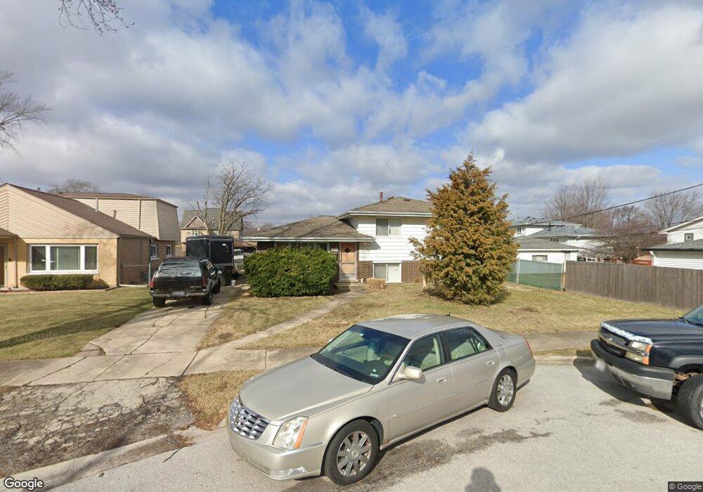
10720 Moody Ave Chicago Ridge, IL 60415
Estimated Value: $271,000 - $320,019
3
Beds
1
Bath
1,017
Sq Ft
$294/Sq Ft
Est. Value
About This Home
This home is located at 10720 Moody Ave, Chicago Ridge, IL 60415 and is currently estimated at $298,755, approximately $293 per square foot. 10720 Moody Ave is a home located in Cook County with nearby schools including Ridge Central Elementary School, Elden D Finley Jr High School, and Harold L. Richards High School.
Ownership History
Date
Name
Owned For
Owner Type
Purchase Details
Closed on
Jun 14, 2001
Sold by
Strandell Harry C and Strandell Marilyn M
Bought by
Strandell Steven M
Current Estimated Value
Home Financials for this Owner
Home Financials are based on the most recent Mortgage that was taken out on this home.
Original Mortgage
$134,400
Outstanding Balance
$51,345
Interest Rate
7.18%
Estimated Equity
$247,410
Purchase Details
Closed on
Apr 18, 1995
Sold by
Worth Bank & Trust
Bought by
Strandell Harry C and Strandell Marilyn M
Create a Home Valuation Report for This Property
The Home Valuation Report is an in-depth analysis detailing your home's value as well as a comparison with similar homes in the area
Home Values in the Area
Average Home Value in this Area
Purchase History
| Date | Buyer | Sale Price | Title Company |
|---|---|---|---|
| Strandell Steven M | $168,000 | -- | |
| Strandell Harry C | -- | -- |
Source: Public Records
Mortgage History
| Date | Status | Borrower | Loan Amount |
|---|---|---|---|
| Open | Strandell Steven M | $134,400 |
Source: Public Records
Tax History Compared to Growth
Tax History
| Year | Tax Paid | Tax Assessment Tax Assessment Total Assessment is a certain percentage of the fair market value that is determined by local assessors to be the total taxable value of land and additions on the property. | Land | Improvement |
|---|---|---|---|---|
| 2024 | $7,033 | $25,000 | $5,226 | $19,774 |
| 2023 | $6,237 | $25,000 | $5,226 | $19,774 |
| 2022 | $6,237 | $19,342 | $4,573 | $14,769 |
| 2021 | $6,002 | $19,340 | $4,572 | $14,768 |
| 2020 | $6,013 | $19,340 | $4,572 | $14,768 |
| 2019 | $5,185 | $16,707 | $4,137 | $12,570 |
| 2018 | $4,928 | $16,707 | $4,137 | $12,570 |
| 2017 | $4,959 | $16,707 | $4,137 | $12,570 |
| 2016 | $5,246 | $15,647 | $3,484 | $12,163 |
| 2015 | $5,097 | $15,647 | $3,484 | $12,163 |
| 2014 | $5,012 | $15,647 | $3,484 | $12,163 |
| 2013 | $4,917 | $16,736 | $3,484 | $13,252 |
Source: Public Records
Map
Nearby Homes
- 10706 Oak Ave
- 10854 Lyman Ave
- 10755 Mason Ave
- 10925 Lyman Ave
- 10937 Moody Ave
- 10825 Oxford Ave
- 10529 Lyman Ave
- 10925 Mcvicker Ave
- 5924 W 109th St
- 10912 Princess Ave
- 10840 S Ridgeland Ave
- 5810 107th Court Way
- 5825 109th St
- 10429 Austin Ave Unit A
- 6040 111th St
- 10832 Massasoit Ave
- 6131 Marshall Ave Unit 1W
- 10501 Forest Ln
- 10956 S Nagle Ave
- 10910 S Natchez Ave
- 10724 Moody Ave
- 6143 107th St
- 6145 107th St
- 6141 107th St
- 10730 Moody Ave
- 10721 Lombard Ave
- 6153 107th St
- 10725 Lombard Ave
- 6139 107th St
- 10731 Lombard Ave
- 10719 Moody Ave
- 10701 Lombard Ave
- 10736 Moody Ave
- 10731 Moody Ave
- 6135 107th St
- 10737 Lombard Ave
- 10737 Moody Ave
- 10742 Moody Ave
- 6131 107th St
- 10743 Lombard Ave