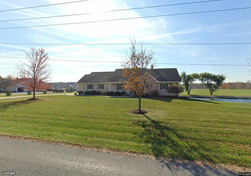
10732 Fisher Rd Wapakoneta, OH 45895
Estimated Value: $360,000 - $404,000
3
Beds
3
Baths
2,508
Sq Ft
$152/Sq Ft
Est. Value
About This Home
This home is located at 10732 Fisher Rd, Wapakoneta, OH 45895 and is currently estimated at $381,689, approximately $152 per square foot. 10732 Fisher Rd is a home located in Auglaize County with nearby schools including Wapakoneta Elementary School, Wapakoneta High School, and Wapakoneta Middle School.
Ownership History
Date
Name
Owned For
Owner Type
Purchase Details
Closed on
Sep 15, 2022
Sold by
Roth Mary Jo S
Bought by
Clements Keith W
Current Estimated Value
Purchase Details
Closed on
Mar 10, 2022
Sold by
Schlenker Roth Mary Jo
Bought by
Roth Mary Jo S
Purchase Details
Closed on
Jun 1, 2004
Sold by
Clements Wayne Parker
Bought by
Clements Mary Jo Schlenker
Purchase Details
Closed on
May 12, 2000
Sold by
Schlenker Carl W
Bought by
Clements Wayne Parker
Create a Home Valuation Report for This Property
The Home Valuation Report is an in-depth analysis detailing your home's value as well as a comparison with similar homes in the area
Home Values in the Area
Average Home Value in this Area
Purchase History
| Date | Buyer | Sale Price | Title Company |
|---|---|---|---|
| Clements Keith W | -- | -- | |
| Clements Keith W | -- | None Listed On Document | |
| Roth Mary Jo S | -- | None Listed On Document | |
| Clements Mary Jo Schlenker | -- | -- | |
| Clements Wayne Parker | -- | -- |
Source: Public Records
Tax History Compared to Growth
Tax History
| Year | Tax Paid | Tax Assessment Tax Assessment Total Assessment is a certain percentage of the fair market value that is determined by local assessors to be the total taxable value of land and additions on the property. | Land | Improvement |
|---|---|---|---|---|
| 2024 | $5,246 | $107,610 | $7,620 | $99,990 |
| 2023 | $3,486 | $107,610 | $7,620 | $99,990 |
| 2022 | $2,361 | $76,240 | $6,930 | $69,310 |
| 2021 | $2,342 | $76,240 | $6,930 | $69,310 |
| 2020 | $1,183 | $76,241 | $6,934 | $69,307 |
| 2019 | $2,024 | $64,870 | $5,877 | $58,993 |
| 2018 | $2,031 | $64,870 | $5,877 | $58,993 |
| 2017 | $2,019 | $64,870 | $5,877 | $58,993 |
| 2016 | $1,801 | $59,080 | $5,593 | $53,487 |
| 2015 | $1,800 | $59,080 | $5,593 | $53,487 |
| 2014 | $1,818 | $59,080 | $5,593 | $53,487 |
| 2013 | $1,858 | $59,080 | $5,593 | $53,487 |
Source: Public Records
Map
Nearby Homes
- 17054 State Route 198
- 1020 Timber Trail
- 1028 Stonegate Ct
- 601 Warren St
- 924 Poppy Dr
- 920 Primrose Dr
- 15644 Bay Rd
- 906 Aster Dr
- 808 Aster Dr
- 106 Valleyview Dr
- 322 Cole Dr
- 1100 W Auglaize St
- 420 Hoopengarner St
- 814 W Benton St
- 414 W Auglaize St
- 608 W Benton St
- 8304 Kruse Rd
- 307 W Auglaize St
- 9 E Silver St
- 0 Kohler Rd
- 10736 Fisher Rd
- 16753 Buckland River Rd
- 16748 Buckland River Rd
- 16774 Buckland River Rd
- 16926 Buckland River Rd
- 16732 Buckland River Rd
- 16993 Buckland River Rd
- 16986 Buckland River Rd
- 16639 Buckland River Rd
- 17021 Buckland River Rd
- 16550 Buckland River Rd
- 16800 Buckland River Rd
- 16557 Buckland River Rd
- 17066 Buckland River Rd
- 16493 Buckland River Rd
- 16524 Buckland River Rd
- 17098 Buckland River Rd
- 16461 Buckland River Rd