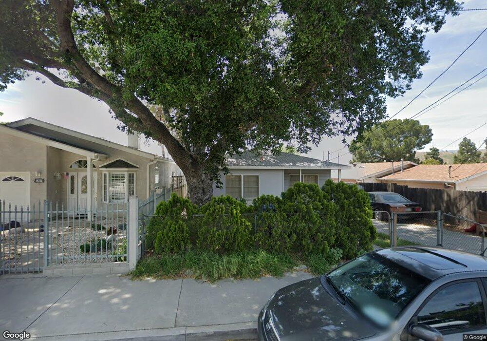
10737 Nassau Ave Sunland, CA 91040
Sunland NeighborhoodEstimated Value: $749,000 - $819,000
3
Beds
2
Baths
1,184
Sq Ft
$662/Sq Ft
Est. Value
About This Home
This home is located at 10737 Nassau Ave, Sunland, CA 91040 and is currently estimated at $783,427, approximately $661 per square foot. 10737 Nassau Ave is a home located in Los Angeles County with nearby schools including Sunland Elementary School, Mt. Gleason Middle School, and Verdugo Hills Senior High School.
Ownership History
Date
Name
Owned For
Owner Type
Purchase Details
Closed on
Jan 21, 1997
Sold by
Elam Properties Inc
Bought by
Solorzano Franklin A and Solorzano Dony S
Current Estimated Value
Home Financials for this Owner
Home Financials are based on the most recent Mortgage that was taken out on this home.
Original Mortgage
$128,681
Outstanding Balance
$13,958
Interest Rate
7.74%
Mortgage Type
FHA
Estimated Equity
$769,469
Purchase Details
Closed on
Nov 21, 1996
Sold by
Federal Home Loan Mortgage Corporation
Bought by
Elam Properties Inc
Purchase Details
Closed on
Oct 16, 1996
Sold by
Soto Bernardo and Federal Home Loan Mortgage Cor
Bought by
Federal Home Loan Mortgage Corporation
Create a Home Valuation Report for This Property
The Home Valuation Report is an in-depth analysis detailing your home's value as well as a comparison with similar homes in the area
Home Values in the Area
Average Home Value in this Area
Purchase History
| Date | Buyer | Sale Price | Title Company |
|---|---|---|---|
| Solorzano Franklin A | $130,000 | First American Title Co | |
| Elam Properties Inc | $89,500 | First American Title Co | |
| Federal Home Loan Mortgage Corporation | $176,747 | First American Title Ins Co |
Source: Public Records
Mortgage History
| Date | Status | Borrower | Loan Amount |
|---|---|---|---|
| Open | Solorzano Franklin A | $128,681 |
Source: Public Records
Tax History Compared to Growth
Tax History
| Year | Tax Paid | Tax Assessment Tax Assessment Total Assessment is a certain percentage of the fair market value that is determined by local assessors to be the total taxable value of land and additions on the property. | Land | Improvement |
|---|---|---|---|---|
| 2025 | $2,706 | $211,698 | $107,638 | $104,060 |
| 2024 | $2,706 | $207,548 | $105,528 | $102,020 |
| 2023 | $2,657 | $203,479 | $103,459 | $100,020 |
| 2022 | $2,536 | $199,490 | $101,431 | $98,059 |
| 2021 | $2,500 | $195,580 | $99,443 | $96,137 |
| 2019 | $2,428 | $189,782 | $96,495 | $93,287 |
| 2018 | $2,366 | $186,061 | $94,603 | $91,458 |
| 2017 | $2,313 | $182,414 | $92,749 | $89,665 |
| 2016 | $2,250 | $178,838 | $90,931 | $87,907 |
| 2015 | $2,219 | $176,153 | $89,566 | $86,587 |
| 2014 | $2,234 | $172,703 | $87,812 | $84,891 |
Source: Public Records
Map
Nearby Homes
- 8230 Hillrose St
- 10623 Woodward Ave
- 10704 Oro Vista Ave
- 8110 Brownstone St
- 10430 Mcvine Ave
- 10429 Mcvine Ave
- 7848 Forsythe St
- 8421 Grenoble St
- 7851 Fenwick St
- 10415 Mcvine Ave Unit 2
- 11034 Scoville Ave
- 11009 Quill Ave
- 10529 Mount Gleason Ave
- 8352 Wyngate St
- 7755 Forsythe St
- 8545 Forsythe St
- 10414 Whitegate Ave
- 10711 Sherman Grove Ave Unit 26
- 10711 Sherman Grove Ave Unit 13
- 10711 Sherman Grove Ave Unit 36
- 10733 Nassau Ave
- 10743 Nassau Ave
- 10729 Nassau Ave
- 10734 Mcvine Ave
- 10738 Mcvine Ave
- 10728 Mcvine Ave
- 10742 Mcvine Ave
- 10734 Nassau Ave
- 10724 Mcvine Ave
- 10742 Nassau Ave
- 10719 Nassau Ave
- 10728 Nassau Ave
- 10755 Nassau Ave
- 10750 Mcvine Ave
- 10720 Mcvine Ave
- 10724 Nassau Ave
- 10757 Nassau Ave
- 10754 Mcvine Ave
- 10720 Nassau Ave
- 10716 Mcvine Ave