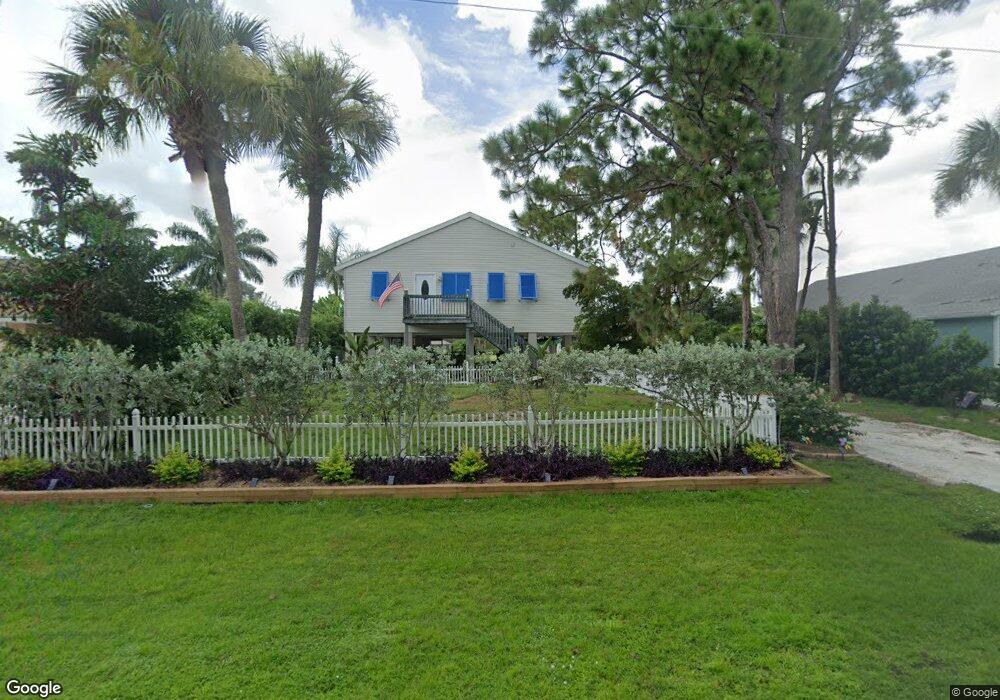
1076 March Dr Port Charlotte, FL 33953
Northwest Port Charlotte NeighborhoodEstimated Value: $308,295 - $504,000
2
Beds
2
Baths
3,040
Sq Ft
$133/Sq Ft
Est. Value
About This Home
This home is located at 1076 March Dr, Port Charlotte, FL 33953 and is currently estimated at $405,574, approximately $133 per square foot. 1076 March Dr is a home located in Charlotte County with nearby schools including Liberty Elementary School, Murdock Middle School, and Port Charlotte High School.
Ownership History
Date
Name
Owned For
Owner Type
Purchase Details
Closed on
Dec 14, 2016
Sold by
Watson Hollee L
Bought by
Flores George L and Harris Flores Calie L
Current Estimated Value
Home Financials for this Owner
Home Financials are based on the most recent Mortgage that was taken out on this home.
Original Mortgage
$251,000
Outstanding Balance
$202,803
Interest Rate
3.54%
Mortgage Type
Negative Amortization
Estimated Equity
$202,771
Purchase Details
Closed on
Feb 3, 2016
Sold by
Watson Kenneth R
Bought by
Watson Hollee L
Purchase Details
Closed on
Aug 30, 1999
Sold by
Atlantic Gulf Com Corp
Bought by
Watson Kenneth R and Watson Hollee L
Create a Home Valuation Report for This Property
The Home Valuation Report is an in-depth analysis detailing your home's value as well as a comparison with similar homes in the area
Home Values in the Area
Average Home Value in this Area
Purchase History
| Date | Buyer | Sale Price | Title Company |
|---|---|---|---|
| Flores George L | $251,000 | Attorney | |
| Watson Hollee L | -- | None Available | |
| Watson Kenneth R | $6,500 | -- |
Source: Public Records
Mortgage History
| Date | Status | Borrower | Loan Amount |
|---|---|---|---|
| Open | Flores George L | $251,000 |
Source: Public Records
Tax History Compared to Growth
Tax History
| Year | Tax Paid | Tax Assessment Tax Assessment Total Assessment is a certain percentage of the fair market value that is determined by local assessors to be the total taxable value of land and additions on the property. | Land | Improvement |
|---|---|---|---|---|
| 2023 | $4,395 | $200,021 | $0 | $0 |
| 2022 | $4,196 | $253,058 | $48,960 | $204,098 |
| 2021 | $3,564 | $165,306 | $25,840 | $139,466 |
| 2020 | $3,592 | $167,753 | $23,800 | $143,953 |
| 2019 | $3,456 | $161,436 | $23,120 | $138,316 |
| 2018 | $2,981 | $142,796 | $21,216 | $121,580 |
| 2017 | $2,943 | $138,581 | $24,548 | $114,033 |
| 2016 | $3,609 | $175,893 | $0 | $0 |
| 2015 | $1,747 | $104,120 | $0 | $0 |
| 2014 | $1,628 | $103,294 | $0 | $0 |
Source: Public Records
Map
Nearby Homes
- 12117 Fiske Ave
- 1100 March Dr
- 1108 March Dr
- 1114 March Dr
- 1144 Anaheim St
- 1200 Anaheim St
- 12060 Eisenhower Dr
- 1114 Campbell St
- 1030 Beekman Cir
- 12147 Kraft Ave
- 12196 Kraft Ave
- 12042 Kraft Ave
- 12090 Kraft Ave
- 1225 Beekman Cir
- 1217 Beekman Cir
- 12107 Judson Ave
- 12073 Judson Ave
- 12065 Judson Ave
- 12048 Judson Ave
- 12241 Judson Ave