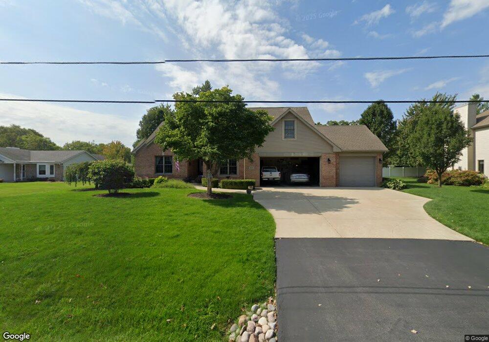
10762 47th Ave Pleasant Prairie, WI 53158
Village of Pleasant Prairie NeighborhoodEstimated Value: $560,751 - $688,000
3
Beds
3
Baths
2,060
Sq Ft
$309/Sq Ft
Est. Value
About This Home
This home is located at 10762 47th Ave, Pleasant Prairie, WI 53158 and is currently estimated at $636,188, approximately $308 per square foot. 10762 47th Ave is a home located in Kenosha County with nearby schools including Prairie Lane Elementary School, Lance Middle School, and Tremper High School.
Ownership History
Date
Name
Owned For
Owner Type
Purchase Details
Closed on
Jan 28, 2005
Sold by
Dtb Investments Llc
Bought by
Weisner Paul M and Weisner Andrea M
Current Estimated Value
Home Financials for this Owner
Home Financials are based on the most recent Mortgage that was taken out on this home.
Original Mortgage
$220,000
Outstanding Balance
$112,117
Interest Rate
5.79%
Mortgage Type
Stand Alone Second
Estimated Equity
$524,071
Create a Home Valuation Report for This Property
The Home Valuation Report is an in-depth analysis detailing your home's value as well as a comparison with similar homes in the area
Home Values in the Area
Average Home Value in this Area
Purchase History
| Date | Buyer | Sale Price | Title Company |
|---|---|---|---|
| Weisner Paul M | $346,000 | None Available |
Source: Public Records
Mortgage History
| Date | Status | Borrower | Loan Amount |
|---|---|---|---|
| Open | Weisner Paul M | $220,000 |
Source: Public Records
Tax History Compared to Growth
Tax History
| Year | Tax Paid | Tax Assessment Tax Assessment Total Assessment is a certain percentage of the fair market value that is determined by local assessors to be the total taxable value of land and additions on the property. | Land | Improvement |
|---|---|---|---|---|
| 2024 | $6,434 | $559,900 | $73,100 | $486,800 |
| 2023 | $6,347 | $482,000 | $66,700 | $415,300 |
| 2022 | $6,460 | $482,000 | $66,700 | $415,300 |
| 2021 | $6,339 | $337,800 | $52,800 | $285,000 |
| 2020 | $6,339 | $337,800 | $52,800 | $285,000 |
| 2019 | $5,816 | $337,800 | $52,800 | $285,000 |
| 2018 | $6,646 | $337,800 | $52,800 | $285,000 |
| 2017 | $5,500 | $285,100 | $48,000 | $237,100 |
| 2016 | $6,075 | $285,100 | $48,000 | $237,100 |
| 2015 | $5,136 | $256,000 | $44,300 | $211,700 |
| 2014 | -- | $256,000 | $44,300 | $211,700 |
Source: Public Records
Map
Nearby Homes
- Lt23 Cedar Ridge Ct
- Lt25 Cedar Ridge Ct
- Lt24 Cedar Ridge Ct
- 4799 103rd St
- Lt32 Cedar Ridge Ct
- Lt30 Cedar Ridge Ct
- Lt34 Cedar Ridge Ct
- Lt17 Cedar Ridge Ct
- Lt18 Cedar Ridge Ct
- Deerfield Plan at Cedar Ridge
- Essex Plan at Cedar Ridge
- Geneva Plan at Cedar Ridge
- Ellington Plan at Cedar Ridge
- Summerhill Plan at Cedar Ridge
- Harlow Plan at Cedar Ridge
- Norwood Plan at Cedar Ridge
- Andover Plan at Cedar Ridge
- Glenwood Plan at Cedar Ridge
- Berkshire Plan at Cedar Ridge
- Sinclair Plan at Cedar Ridge
- 10740 47th Ave
- 10786 47th Ave
- 4803 Springbrook Rd
- 10747 47th Ave
- 10718 47th Ave
- 4821 Springbrook Rd
- 10806 47th Ave
- 10781 47th Ave
- 10719 47th Ave
- 4692 108th St
- 0 Springbrook Rd
- 4843 Springbrook Rd
- 10814 47th Ave
- 10689 48th Ave
- 4790 Springbrook Rd
- 4871 Springbrook Rd
- 4689 108th St
- 10820 47th Ave
- 4899 Springbrook Rd
- 4750 Springbrook Rd