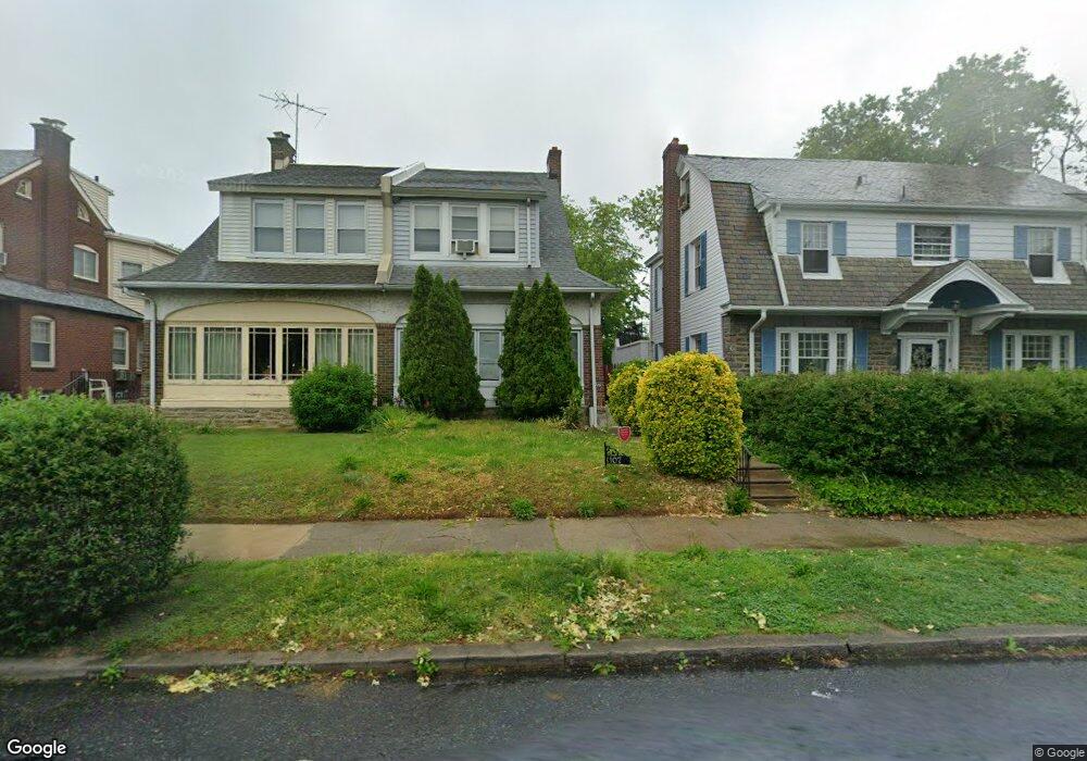
1079 Granite St Philadelphia, PA 19124
Frankford NeighborhoodEstimated Value: $233,000 - $351,000
4
Beds
2
Baths
1,670
Sq Ft
$178/Sq Ft
Est. Value
About This Home
This home is located at 1079 Granite St, Philadelphia, PA 19124 and is currently estimated at $296,441, approximately $177 per square foot. 1079 Granite St is a home located in Philadelphia County with nearby schools including Frankford High School, The Philadelphia Charter School for the Arts & Sciences, and Northwood Academy Charter School.
Ownership History
Date
Name
Owned For
Owner Type
Purchase Details
Closed on
Oct 26, 2001
Sold by
Cebular David R and Cebular Deborah E
Bought by
Williams Kia
Current Estimated Value
Home Financials for this Owner
Home Financials are based on the most recent Mortgage that was taken out on this home.
Original Mortgage
$99,114
Outstanding Balance
$37,832
Interest Rate
6.7%
Mortgage Type
FHA
Estimated Equity
$258,609
Create a Home Valuation Report for This Property
The Home Valuation Report is an in-depth analysis detailing your home's value as well as a comparison with similar homes in the area
Home Values in the Area
Average Home Value in this Area
Purchase History
| Date | Buyer | Sale Price | Title Company |
|---|---|---|---|
| Williams Kia | $99,900 | -- |
Source: Public Records
Mortgage History
| Date | Status | Borrower | Loan Amount |
|---|---|---|---|
| Open | Williams Kia | $99,114 |
Source: Public Records
Tax History Compared to Growth
Tax History
| Year | Tax Paid | Tax Assessment Tax Assessment Total Assessment is a certain percentage of the fair market value that is determined by local assessors to be the total taxable value of land and additions on the property. | Land | Improvement |
|---|---|---|---|---|
| 2026 | $2,979 | $264,000 | $52,800 | $211,200 |
| 2025 | $2,979 | $264,000 | $52,800 | $211,200 |
| 2024 | $2,979 | $264,000 | $52,800 | $211,200 |
| 2023 | $2,979 | $212,800 | $42,560 | $170,240 |
| 2022 | $2,360 | $212,800 | $42,560 | $170,240 |
| 2021 | $2,360 | $0 | $0 | $0 |
| 2020 | $2,360 | $0 | $0 | $0 |
| 2019 | $2,265 | $0 | $0 | $0 |
| 2018 | $2,114 | $0 | $0 | $0 |
| 2017 | $2,114 | $0 | $0 | $0 |
| 2016 | $2,114 | $0 | $0 | $0 |
| 2015 | $2,023 | $0 | $0 | $0 |
| 2014 | -- | $151,000 | $41,895 | $109,105 |
| 2012 | -- | $22,368 | $3,498 | $18,870 |
Source: Public Records
Map
Nearby Homes
- 1048 Bridge St
- 1137 Bridge St
- 1204 Pratt St
- 1218 Pratt St
- 1220 Pratt St
- 5118 Oakland St
- 5659 Miriam Rd
- 1208 Haworth St
- 5661 Miriam Rd
- 1214 Haworth St
- 5640 Miriam Rd
- 5347 Sylvester St
- 1052 Allengrove St
- 1244 E Sanger St
- 5505 Loretto Ave
- 5304 Akron St
- 5241 Akron St
- 4046 E Roosevelt Blvd
- 1859 Harrison St
- 5244 Saul St
- 1077 Granite St
- 1083 Granite St
- 1071 Granite St
- 1069 Granite St
- 0 Oxford Ave
- 5252 Oxford Ave
- 1063 Granite St
- 5254 Oxford Ave
- 1061 Granite St
- 1074 Granite St
- 1076 Granite St
- 1082 Granite St
- 1068 Granite St
- 5260 Oxford Ave
- 1066 Granite St
- 1055 Granite St
- 1084 Granite St
- 1060 Granite St
- 1053 Granite St
- 1052 Bridge St