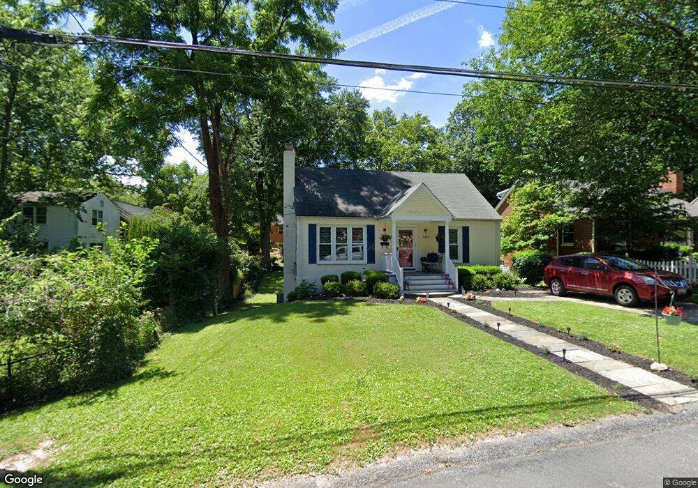
10804 Pearson St Kensington, MD 20895
North Kensington NeighborhoodEstimated Value: $629,120 - $679,000
4
Beds
2
Baths
1,624
Sq Ft
$400/Sq Ft
Est. Value
About This Home
This home is located at 10804 Pearson St, Kensington, MD 20895 and is currently estimated at $650,030, approximately $400 per square foot. 10804 Pearson St is a home located in Montgomery County with nearby schools including Mancelona Middle School, Rock View Elementary School, and Newport Mill Middle School.
Ownership History
Date
Name
Owned For
Owner Type
Purchase Details
Closed on
Nov 29, 2011
Sold by
Harlow Julie P and Harlow Brian E
Bought by
Saben Alyson L
Current Estimated Value
Home Financials for this Owner
Home Financials are based on the most recent Mortgage that was taken out on this home.
Original Mortgage
$300,000
Outstanding Balance
$205,220
Interest Rate
4.01%
Mortgage Type
New Conventional
Estimated Equity
$444,810
Purchase Details
Closed on
Apr 27, 1999
Sold by
E Leo M and E Moss L
Bought by
P Brian E and P Harlow J
Create a Home Valuation Report for This Property
The Home Valuation Report is an in-depth analysis detailing your home's value as well as a comparison with similar homes in the area
Home Values in the Area
Average Home Value in this Area
Purchase History
| Date | Buyer | Sale Price | Title Company |
|---|---|---|---|
| Saben Alyson L | $375,000 | Stewart Title Guaranty Co | |
| P Brian E | $159,000 | -- |
Source: Public Records
Mortgage History
| Date | Status | Borrower | Loan Amount |
|---|---|---|---|
| Open | Saben Alyson L | $300,000 |
Source: Public Records
Tax History Compared to Growth
Tax History
| Year | Tax Paid | Tax Assessment Tax Assessment Total Assessment is a certain percentage of the fair market value that is determined by local assessors to be the total taxable value of land and additions on the property. | Land | Improvement |
|---|---|---|---|---|
| 2025 | $6,347 | $516,733 | -- | -- |
| 2024 | $6,347 | $493,800 | $266,200 | $227,600 |
| 2023 | $5,475 | $479,700 | $0 | $0 |
| 2022 | $5,040 | $465,600 | $0 | $0 |
| 2021 | $4,550 | $451,500 | $240,100 | $211,400 |
| 2020 | $4,550 | $429,833 | $0 | $0 |
| 2019 | $4,277 | $408,167 | $0 | $0 |
| 2018 | $4,015 | $386,500 | $240,100 | $146,400 |
| 2017 | $4,014 | $380,533 | $0 | $0 |
| 2016 | -- | $374,567 | $0 | $0 |
| 2015 | $3,483 | $368,600 | $0 | $0 |
| 2014 | $3,483 | $361,867 | $0 | $0 |
Source: Public Records
Map
Nearby Homes
- 10802 Stella Ct
- 3355 University Blvd W Unit 206
- 3333 University Blvd W Unit 1008
- 3117 Plyers Mill Rd
- 3014 Jennings Rd
- 3511 Decatur Ave
- 3421 University Blvd W Unit 3421-302
- 3419 University Blvd W Unit 102
- 3600 Decatur Ave
- 10502 Drumm Ave
- 2932 University Blvd W
- 11006 Madison St
- 11921 Coronada Place
- 3013 Ferndale St
- 3603 Plyers Mill Rd
- 11214 Midvale Rd
- 3722 Lawrence Ave
- 3303 Fayette Rd
- 3010 Fayette Rd
- 11209 Midvale Rd
- 10806 Pearson St
- 3203 Mccomas Ave
- 3203 Mccomas Ave Unit 3
- 10800 Pearson St
- 3205 Mccomas Ave
- 10808 Pearson St
- 10810 Pearson St
- 10805 Pearson St
- 10807 Pearson St
- 10801 Pearson St
- 3207 Mccomas Ave
- 10809 Pearson St
- 3208 Mccomas Ave
- 3212 Mccomas Ave
- 3125 Mccomas Ave
- 3204 Mccomas Ave
- 10812 Pearson St
- 3200 Mccomas Ave
- 3209 Mccomas Ave
- 10813 Pearson St