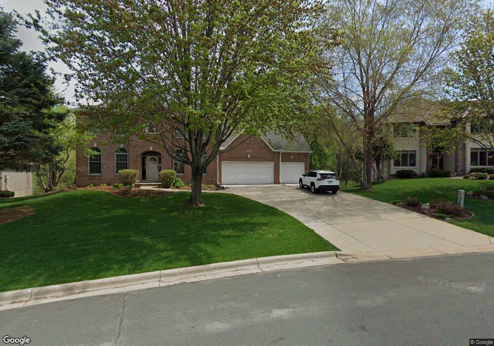
10809 Chatham Ct N Burnsville, MN 55337
Estimated Value: $609,000 - $651,000
5
Beds
4
Baths
3,274
Sq Ft
$194/Sq Ft
Est. Value
About This Home
This home is located at 10809 Chatham Ct N, Burnsville, MN 55337 and is currently estimated at $633,711, approximately $193 per square foot. 10809 Chatham Ct N is a home located in Dakota County with nearby schools including Burnsville High School, Gateway STEM Academy, and Sunrise International Montessori School.
Ownership History
Date
Name
Owned For
Owner Type
Purchase Details
Closed on
Jan 24, 2013
Sold by
Braun Paul R
Bought by
Braun Paul R and Paul R Braun Revocable Trust
Current Estimated Value
Purchase Details
Closed on
Sep 16, 2005
Sold by
Bernstein Michael C and Bernstein Amy S
Bought by
Braun Paul R and Braun Catherine L
Purchase Details
Closed on
Sep 24, 2002
Sold by
Bergh Hans P and Plotz Sharon
Bought by
Bernstein Michael and Bernstein Amy
Create a Home Valuation Report for This Property
The Home Valuation Report is an in-depth analysis detailing your home's value as well as a comparison with similar homes in the area
Home Values in the Area
Average Home Value in this Area
Purchase History
| Date | Buyer | Sale Price | Title Company |
|---|---|---|---|
| Braun Paul R | -- | None Available | |
| Braun Paul R | $532,000 | -- | |
| Bernstein Michael | $490,000 | -- |
Source: Public Records
Tax History Compared to Growth
Tax History
| Year | Tax Paid | Tax Assessment Tax Assessment Total Assessment is a certain percentage of the fair market value that is determined by local assessors to be the total taxable value of land and additions on the property. | Land | Improvement |
|---|---|---|---|---|
| 2024 | $6,414 | $604,200 | $153,800 | $450,400 |
| 2023 | $6,414 | $588,300 | $154,000 | $434,300 |
| 2022 | $5,640 | $578,400 | $153,600 | $424,800 |
| 2021 | $5,712 | $517,400 | $133,500 | $383,900 |
| 2020 | $5,884 | $499,800 | $130,000 | $369,800 |
| 2019 | $5,846 | $496,000 | $123,800 | $372,200 |
| 2018 | $6,165 | $467,700 | $117,900 | $349,800 |
| 2017 | $5,917 | $478,300 | $112,300 | $366,000 |
| 2016 | $6,204 | $449,900 | $107,000 | $342,900 |
| 2015 | $5,818 | $452,700 | $103,800 | $348,900 |
| 2014 | -- | $443,800 | $101,900 | $341,900 |
| 2013 | -- | $431,600 | $93,400 | $338,200 |
Source: Public Records
Map
Nearby Homes
- 3108 Foxpoint Cir
- 3113 Chandler Ct
- 11017 27th Ave S
- 11036 27th Ave S
- 10934 Southview Dr
- 4165 Old Sibley Hwy
- 2001 Woods Ln
- 2177 Cool Stream Cir
- 11459 Galtier Dr
- 2007 E 115th St
- 11311 W River Hills Dr
- 1601 Raleigh Dr
- 4413 Slater Rd
- 4427 Cinnamon Ridge Cir
- 4425 Cinnamon Ridge Cir
- 3017 Mcleod St
- 4463 Cinnamon Ridge Cir
- 4370 Nicols Rd
- 2079 Garnet Ln
- 4247 Limestone Dr
- 10805 Chatham Ct N
- 10813 Chatham Ct N
- 10801 Chatham Ct N
- 10812 Chatham Ct N
- 2800 Hayes Dr
- 2708 Hayes Dr
- 2804 Hayes Dr
- 10808 Chatham Ct N
- 10816 Chatham Ct N
- 10800 Chatham Ct N
- 10804 Chatham Ct N
- 10723 27th Ave S
- 10801 27th Ave S
- 10820 Clifton Ave
- 2700 Hayes Dr
- 10719 27th Ave S
- 10824 Clifton Ave
- 10816 Clifton Ave
- 10812 Clifton Ave
- 10900 Chatham Ct S