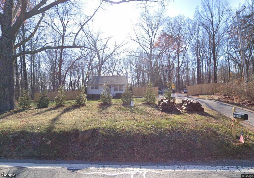
10820 Brink Rd Germantown, MD 20876
Estimated Value: $320,455 - $466,000
--
Bed
1
Bath
882
Sq Ft
$452/Sq Ft
Est. Value
About This Home
This home is located at 10820 Brink Rd, Germantown, MD 20876 and is currently estimated at $398,614, approximately $451 per square foot. 10820 Brink Rd is a home located in Montgomery County with nearby schools including William B. Gibbs Jr., Neelsville Middle, and Seneca Valley High School.
Ownership History
Date
Name
Owned For
Owner Type
Purchase Details
Closed on
Mar 30, 2021
Sold by
Tws Land Barons Llp
Bought by
Contreras Noel A and Dias Silvia
Current Estimated Value
Home Financials for this Owner
Home Financials are based on the most recent Mortgage that was taken out on this home.
Original Mortgage
$319,113
Interest Rate
3%
Mortgage Type
FHA
Purchase Details
Closed on
Aug 1, 2003
Sold by
Moore Ada B
Bought by
Tws Land Barons Llp
Create a Home Valuation Report for This Property
The Home Valuation Report is an in-depth analysis detailing your home's value as well as a comparison with similar homes in the area
Home Values in the Area
Average Home Value in this Area
Purchase History
| Date | Buyer | Sale Price | Title Company |
|---|---|---|---|
| Contreras Noel A | $325,000 | Keystone Ttl Setmnt Svcs Llc | |
| Tws Land Barons Llp | $200,000 | -- |
Source: Public Records
Mortgage History
| Date | Status | Borrower | Loan Amount |
|---|---|---|---|
| Previous Owner | Contreras Noel A | $319,113 |
Source: Public Records
Tax History Compared to Growth
Tax History
| Year | Tax Paid | Tax Assessment Tax Assessment Total Assessment is a certain percentage of the fair market value that is determined by local assessors to be the total taxable value of land and additions on the property. | Land | Improvement |
|---|---|---|---|---|
| 2025 | $3,872 | $304,700 | -- | -- |
| 2024 | $3,872 | $292,300 | $0 | $0 |
| 2023 | $4,396 | $279,900 | $219,500 | $60,400 |
| 2022 | $2,820 | $275,833 | $0 | $0 |
| 2021 | $6,829 | $271,767 | $0 | $0 |
| 2020 | $6,687 | $267,700 | $219,500 | $48,200 |
| 2019 | $6,639 | $266,800 | $0 | $0 |
| 2018 | $2,937 | $265,900 | $0 | $0 |
| 2017 | $3,390 | $265,000 | $0 | $0 |
| 2016 | $3,667 | $263,433 | $0 | $0 |
| 2015 | $3,667 | $261,867 | $0 | $0 |
| 2014 | $3,667 | $260,300 | $0 | $0 |
Source: Public Records
Map
Nearby Homes
- 11609 Seneca Forest Cir
- 21113 Kaul Ln
- 20820 Tall Forest Dr
- 0 Neelsville Church Rd
- 11545 Scottsbury Terrace
- 21822 Boneset Way
- 832 Butterfly Weed Dr
- 11609 Hourglass Way
- 11411 Brook Run Dr
- 20415 Cabana Dr
- 20416 Cabana Dr
- 20708 Bell Bluff Rd
- 12125 Songbird Ln
- 20600 Bell Bluff Rd
- 11820 Eton Manor Dr Unit 104
- 12212 Milestone Manor Ln
- 47 Drumcastle Ct
- 11409 Berland Place
- 21307 China Aster Ct
- 12222 Milestone Manor Ln
- 0 Brink Rd
- 21312 Glendevon Ct
- 10840 Brink Rd
- 21313 Leaman Ln
- 21308 Glendevon Ct
- 21309 Leaman Ln
- 21305 Leaman Ln
- 10900 Brink Rd
- 21304 Glendevon Ct
- 21301 Leaman Ln
- 11001 Treva Ct
- 21313 Glendevon Ct
- 21300 Leaman Ln
- 11005 Treva Ct
- 21312 Leaman Ln
- 10904 Brink Rd
- 21305 Glendevon Ct
- 11009 Treva Ct
- 11000 Treva Ct
- 21300 Glendevon Ct