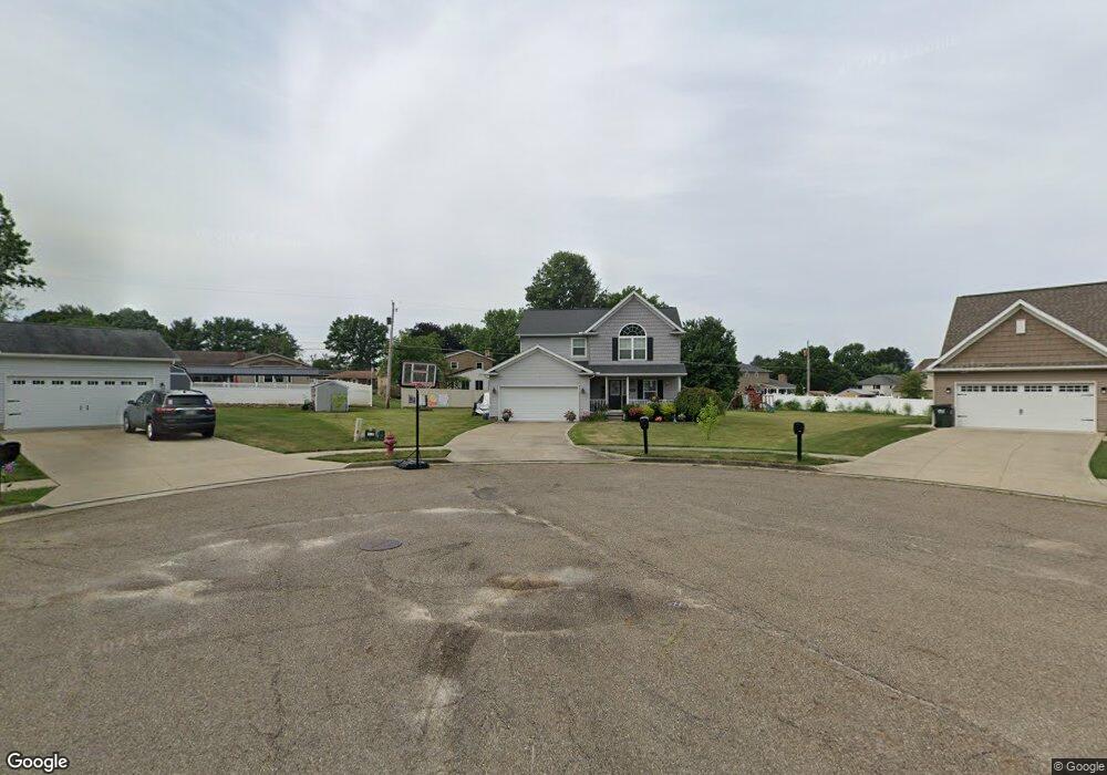
1085 Cypress Ave Louisville, OH 44641
Estimated Value: $317,019 - $354,000
3
Beds
3
Baths
1,838
Sq Ft
$182/Sq Ft
Est. Value
About This Home
This home is located at 1085 Cypress Ave, Louisville, OH 44641 and is currently estimated at $335,005, approximately $182 per square foot. 1085 Cypress Ave is a home located in Stark County with nearby schools including Louisville High School and St. Thomas Aquinas High School & Middle School.
Ownership History
Date
Name
Owned For
Owner Type
Purchase Details
Closed on
Jun 25, 2013
Sold by
Djs Family Properties Ltd
Bought by
Yost Autumn S
Current Estimated Value
Home Financials for this Owner
Home Financials are based on the most recent Mortgage that was taken out on this home.
Original Mortgage
$162,246
Interest Rate
3.52%
Mortgage Type
Construction
Purchase Details
Closed on
May 15, 2013
Sold by
Djs Family Properties Ltd
Bought by
Schalmo Janet T
Home Financials for this Owner
Home Financials are based on the most recent Mortgage that was taken out on this home.
Original Mortgage
$162,246
Interest Rate
3.52%
Mortgage Type
Construction
Create a Home Valuation Report for This Property
The Home Valuation Report is an in-depth analysis detailing your home's value as well as a comparison with similar homes in the area
Home Values in the Area
Average Home Value in this Area
Purchase History
| Date | Buyer | Sale Price | Title Company |
|---|---|---|---|
| Yost Autumn S | $25,000 | None Available | |
| Schalmo Janet T | $2,000 | None Available |
Source: Public Records
Mortgage History
| Date | Status | Borrower | Loan Amount |
|---|---|---|---|
| Previous Owner | Yost Autumn S | $162,246 |
Source: Public Records
Tax History Compared to Growth
Tax History
| Year | Tax Paid | Tax Assessment Tax Assessment Total Assessment is a certain percentage of the fair market value that is determined by local assessors to be the total taxable value of land and additions on the property. | Land | Improvement |
|---|---|---|---|---|
| 2025 | -- | $100,350 | $19,670 | $80,680 |
| 2024 | -- | $100,350 | $19,670 | $80,680 |
| 2023 | $3,559 | $80,890 | $18,550 | $62,340 |
| 2022 | $3,624 | $82,220 | $18,550 | $63,670 |
| 2021 | $3,634 | $82,220 | $18,550 | $63,670 |
| 2020 | $3,147 | $77,070 | $16,730 | $60,340 |
| 2019 | $3,076 | $74,940 | $16,730 | $58,210 |
| 2018 | $3,064 | $74,940 | $16,730 | $58,210 |
| 2017 | $2,846 | $67,170 | $14,700 | $52,470 |
| 2016 | $2,904 | $67,170 | $14,700 | $52,470 |
| 2015 | $2,913 | $67,170 | $14,700 | $52,470 |
| 2014 | $709 | $58,070 | $12,710 | $45,360 |
| 2013 | $218 | $9,350 | $9,350 | $0 |
Source: Public Records
Map
Nearby Homes
- 1715 High St
- 2110 Edmar St
- 1812 E Broad St
- 641 S Nickelplate St
- 308 Superior St
- 520 S Silver St
- 728 E Broad St
- 908 Sand Lot Cir
- 2015 E Main St
- 3390 Meese Rd NE
- 0 Michigan Blvd
- 510 S Bauman Ct
- 204 E Broad St
- 107 E Broad St
- 325 Lincoln Ave
- 8225 Georgetown St
- 1702 View Pointe Ave
- 1170 Winding Ridge Ave
- 1639 Horizon Dr
- 910 Crosswyck Cir
- 1055 Cypress Ave
- 1827 Opal St
- 1030 Cypress St
- 1050 Cypress St
- 1035 Cypress St
- 1080 Cypress Ave
- 1817 Opal St
- 1837 Opal St
- 1080 S Marion Ave
- 1060 S Marion Ave
- 1050 Cypress Ave
- 1805 Opal St
- 1040 S Marion Ave
- 1005 Cypress Ave
- 1826 Opal St
- 1000 Cypress Ave
- 1077 Hillcliff St
- 1021 Hillcliff St
- 1816 Opal St
- 1836 Opal St