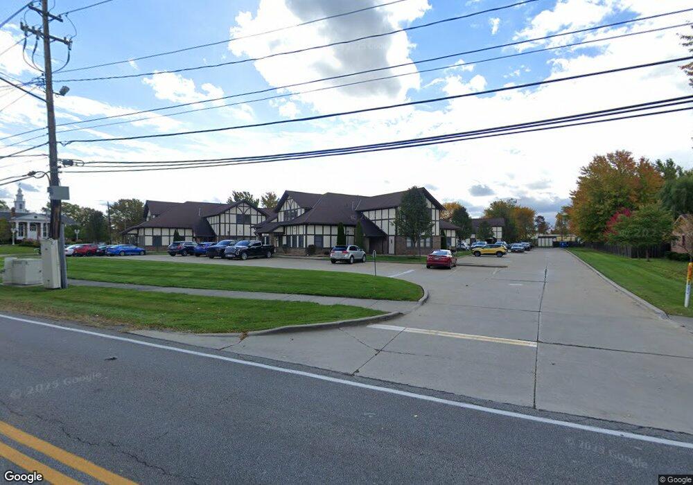
10850 Pearl Rd Unit D-4 Strongsville, OH 44136
Estimated Value: $101,258
--
Bed
--
Bath
843
Sq Ft
$120/Sq Ft
Est. Value
About This Home
This home is located at 10850 Pearl Rd Unit D-4, Strongsville, OH 44136 and is currently estimated at $101,258, approximately $120 per square foot. 10850 Pearl Rd Unit D-4 is a home located in Cuyahoga County with nearby schools including Strongsville High School and Sts Joseph & John Interparochial School.
Ownership History
Date
Name
Owned For
Owner Type
Purchase Details
Closed on
Jun 17, 2016
Sold by
Duke Christopher E and Duke Shelley K
Bought by
31 Buckeye Llc
Current Estimated Value
Purchase Details
Closed on
May 20, 2003
Sold by
Mcbride Gerald F
Bought by
Duke Christopher E and Duke Shelly K
Home Financials for this Owner
Home Financials are based on the most recent Mortgage that was taken out on this home.
Original Mortgage
$80,800
Interest Rate
5.95%
Mortgage Type
Commercial
Purchase Details
Closed on
Jan 1, 1990
Bought by
Mcbride Majorie
Create a Home Valuation Report for This Property
The Home Valuation Report is an in-depth analysis detailing your home's value as well as a comparison with similar homes in the area
Home Values in the Area
Average Home Value in this Area
Purchase History
| Date | Buyer | Sale Price | Title Company |
|---|---|---|---|
| 31 Buckeye Llc | $55,000 | Ace Title | |
| Duke Christopher E | $100,000 | -- | |
| Mcbride Majorie | -- | -- |
Source: Public Records
Mortgage History
| Date | Status | Borrower | Loan Amount |
|---|---|---|---|
| Previous Owner | Duke Christopher E | $80,800 |
Source: Public Records
Tax History Compared to Growth
Tax History
| Year | Tax Paid | Tax Assessment Tax Assessment Total Assessment is a certain percentage of the fair market value that is determined by local assessors to be the total taxable value of land and additions on the property. | Land | Improvement |
|---|---|---|---|---|
| 2024 | $2,201 | $30,660 | $3,080 | $27,580 |
| 2023 | $1,573 | $19,250 | $3,080 | $16,170 |
| 2022 | $1,569 | $19,250 | $3,080 | $16,170 |
| 2021 | $1,578 | $19,250 | $3,080 | $16,170 |
| 2020 | $1,625 | $19,250 | $3,080 | $16,170 |
| 2019 | $1,579 | $55,000 | $8,800 | $46,200 |
| 2018 | $2,015 | $19,250 | $3,080 | $16,170 |
| 2017 | $2,635 | $33,080 | $2,910 | $30,170 |
| 2016 | $2,620 | $33,080 | $2,910 | $30,170 |
| 2015 | $2,599 | $33,080 | $2,910 | $30,170 |
| 2014 | $4,187 | $35,180 | $3,080 | $32,100 |
Source: Public Records
Map
Nearby Homes
- 19240 Briarwood Ln
- 11432 Pearl Rd
- 10986 Fawn Meadow Ln
- 11499 Pearl Rd Unit A106
- 11179 Fawn Meadow Ln
- 19890 Idlewood Trail
- 19997 Idlewood Trail
- 20050 Idlewood Trail
- 11650 River Moss Rd
- 20424 Scotch Pine Way
- 18336 Falling Water Rd
- 12385 Corinth Ct
- 12539 Olympus Way
- 18433 Whitney Rd
- 20684 Albion Rd
- 9401 Pheasant Run Place
- 17945 Cliffside Dr
- 12647 Edgepark Cir
- 18248 Meadow Ln
- 12694 Ionia Ct
- 10850 Pearl Rd Unit D8
- 10850 Pearl Rd Unit D7&8
- 10850 Pearl Rd Unit D7&D8
- 10850 Pearl Rd Unit D7
- 10850 Pearl Rd Unit B-7
- 10850 Pearl Rd Unit B-4, B-8
- 10850 Pearl Rd Unit D3
- 10850 Pearl Rd Unit B-8
- 10900 Pearl Rd Unit C-3
- 10900 Pearl Rd
- 10900 Pearl Rd Unit C4
- 10900 Pearl Rd Unit C-1
- 10800 Pearl Rd Unit B4
- 10800 Pearl Rd Unit B7
- 10800 Pearl Rd Unit B5
- 10800 Pearl Rd Unit A-8
- 10800 Pearl Rd
- 10800 Pearl Rd Unit B6-B7
- 10800 Pearl Rd Unit B-4 & B-8
- 10750 Pearl Rd Unit E2