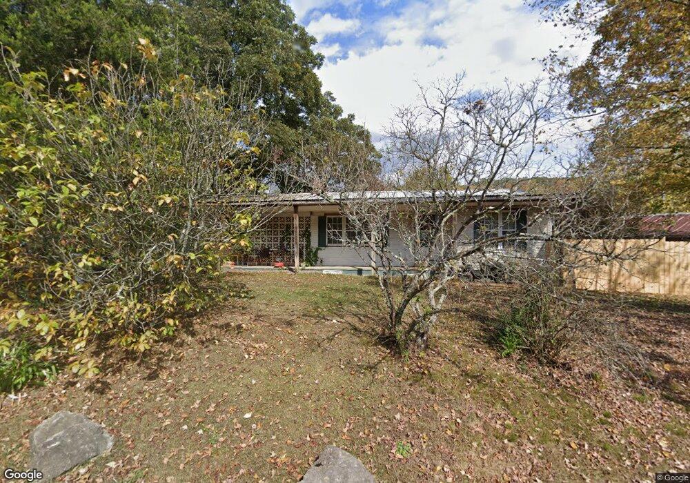
1086 Beard Valley Rd Maynardville, TN 37807
Paulette NeighborhoodEstimated Value: $214,939 - $322,000
--
Bed
1
Bath
752
Sq Ft
$363/Sq Ft
Est. Value
About This Home
This home is located at 1086 Beard Valley Rd, Maynardville, TN 37807 and is currently estimated at $272,735, approximately $362 per square foot. 1086 Beard Valley Rd is a home located in Union County with nearby schools including Paulette Elementary School, Union County High School, and H Maynard Middle School.
Ownership History
Date
Name
Owned For
Owner Type
Purchase Details
Closed on
Dec 27, 2022
Sold by
Wade Andrew J and Wade Patricia B
Bought by
Walters Matthew Raymond
Current Estimated Value
Purchase Details
Closed on
Sep 30, 2021
Sold by
Calloway Jimmy B and Calloway April
Bought by
Union County
Purchase Details
Closed on
Oct 17, 1992
Bought by
Calloway Jimmy
Purchase Details
Closed on
Apr 10, 1964
Bought by
Caloway Hobert
Create a Home Valuation Report for This Property
The Home Valuation Report is an in-depth analysis detailing your home's value as well as a comparison with similar homes in the area
Home Values in the Area
Average Home Value in this Area
Purchase History
| Date | Buyer | Sale Price | Title Company |
|---|---|---|---|
| Walters Matthew Raymond | $300,000 | First Priority Title | |
| Walters Matthew Raymond | $300,000 | First Priority Title | |
| Union County | -- | None Available | |
| Union County | -- | None Available | |
| Calloway Jimmy | $15,000 | -- | |
| Calloway Jimmy | $15,000 | -- | |
| Caloway Hobert | -- | -- | |
| Caloway Hobert | -- | -- |
Source: Public Records
Tax History Compared to Growth
Tax History
| Year | Tax Paid | Tax Assessment Tax Assessment Total Assessment is a certain percentage of the fair market value that is determined by local assessors to be the total taxable value of land and additions on the property. | Land | Improvement |
|---|---|---|---|---|
| 2024 | $839 | $44,150 | $4,075 | $40,075 |
| 2023 | $839 | $44,150 | $4,075 | $40,075 |
| 2022 | $702 | $44,150 | $4,075 | $40,075 |
| 2021 | $686 | $32,075 | $2,725 | $29,350 |
| 2020 | $686 | $32,075 | $2,725 | $29,350 |
| 2019 | $786 | $32,075 | $2,725 | $29,350 |
| 2018 | $786 | $36,725 | $2,725 | $34,000 |
| 2017 | $786 | $36,725 | $2,725 | $34,000 |
| 2016 | $688 | $31,725 | $3,475 | $28,250 |
| 2015 | $688 | $31,725 | $3,475 | $28,250 |
| 2014 | $565 | $31,739 | $0 | $0 |
Source: Public Records
Map
Nearby Homes
- 112 Dogwood St
- L-7 Williams Dr
- 213 Brock Rd
- 275 Dogwood Ln
- 254 Dogwood Ln
- 215 Jamie St
- 211 Jamie St
- 323 Maynardville Hwy
- 375 Russell Dr
- 9211 Brock Rd
- 9210 Brock Rd
- 7725 Texas Valley Rd
- 9024 Welch Rd
- 0 Satterfield Rd Unit 1313221
- 8210 Wood Rd
- 9502 Old Loyston Rd
- 589 Possum Valley Rd
- 00 Old Tazewell Pike
- 250 Burkhart Rd
- 3717 Hickory Valley Rd
- 1093 Beard Valley Rd
- 1083 Beard Valley Rd
- 110 Hill Acre Rd
- 105 Hill Acre Rd
- 115 Hill Acre Rd
- 1120 Beard Valley Rd
- 114 Hill Acre Rd
- 1115 Beard Valley Rd
- 1115 Beard Valley Rd Unit 3
- 118 Hill Acre Rd
- 122 Hill Acre Rd
- 1414 Maynardville Hwy
- 1059 Beard Valley Rd
- 1280 Satterfield Rd
- 1052 Beard Valley Rd
- 1339 Maynardville Hwy
- 1286 Satterfield Rd
- 289 Old Maynardville Hwy W
- 281 Old Maynardville Hwy W
- 1290 Satterfield Rd