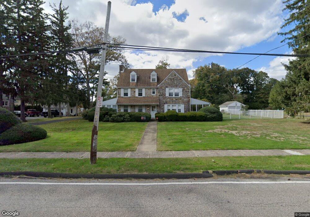
1086 Southampton Rd Philadelphia, PA 19116
Somerton NeighborhoodEstimated Value: $568,853 - $666,000
--
Bed
--
Bath
3,470
Sq Ft
$179/Sq Ft
Est. Value
About This Home
This home is located at 1086 Southampton Rd, Philadelphia, PA 19116 and is currently estimated at $620,213, approximately $178 per square foot. 1086 Southampton Rd is a home located in Philadelphia County with nearby schools including Watson Comly School, CCA Baldi Middle School, and George Washington High School.
Ownership History
Date
Name
Owned For
Owner Type
Purchase Details
Closed on
Sep 18, 2016
Sold by
Davis William M and Stretz Kristen M
Bought by
Davis William M and Stretz Kristen M
Current Estimated Value
Purchase Details
Closed on
Oct 30, 2015
Sold by
Ventura Theresa M and The Estate Of Mary E Dennehey
Bought by
Davis William M and Stretz Kristen M
Home Financials for this Owner
Home Financials are based on the most recent Mortgage that was taken out on this home.
Original Mortgage
$400,000
Interest Rate
3.92%
Mortgage Type
New Conventional
Purchase Details
Closed on
May 9, 1997
Sold by
Dennehey Mary E and Dennehey Gerald Albert
Bought by
Dennehey Mary E
Create a Home Valuation Report for This Property
The Home Valuation Report is an in-depth analysis detailing your home's value as well as a comparison with similar homes in the area
Home Values in the Area
Average Home Value in this Area
Purchase History
| Date | Buyer | Sale Price | Title Company |
|---|---|---|---|
| Davis William M | -- | None Available | |
| Davis William M | $500,000 | None Available | |
| Dennehey Mary E | -- | -- |
Source: Public Records
Mortgage History
| Date | Status | Borrower | Loan Amount |
|---|---|---|---|
| Previous Owner | Davis William M | $400,000 |
Source: Public Records
Tax History Compared to Growth
Tax History
| Year | Tax Paid | Tax Assessment Tax Assessment Total Assessment is a certain percentage of the fair market value that is determined by local assessors to be the total taxable value of land and additions on the property. | Land | Improvement |
|---|---|---|---|---|
| 2026 | $6,043 | $516,100 | $103,220 | $412,880 |
| 2025 | $6,043 | $516,100 | $103,220 | $412,880 |
| 2024 | $6,043 | $516,100 | $103,220 | $412,880 |
| 2023 | $6,043 | $431,700 | $86,340 | $345,360 |
| 2022 | $5,053 | $431,700 | $86,340 | $345,360 |
| 2021 | $5,053 | $0 | $0 | $0 |
| 2020 | $5,053 | $0 | $0 | $0 |
| 2019 | $4,458 | $0 | $0 | $0 |
| 2018 | $4,369 | $0 | $0 | $0 |
| 2017 | $4,369 | $0 | $0 | $0 |
| 2016 | $3,949 | $0 | $0 | $0 |
| 2015 | $3,780 | $0 | $0 | $0 |
| 2014 | -- | $312,100 | $129,009 | $183,091 |
| 2012 | -- | $46,016 | $18,119 | $27,897 |
Source: Public Records
Map
Nearby Homes
- 13430 Worthington Rd
- 15019 Worthington Rd Unit B
- 15014 Theresa Dr
- 15110 Ina Dr
- 13053 Dorothy Dr
- 13039 Stevens Rd
- 13049 Lindsay St
- 15202 Bernita Dr
- 1216 Anna Dr
- 13027 Worthington Rd
- 15162 Wayside Rd
- 15137 Ina Dr
- 13441 Trevose Rd
- 15140 Kovats Dr
- 611 Edison Ave Unit C
- 13250 Trevose Rd
- 600 Edison Ave Unit 606
- 613 Poquessing Ave
- 612 Poquessing Ave
- 121 Trevose Rd
- 1078 Southampton Rd
- 1094 Southampton Rd
- 1049 Edison Ave
- 1045 Edison Ave
- 1075 Edison Ave
- 1021 Edison Ave
- 1060 Southampton Rd
- 1015 Edison Ave
- 1059 Edison Ave
- 1050 Southampton Rd
- 14025 Kelvin Ave
- 14001 Kelvin Ave
- 14015 Kelvin Ave
- 1050 Edison Ave
- 1060 Edison Ave
- 1072 Edison Ave
- 1040 Edison Ave
- 1070 Edison Ave
- 1074 Edison Ave
- 1040 Southampton Rd