Estimated Value: $959,000 - $4,691,000
8
Beds
6
Baths
3,044
Sq Ft
$1,073/Sq Ft
Est. Value
About This Home
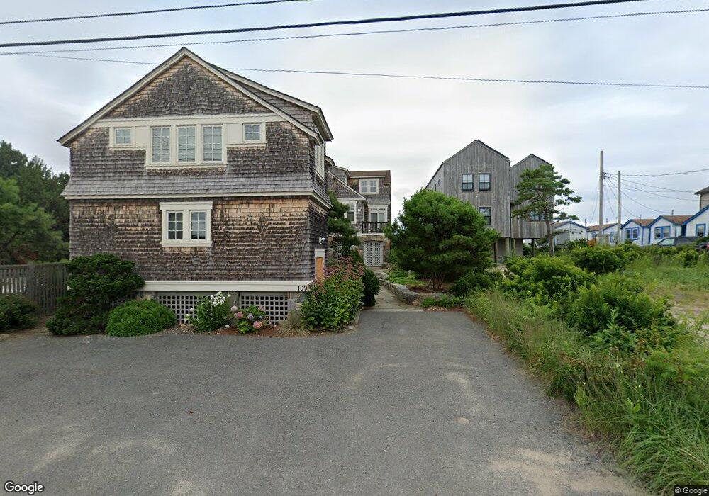
This home is located at 109 Ocean Ave, Wells, ME 04090 and is currently estimated at $3,266,855, approximately $1,073 per square foot. 109 Ocean Ave is a home located in York County with nearby schools including Wells Junior High School, Wells Elementary School, and Wells High School.
Ownership History
Date
Name
Owned For
Owner Type
Purchase Details
Closed on
Dec 3, 2014
Sold by
Pulsifer Anne E
Bought by
Campagna Janet C and Abdelrazek Yasser A
Current Estimated Value
Home Financials for this Owner
Home Financials are based on the most recent Mortgage that was taken out on this home.
Original Mortgage
$720,000
Outstanding Balance
$538,103
Interest Rate
3%
Mortgage Type
Adjustable Rate Mortgage/ARM
Estimated Equity
$2,728,752
Create a Home Valuation Report for This Property
The Home Valuation Report is an in-depth analysis detailing your home's value as well as a comparison with similar homes in the area
Home Values in the Area
Average Home Value in this Area
Purchase History
| Date | Buyer | Sale Price | Title Company |
|---|---|---|---|
| Campagna Janet C | -- | -- | |
| Campagna Janet C | -- | -- |
Source: Public Records
Mortgage History
| Date | Status | Borrower | Loan Amount |
|---|---|---|---|
| Open | Campagna Janet C | $720,000 | |
| Closed | Campagna Janet C | $720,000 |
Source: Public Records
Tax History Compared to Growth
Tax History
| Year | Tax Paid | Tax Assessment Tax Assessment Total Assessment is a certain percentage of the fair market value that is determined by local assessors to be the total taxable value of land and additions on the property. | Land | Improvement |
|---|---|---|---|---|
| 2024 | $22,790 | $3,748,420 | $2,627,040 | $1,121,380 |
| 2023 | $22,341 | $3,748,420 | $2,627,040 | $1,121,380 |
| 2022 | $22,939 | $2,192,980 | $1,421,470 | $771,510 |
| 2021 | $23,070 | $2,192,980 | $1,421,470 | $771,510 |
| 2020 | $22,982 | $2,192,980 | $1,421,470 | $771,510 |
| 2019 | $23,054 | $2,212,480 | $1,421,470 | $791,010 |
| 2018 | $22,833 | $2,212,480 | $1,421,470 | $791,010 |
| 2017 | $18,213 | $1,792,590 | $1,421,470 | $371,120 |
| 2016 | $12,870 | $1,279,310 | $1,279,310 | $0 |
| 2015 | $13,643 | $1,371,190 | $1,279,310 | $91,880 |
| 2013 | $12,505 | $1,371,190 | $1,279,310 | $91,880 |
Source: Public Records
Map
Nearby Homes
- 168 Ocean Ave
- 314 Ocean Ave
- 341 Ocean Ave Unit 1
- 9 Bourne Ave Unit B6
- 9 Bourne Ave Unit P-22
- 718 Main St Unit A3
- 390 Ocean Ave
- 404 Ocean Ave Unit 7
- 76 Post Rd Unit 17M &18M
- 32 Tatnic Rd
- 32 Queens Way
- 15 Blanchard St
- 1 Old County Rd Unit 702
- 1 Old County Rd Unit 165
- 1 Old County Rd Unit 132
- 11 Partridge Ln
- 56 Kings Hwy
- Lot 2 Maling Ln
- 64 Old Kings Hwy
- 53 Spinnaker Ridge Dr Unit 8
- 113 Ocean Ave
- 121 Ocean Ave
- 105 Ocean Ave
- 108 Ocean Ave
- 101 Ocean Ave Unit 2
- 101 Ocean Ave Unit 1
- 101 Ocean Ave Unit 3
- 101 Ocean Ave Unit 6
- 101 Ocean Ave Unit 7
- 101 Ocean Ave Unit 4
- 101 Ocean Ave Unit 5
- 112 Ocean Ave
- 116 Ocean Ave
- M112,L21 Ocean
- 97 Ocean Ave Unit 2
- 97 Ocean Ave Unit 1
- 97 Ocean Ave Unit 1 & 2
- 97 Ocean Ave
- 124 Ocean Ave
- 127 Ocean Ave